

VISITOR
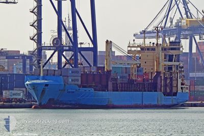
Container Ship

Current Trip
| Trip Time | 2 days |
|---|---|
| Trip Distance | 676.31 nm |
| AVG Speed | 12.4 Knots |
| MAX Speed | 15 Knots |
| Draught | 8.5 m |
| AVG Wind | 9.2 knots |
| MAX Wind | 14.8 knots |
| MIN Temp | 23.4°C / 74.12°F |
| MAX Temp | 27.6°C / 81.68°F |
| Position Received | 4 d ago |
Current Position
| Longitude | --- |
|---|---|
| Latitude | --- |
| Status | Under way using engine |
| Speed | 12.4 Knots |
| Course | 205° |
| Area | Caribbean Sea |
| Station | T-AIS |
| Position Received | 4 d ago |
Information
The current position of VISITOR is in Caribbean Sea with coordinates 18.21133° / -70.06833° as reported on 2025-03-16 11:00 by AIS to our vessel tracker app. The vessel's current speed is 12.4 Knots and is currently inside the port of PUERTO CORTES.
The vessel VISITOR (IMO: 9297606, MMSI: 255805839) is a Container Ship that was built in 2004 ( 21 years old ). It's sailing under the flag of [PT] Portugal.
In this page you can find informations about the vessels current position, last detected port calls, and current voyage information. If the vessels is not in coverage by AIS you will find the latest position.
The current position of VISITOR is detected by our AIS receivers and we are not responsible for the reliability of the data. The last position was recorded while the vessel was in Coverage by the Ais receivers of our vessel tracking app.
The current draught of VISITOR as reported by AIS is 8.5 meters
Weather
| Temperature | 23.3°C / 73.94°F |
|---|---|
| Wind Speed | 5 knots |
| Direction | 125° SE |
| Pressure | 1017.3 hPa |
| Humidity | 90.1 % |
| Cloud Coverage | 32 % |


Featured Company
Last Port Calls
| Port | Arrival | Departure | Time In Port |
|---|---|---|---|
| 2025-03-20 20:30 | |||
| 2025-03-17 16:43 | 2025-03-18 16:04 | 23 h | |
| 2025-03-15 12:57 | 2025-03-16 06:01 | 17 h | |
| 2025-03-14 05:24 | 2025-03-15 08:59 | 1 d | |
| 2025-03-06 19:09 | 2025-03-07 16:51 | 21 h | |
| 2025-03-05 07:51 | 2025-03-06 06:11 | 22 h | |
| 2025-03-01 12:55 | 2025-03-02 18:15 | 1 d | |
| 2025-02-27 19:49 | 2025-02-28 10:12 | 14 h | |
| 2025-02-25 22:05 | 2025-02-27 07:02 | 1 d | |
| 2025-02-16 16:35 | 2025-02-21 18:07 | 5 d |
Most Visited Ports (Last year)
| Port | Arrivals | |
|---|---|---|
| 16 | ||
| 15 | ||
| 13 | ||
| 13 | ||
| 9 | ||
| 8 |
Last Trips
| Origin | Departure | Destination | Arrival | Distance | |
|---|---|---|---|---|---|
| 2025-03-18 16:04 | 2025-03-20 20:30 | 676.31 nm | |||
| 2025-03-16 06:01 | 2025-03-17 16:43 | 420.45 nm | |||
| 2025-03-15 08:59 | 2025-03-15 12:57 | 30.37 nm | |||
| 2025-03-07 16:51 | 2025-03-14 05:24 | 1143.35 nm | |||
| 2025-03-06 06:11 | 2025-03-06 19:09 | 64.63 nm | |||
| 2025-03-02 18:15 | 2025-03-05 07:51 | 728.22 nm | |||
| 2025-02-28 10:12 | 2025-03-01 12:55 | 420.22 nm | |||
| 2025-02-27 07:02 | 2025-02-27 19:49 | 30.33 nm | |||
| 2025-02-21 18:07 | 2025-02-25 22:05 | 1094.74 nm | |||
| 2025-02-16 11:27 | 2025-02-16 16:35 | 61.56 nm |
Events
| Time | Event | Details | Position / Dest | Info |
|---|---|---|---|---|
| 2025-03-21 04:01 | STOP Moving |
15.84250 / -87.94366
[HN] PUERTO CORTES
|
Speed: Course: 280° |
|
| 2025-03-21 02:30 | PORT ARRIVAL |
|
15.83817 / -87.96267
[HN] PUERTO CORTES
|
Speed: 11.4 kn Course: 196° |
| 2025-03-18 21:04 | PORT DEPARTURE |
|
17.95850 / -76.84683
RIO HAINA
|
Speed: 9.7 kn Course: 245° |
| 2025-03-18 20:48 | START Moving |
17.98383 / -76.83234
[JM] KINGSTON (JM)
|
Speed: 5.6 kn Course: 138° |
|
| 2025-03-17 22:08 | STOP Moving |
17.98800 / -76.83483
[JM] KINGSTON (JM)
|
Speed: Course: 312° |
|
| 2025-03-17 21:43 | PORT ARRIVAL |
|
17.96650 / -76.83667
[JM] KINGSTON (JM)
|
Speed: 15.4 kn Course: 18° |
| 2025-03-16 11:05 | Status Changed | Default Under way using engine |
18.20033 / -70.07816
RIO HAINA
|
Speed: 12.4 kn Course: 205° |
| 2025-03-16 11:00 | OUT of Coverage |
18.21133 / -70.06833
Caribbean Sea
|
Speed: 12.4 kn Course: 205° |
|
| 2025-03-16 11:00 | Status Changed | Under way using engine Default |
18.21300 / -70.06750
RIO HAINA
|
Speed: 12.5 kn Course: 203° |
| 2025-03-16 10:50 | Status Changed | Default Under way using engine |
18.24600 / -70.05317
RIO HAINA
|
Speed: 12.4 kn Course: 202° |