

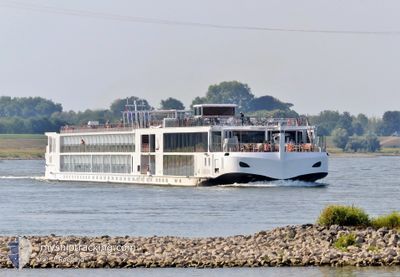
VIKING EINAR
Passenger

Current Trip
KINDERDIJK
| Time Travelled | 1 day |
|---|---|
| Remaining Time | --- |
| Distance Travelled | 96.77 nm |
| Remaining Distance | --- |
| AVG Speed | 8.7 Knots |
| MAX Speed | 11.5 Knots |
| AVG Wind | 3.3 knots |
| MAX Wind | 6 knots |
| MIN Temp | 3.1°C / 37.58°F |
| MAX Temp | 15.5°C / 59.9°F |
| Draught | 1.9 m |
| Position Received | 1 m ago |
Current Position
| Longitude | --- |
|---|---|
| Latitude | --- |
| Status | Under way using engine |
| Speed | 10.4 Knots |
| Course | 247.4° |
| Area | North Sea |
| Station | T-AIS |
| Position Received | 1 m ago |
Information
The current position of VIKING EINAR is in North Sea with coordinates 51.62962° / 4.22337° as reported on 2025-03-27 22:46 by AIS to our vessel tracker app. The vessel's current speed is 10.4 Knots
The vessel VIKING EINAR (IMO: 7002108, MMSI: 269057687) is a Passenger It's sailing under the flag of [CH] Switzerland.
In this page you can find informations about the vessels current position, last detected port calls, and current voyage information. If the vessels is not in coverage by AIS you will find the latest position.
The current position of VIKING EINAR is detected by our AIS receivers and we are not responsible for the reliability of the data. The last position was recorded while the vessel was in Coverage by the Ais receivers of our vessel tracking app.
The current draught of VIKING EINAR as reported by AIS is 1.9 meters
Weather
| Temperature | 8°C / 46.4°F |
|---|---|
| Wind Speed | 5 knots |
| Direction | 225° SW |
| Pressure | 1017.3 hPa |
| Humidity | 74.4 % |
| Cloud Coverage | 3 % |


Featured Company
Last Port Calls
| Port | Arrival | Departure | Time In Port |
|---|---|---|---|
| 2025-03-26 06:52 | 2025-03-26 06:58 | 6 m | |
| 2025-03-26 03:02 | 2025-03-26 03:37 | 34 m | |
| 2025-03-23 05:39 | 2025-03-25 03:31 | 1 d | |
| 2025-03-23 01:48 | 2025-03-23 02:21 | 32 m | |
| 2025-03-22 14:25 |
Most Visited Ports (Last year)
| Port | Arrivals | |
|---|---|---|
| 38 | ||
| 32 | ||
| 23 | ||
| 16 | ||
| 16 | ||
| 16 |
Last Trips
| Origin | Departure | Destination | Arrival | Distance | |
|---|---|---|---|---|---|
| 2025-03-26 03:37 | 2025-03-26 06:52 | 21.47 nm | |||
| 2025-03-25 03:31 | 2025-03-26 03:02 | 112.59 nm | |||
| 2025-03-23 02:21 | 2025-03-23 05:39 | 30.88 nm | |||
| 2025-03-22 14:25 | 2025-03-23 01:48 | 119.94 nm |
Events
| Time | Event | Details | Position / Dest | Info |
|---|---|---|---|---|
| 2025-03-27 22:03 | START Moving | 1.33 nm, West of WILLEMSTAD |
51.68773 / 4.40580
KINDERDIJK
|
Speed: 3.7 kn Course: 229° |
| 2025-03-27 22:01 | Status Changed | Under way using engine Moored |
51.68884 / 4.40796
KINDERDIJK
|
Speed: 0.7 kn Course: 228° |
| 2025-03-27 21:53 | Status Changed | Moored Under way using engine |
51.68932 / 4.40877
KINDERDIJK
|
Speed: Course: 228° |
| 2025-03-27 21:50 | STOP Moving | 1.2 nm, West of WILLEMSTAD |
51.68932 / 4.40878
KINDERDIJK
|
Speed: 0.1 kn Course: 228° |
| 2025-03-27 18:41 | START Moving | 0.72 nm, North West of ROTTERDAM CENTRUM |
51.91389 / 4.48987
KINDERDIJK
|
Speed: 6.4 kn Course: 51.7° |
| 2025-03-27 18:39 | Status Changed | Under way using engine Moored |
51.91253 / 4.48708
KINDERDIJK
|
Speed: 1.3 kn Course: 31° |
| 2025-03-27 16:07 | Status Changed | Moored Under way using engine |
51.91259 / 4.48540
KINDERDIJK
|
Speed: 0.1 kn Course: 30° |
| 2025-03-27 15:58 | STOP Moving | 0.72 nm, North West of ROTTERDAM CENTRUM |
51.91305 / 4.48725
KINDERDIJK
|
Speed: 0.3 kn Course: 305° |
| 2025-03-27 15:08 | START Moving | 0.81 nm, North East of RIDDERKERK |
51.89081 / 4.63740
KINDERDIJK
|
Speed: 4.4 kn Course: 283° |
| 2025-03-27 15:07 | Status Changed | Under way using engine Moored |
51.89029 / 4.63896
KINDERDIJK
|
Speed: 0.1 kn Course: 279° |