

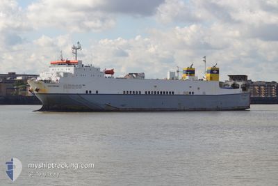
VICTORINE
Ro-Ro Cargo

Current Trip
| Time Travelled | 10 h, 34 mins |
|---|---|
| Remaining Time | 1 day |
| Distance Travelled | 165.32 nm |
| Remaining Distance | 361.90 nm |
| AVG Speed | 15.8 Knots |
| MAX Speed | 16.4 Knots |
| AVG Wind | 14.7 knots |
| MAX Wind | 19 knots |
| MIN Temp | 8.6°C / 47.48°F |
| MAX Temp | 11.1°C / 51.98°F |
| Draught | 5.8 m |
| Position Received | Now |
Current Position
| Longitude | --- |
|---|---|
| Latitude | --- |
| Status | Under way using engine |
| Speed | 15.5 Knots |
| Course | 93.4° |
| Area | Celtic Sea |
| Station | T-AIS |
| Position Received | Now |
Information
The current position of VICTORINE is in Celtic Sea with coordinates 49.89361° / -5.39731° as reported on 2025-03-06 05:26 by AIS to our vessel tracker app. The vessel's current speed is 15.5 Knots and is heading at the port of ZEEBRUGGE. The estimated time of arrival as calculated by MyShipTracking vessel tracking app is 2025-03-07 05:27 LT
The vessel VICTORINE (IMO: 9184029, MMSI: 256274000) is a Ro-Ro Cargo that was built in 2000 ( 25 years old ). It's sailing under the flag of [MT] Malta.
In this page you can find informations about the vessels current position, last detected port calls, and current voyage information. If the vessels is not in coverage by AIS you will find the latest position.
The current position of VICTORINE is detected by our AIS receivers and we are not responsible for the reliability of the data. The last position was recorded while the vessel was in Coverage by the Ais receivers of our vessel tracking app.
The current draught of VICTORINE as reported by AIS is 5.8 meters
Weather
| Temperature | 10.9°C / 51.62°F |
|---|---|
| Wind Speed | 14 knots |
| Direction | 148° SSE |
| Pressure | 1011.2 hPa |
| Humidity | 81.4 % |
| Cloud Coverage | --- |


Featured Company
Last Port Calls
| Port | Arrival | Departure | Time In Port |
|---|---|---|---|
| 2025-03-05 06:31 | 2025-03-05 18:52 | 12 h | |
| 2025-03-03 02:20 | 2025-03-03 11:48 | 9 h | |
| 2025-03-01 06:46 | 2025-03-01 17:45 | 10 h | |
| 2025-02-27 10:01 | 2025-02-27 18:35 | 8 h | |
| 2025-02-25 12:47 | 2025-02-25 22:42 | 9 h | |
| 2025-02-25 12:36 | 2025-02-25 12:44 | 7 m | |
| 2025-02-23 17:41 | 2025-02-24 00:26 | 6 h | |
| 2025-02-20 14:50 | 2025-02-22 07:42 | 1 d | |
| 2025-02-18 13:47 | 2025-02-18 20:57 | 7 h | |
| 2025-02-16 12:00 | 2025-02-16 17:42 | 5 h |
Last Trips
| Origin | Departure | Destination | Arrival | Distance | |
|---|---|---|---|---|---|
| 2025-03-03 12:48 | 2025-03-05 06:31 | 520.62 nm | |||
| 2025-03-01 17:45 | 2025-03-03 03:20 | 530.58 nm | |||
| 2025-02-27 19:35 | 2025-03-01 06:46 | 521.23 nm | |||
| 2025-02-25 22:42 | 2025-02-27 11:01 | 530.25 nm | |||
| 2025-02-25 12:44 | 2025-02-25 12:47 | 0.61 nm | |||
| 2025-02-24 01:26 | 2025-02-25 12:36 | 521.37 nm | |||
| 2025-02-22 07:42 | 2025-02-23 18:41 | 528.70 nm | |||
| 2025-02-18 21:57 | 2025-02-20 14:50 | 619.38 nm | |||
| 2025-02-16 17:42 | 2025-02-18 14:47 | 527.77 nm | |||
| 2025-02-15 18:26 | 2025-02-16 12:00 | 163.53 nm |
Events
| Time | Event | Details | Position / Dest | Info |
|---|---|---|---|---|
| 2025-03-06 05:02 | Change Sea Area | United Kingdom part of the English Channel United Kingdom part of the Celtic Sea |
49.90105 / -5.55842
English Channel
BE ZEE
|
Speed: 15.6 kn Course: 93.9° |
| 2025-03-06 00:46 | Status Changed | Under way using engine Default |
50.59978 / -6.69646
BE ZEE
|
Speed: 15.8 kn Course: 138° |
| 2025-03-06 00:44 | Status Changed | Default Under way using engine |
50.60828 / -6.70860
BE ZEE
|
Speed: 15.8 kn Course: 137.3° |
| 2025-03-05 23:16 | Change Sea Area | United Kingdom part of the Celtic Sea Irish part of the Celtic Sea |
50.90105 / -7.11228
Celtic Sea
BE ZEE
|
Speed: 16 kn Course: 141.9° |
| 2025-03-05 18:52 | PORT DEPARTURE |
|
51.81272 / -8.26874
BE ZEE
|
Speed: 13.1 kn Course: 150° |
| 2025-03-05 18:28 | Draught Changed | 5.8 6.1 |
51.84454 / -8.30478
[IE] CORK
|
Speed: 6 kn Course: 55° |
| 2025-03-05 18:15 | START Moving |
51.83396 / -8.32645
[IE] CORK
|
Speed: 3.2 kn Course: 333° |
|
| 2025-03-05 17:33 | Status Changed | Under way using engine Moored |
51.83234 / -8.32462
[IE] CORK
|
Speed: Course: 314° |
| 2025-03-05 16:23 | ETA Changed | 2025/03/07 08:00 2025/03/05 07:00 |
51.83235 / -8.32462
[IE] CORK
|
Speed: Course: 315° |
| 2025-03-05 16:14 | Destination Changed | BE ZEE IEORK |
51.83237 / -8.32462
[IE] CORK
|
Speed: Course: 315° |