
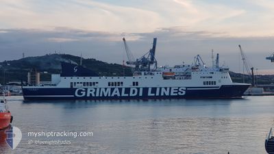
VENEZIA
Ro-Ro/Passenger Ship
Current Trip
| Time Travelled | 19 h, 5 mins |
|---|---|
| Remaining Time | --- |
| Distance Travelled | 376.07 nm |
| Remaining Distance | --- |
| AVG Speed | 19.4 Knots |
| MAX Speed | 20.9 Knots |
| AVG Wind | 3.7 knots |
| MAX Wind | 11 knots |
| MIN Temp | 13.3°C / 55.94°F |
| MAX Temp | 15.9°C / 60.62°F |
| Draught | 6 m |
| Position Received | 1 m ago |
Current Position
| Longitude | --- |
|---|---|
| Latitude | --- |
| Status | Under way using engine |
| Speed | 18.3 Knots |
| Course | 154.6° |
| Area | Adriatic Sea |
| Station | T-AIS |
| Position Received | 1 m ago |
Info
Information
The current position of VENEZIA is in Adriatic Sea with coordinates 39.80026° / 19.97536° as reported on 2025-12-10 13:49 by AIS to our vessel tracker app. The vessel's current speed is 18.3 Knots
The vessel VENEZIA (IMO: 9304631, MMSI: 247408100) is a Ro-Ro/Passenger Ship that was built in 2004 ( 21 years old ). It's sailing under the flag of [IT] Italy.
In this page you can find informations about the vessels current position, last detected port calls, and current voyage information. If the vessels is not in coverage by AIS you will find the latest position.
The current position of VENEZIA is detected by our AIS receivers and we are not responsible for the reliability of the data. The last position was recorded while the vessel was in Coverage by the Ais receivers of our vessel tracking app.
The current draught of VENEZIA as reported by AIS is 6 meters
Weather
| Temperature | 14.8°C / 58.64°F |
|---|---|
| Wind Speed | --- |
| Direction | 268° W |
| Pressure | 1021.2 hPa |
| Humidity | 58.8 % |
| Cloud Coverage | 6 % |
Featured Company
Last Port Calls
| Port | Arrival | Departure | Time In Port |
|---|---|---|---|
| 2025-12-09 17:17 | 2025-12-09 19:45 | 2 h | |
| 2025-12-07 17:33 | 2025-12-07 19:53 | 2 h | |
| 2025-12-06 17:10 | 2025-12-06 21:57 | 4 h | |
| 2025-12-04 16:29 | 2025-12-05 19:47 | 1 d | |
| 2025-12-03 17:35 | 2025-12-03 21:35 | 4 h | |
| 2025-12-02 17:02 | 2025-12-02 20:25 | 3 h | |
| 2025-11-30 17:37 | 2025-11-30 19:52 | 2 h | |
| 2025-11-29 17:19 | 2025-11-29 22:12 | 4 h | |
| 2025-11-27 16:45 | 2025-11-28 19:45 | 1 d | |
| 2025-11-26 17:21 | 2025-11-26 22:02 | 4 h |
Most Visited Ports (Last year)
| Port | Arrivals | |
|---|---|---|
| 121 | ||
| 118 | ||
| 38 | ||
| 3 |
Last Trips
| Origin | Departure | Destination | Arrival | Distance | |
|---|---|---|---|---|---|
| 2025-12-07 19:53 | 2025-12-09 17:17 | 801.78 nm | |||
| 2025-12-06 21:57 | 2025-12-07 17:33 | 397.90 nm | |||
| 2025-12-05 19:47 | 2025-12-06 17:10 | 401.32 nm | |||
| 2025-12-03 21:35 | 2025-12-04 16:29 | 405.39 nm | |||
| 2025-12-02 20:25 | 2025-12-03 17:35 | 401.78 nm | |||
| 2025-11-30 19:52 | 2025-12-02 17:02 | 785.97 nm | |||
| 2025-11-29 22:12 | 2025-11-30 17:37 | 402.72 nm | |||
| 2025-11-28 19:45 | 2025-11-29 17:19 | 403.04 nm | |||
| 2025-11-26 22:02 | 2025-11-27 16:45 | 404.28 nm | |||
| 2025-11-25 19:45 | 2025-11-26 17:21 | 400.21 nm |
Events
| Time | Event | Details | Position / Dest | Info |
|---|---|---|---|---|
| 2025-12-10 13:41 | Change Sea Area | Greek part of the Adriatic Sea Albanian part of the Adriatic Sea |
39.83194 / 19.94215
Adriatic Sea
ITAOI>GRIGO
|
Speed: 18.5 kn Course: 136.2° |
| 2025-12-10 12:47 | Change Sea Area | Albanian part of the Adriatic Sea Greek part of the Adriatic Sea |
39.99554 / 19.65456
Adriatic Sea
ITAOI>GRIGO
|
Speed: 18.5 kn Course: 122.4° |
| 2025-12-10 12:41 | Change Sea Area | Greek part of the Adriatic Sea Albanian part of the Adriatic Sea |
40.01129 / 19.62104
Adriatic Sea
ITAOI>GRIGO
|
Speed: 18.4 kn Course: 121.6° |
| 2025-12-10 12:19 | Status Changed | Under way using engine Default |
40.06856 / 19.50023
ITAOI>GRIGO
|
Speed: 18.4 kn Course: 122° |
| 2025-12-10 12:15 | IN Coverage |
40.06856 / 19.50023
Adriatic Sea
ITAOI>GRIGO
|
Speed: 18.5 kn Course: 124.4° |
|
| 2025-12-10 11:11 | Status Changed | Default Under way using engine |
40.26313 / 19.11810
ITAOI>GRIGO
|
Speed: 18.4 kn Course: 122.3° |
| 2025-12-10 11:07 | OUT of Coverage |
40.27362 / 19.09601
Adriatic Sea
ITAOI>GRIGO
|
Speed: 18.4 kn Course: 122.3° |
|
| 2025-12-10 10:54 | Status Changed | Under way using engine Default |
40.31059 / 19.02049
ITAOI>GRIGO
|
Speed: 18.8 kn Course: 124° |
| 2025-12-10 10:39 | Status Changed | Default Under way using engine |
40.35296 / 18.93798
ITAOI>GRIGO
|
Speed: 18.6 kn Course: 122.8° |
| 2025-12-10 10:24 | Change Sea Area | Albanian part of the Adriatic Sea Italian part of the Adriatic Sea |
40.39748 / 18.85140
Adriatic Sea
ITAOI>GRIGO
|
Speed: 18.6 kn Course: 123.7° |