

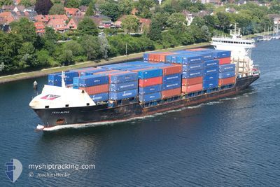
VEGA ALPHA
Container Ship

Current Trip
| Time Travelled | 1 day |
|---|---|
| Remaining Time | --- |
| Distance Travelled | 344.21 nm |
| Remaining Distance | 397.70 nm |
| AVG Speed | 11.8 Knots |
| MAX Speed | 15.2 Knots |
| AVG Wind | 8.8 knots |
| MAX Wind | 13.3 knots |
| MIN Temp | 5.9°C / 42.62°F |
| MAX Temp | 14.3°C / 57.74°F |
| Draught | 5.3 m |
| Position Received | 1 m ago |
Current Position
| Longitude | --- |
|---|---|
| Latitude | --- |
| Status | Under way using engine |
| Speed | 0.4 Knots |
| Course | 47° |
| Area | North Sea |
| Station | T-AIS |
| Position Received | 1 m ago |
Information
The current position of VEGA ALPHA is in North Sea with coordinates 53.89356° / 9.14499° as reported on 2025-03-24 13:54 by AIS to our vessel tracker app. The vessel's current speed is 0.4 Knots and is heading at the port of GDYNIA. The estimated time of arrival as calculated by MyShipTracking vessel tracking app is 2025-03-26 02:00 LT
The vessel VEGA ALPHA (IMO: 9301081, MMSI: 538090596) is a Container Ship that was built in 2005 ( 20 years old ). It's sailing under the flag of [MH] Marshall Is.
In this page you can find informations about the vessels current position, last detected port calls, and current voyage information. If the vessels is not in coverage by AIS you will find the latest position.
The current position of VEGA ALPHA is detected by our AIS receivers and we are not responsible for the reliability of the data. The last position was recorded while the vessel was in Coverage by the Ais receivers of our vessel tracking app.
The current draught of VEGA ALPHA as reported by AIS is 5.3 meters
Weather
| Temperature | 14.7°C / 58.46°F |
|---|---|
| Wind Speed | 6 knots |
| Direction | 298° WNW |
| Pressure | 1012.3 hPa |
| Humidity | 53 % |
| Cloud Coverage | 60 % |


Featured Company
Last Port Calls
| Port | Arrival | Departure | Time In Port |
|---|---|---|---|
| 2025-03-22 09:17 | 2025-03-23 11:26 | 1 d | |
| 2025-03-17 22:05 | 2025-03-19 02:13 | 1 d | |
| 2025-03-16 15:12 | 2025-03-16 15:15 | 3 m | |
| 2025-03-13 16:13 | 2025-03-15 01:53 | 1 d | |
| 2025-03-10 08:27 | 2025-03-10 18:22 | 9 h | |
| 2025-03-08 16:54 | 2025-03-09 13:39 | 20 h | |
| 2025-03-06 15:45 | 2025-03-07 07:03 | 15 h | |
| 2025-03-03 18:45 | 2025-03-05 04:39 | 1 d | |
| 2025-02-28 11:04 | 2025-03-01 18:00 | 1 d | |
| 2025-02-24 14:15 | 2025-02-25 23:33 | 1 d |
Last Trips
| Origin | Departure | Destination | Arrival | Distance | |
|---|---|---|---|---|---|
| 2025-03-19 02:13 | 2025-03-22 09:17 | 752.95 nm | |||
| 2025-03-16 15:15 | 2025-03-17 22:05 | 353.92 nm | |||
| 2025-03-15 01:53 | 2025-03-16 15:12 | 397.12 nm | |||
| 2025-03-10 18:22 | 2025-03-13 16:13 | 909.51 nm | |||
| 2025-03-09 13:39 | 2025-03-10 08:27 | 236.50 nm | |||
| 2025-03-07 07:03 | 2025-03-08 16:54 | 312.24 nm | |||
| 2025-03-05 04:39 | 2025-03-06 15:45 | 379.43 nm | |||
| 2025-03-01 18:00 | 2025-03-03 18:45 | 376.33 nm | |||
| 2025-02-25 23:33 | 2025-02-28 11:04 | 417.05 nm | |||
| 2025-02-20 07:09 | 2025-02-24 14:15 | 843.46 nm |
Events
| Time | Event | Details | Position / Dest | Info |
|---|---|---|---|---|
| 2025-03-24 13:54 | STOP Moving | 0.78 nm, South West of BRUNSBUETTEL |
53.89351 / 9.14488
PLGDY
|
Speed: 0.3 kn Course: 47° |
| 2025-03-24 11:02 | Status Changed | Under way using engine Default |
53.96471 / 8.56001
PLGDY
|
Speed: 13 kn Course: 101° |
| 2025-03-24 10:58 | Status Changed | Default Under way using engine |
53.96760 / 8.53292
PLGDY
|
Speed: 13 kn Course: 101.1° |
| 2025-03-24 10:51 | Status Changed | Under way using engine Default |
53.97255 / 8.49105
PLGDY
|
Speed: 13 kn Course: 100° |
| 2025-03-24 10:38 | Status Changed | Default Under way using engine |
53.98078 / 8.41270
PLGDY
|
Speed: 12.7 kn Course: 101.3° |
| 2025-03-24 10:00 | Status Changed | Under way using engine Default |
53.99352 / 8.17529
PLGDY
|
Speed: 9.8 kn Course: 83° |
| 2025-03-24 09:54 | Status Changed | Default Under way using engine |
53.99197 / 8.14963
PLGDY
|
Speed: 8.5 kn Course: 84° |
| 2025-03-24 08:56 | Status Changed | Under way using engine Default |
54.05803 / 7.87707
PLGDY
|
Speed: 12.4 kn Course: 121° |
| 2025-03-24 08:42 | IN Coverage |
54.05803 / 7.87707
North Sea
PLGDY
|
Speed: 12.4 kn Course: 120.2° |
|
| 2025-03-24 07:52 | OUT of Coverage |
54.16143 / 7.54728
North Sea
PLGDY
|
Speed: 12.7 kn Course: 88.9° |