
VECTOR
Cargo
Current Trip
| Time Travelled | 17 h, 39 mins |
|---|---|
| Remaining Time | --- |
| Distance Travelled | 72.74 nm |
| Remaining Distance | --- |
| AVG Speed | 4.6 Knots |
| MAX Speed | 5.9 Knots |
| AVG Wind | 3.4 knots |
| MAX Wind | 5 knots |
| MIN Temp | 2.1°C / 35.78°F |
| MAX Temp | 6.6°C / 43.88°F |
| Draught | 2.5 m |
| Position Received | Now |
Current Position
| Longitude | --- |
|---|---|
| Latitude | --- |
| Status | Under way using engine |
| Speed | 3.3 Knots |
| Course | 136.4° |
| Area | North Sea |
| Station | T-AIS |
| Position Received | Now |
Info
Information
The current position of VECTOR is in North Sea with coordinates 50.04872° / 7.78519° as reported on 2026-03-15 14:19 by AIS to our vessel tracker app. The vessel's current speed is 3.3 Knots and is heading at the port of EEMSHAVEN. The estimated time of arrival as calculated by MyShipTracking vessel tracking app is 2026-03-06 13:17 LT
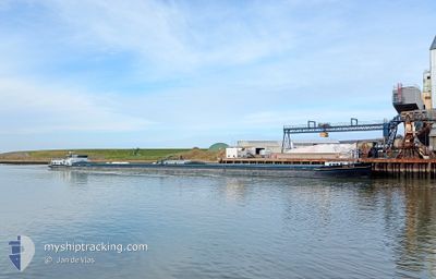
The vessel VECTOR (MMSI: 244620640) is a Cargo It's sailing under the flag of [NL] Netherlands.
In this page you can find informations about the vessels current position, last detected port calls, and current voyage information. If the vessels is not in coverage by AIS you will find the latest position.
The current position of VECTOR is detected by our AIS receivers and we are not responsible for the reliability of the data. The last position was recorded while the vessel was in Coverage by the Ais receivers of our vessel tracking app.
The current draught of VECTOR as reported by AIS is 2.5 meters
Weather
| Temperature | 6.6°C / 43.88°F |
|---|---|
| Wind Speed | 2 knots |
| Direction | 302° WNW |
| Pressure | 1016.3 hPa |
| Humidity | 61.5 % |
| Cloud Coverage | 100 % |
Featured Company
Last Port Calls
| Port | Arrival | Departure | Time In Port |
|---|---|---|---|
| 2026-03-14 19:31 | 2026-03-14 20:41 | 1 h | |
| 2026-03-11 20:34 | 2026-03-13 21:13 | 2 d | |
| 2026-03-11 18:33 | 2026-03-11 19:08 | 34 m | |
| 2026-03-10 15:04 | 2026-03-10 16:13 | 1 h | |
| 2026-03-10 03:04 | 2026-03-10 12:57 | 9 h | |
| 2026-03-08 15:55 | 2026-03-10 01:40 | 1 d | |
| 2026-03-07 18:36 | 2026-03-08 14:20 | 19 h | |
| 2026-03-07 15:52 | 2026-03-07 16:24 | 32 m | |
| 2026-03-06 13:05 | 2026-03-06 13:38 | 32 m | |
| 2026-03-04 05:15 |
Most Visited Ports (Last year)
| Port | Arrivals | |
|---|---|---|
| 20 | ||
| 18 | ||
| 16 | ||
| 16 | ||
| 15 | ||
| 14 |
Last Trips
| Origin | Departure | Destination | Arrival | Distance | |
|---|---|---|---|---|---|
| 2026-03-13 22:13 | 2026-03-14 20:31 | 113.47 nm | |||
| 2026-03-11 20:08 | 2026-03-11 21:34 | 9.56 nm | |||
| 2026-03-10 17:13 | 2026-03-11 19:33 | 120.41 nm | |||
| 2026-03-10 13:57 | 2026-03-10 16:04 | 11.92 nm | |||
| 2026-03-10 02:40 | 2026-03-10 04:04 | 13.81 nm | |||
| 2026-03-08 15:20 | 2026-03-08 16:55 | 12.79 nm | |||
| 2026-03-07 17:24 | 2026-03-07 19:36 | 11.27 nm | |||
| 2026-03-06 14:38 | 2026-03-07 16:52 | 120.86 nm | |||
| 2026-03-04 06:15 | 2026-03-06 14:05 | 222.15 nm | |||
| 2026-02-22 05:05 | 2026-02-22 22:48 | 85.71 nm |
Events
| Time | Event | Details | Position / Dest | Info |
|---|---|---|---|---|
| 2026-03-15 14:08 | Status Changed | Under way using engine Default |
50.05693 / 7.77472
EEMSHAVEN
|
Speed: 4.2 kn Course: -1° |
| 2026-03-15 13:53 | Status Changed | Default Under way using engine |
50.07219 / 7.77384
EEMSHAVEN
|
Speed: 3.5 kn Course: 165° |
| 2026-03-15 13:53 | Status Changed | Under way using engine Default |
50.07286 / 7.77353
EEMSHAVEN
|
Speed: 3.7 kn Course: -1° |
| 2026-03-15 13:45 | IN Coverage |
50.07286 / 7.77353
North Sea
|
Speed: 3.5 kn Course: 165° |
|
| 2026-03-15 04:41 | Status Changed | Default Under way using engine |
50.50850 / 7.30501
EEMSHAVEN
|
Speed: 4.4 kn Course: 157.7° |
| 2026-03-15 04:36 | OUT of Coverage |
50.51407 / 7.29961
North Sea
|
Speed: 4.4 kn Course: 157.7° |
|
| 2026-03-15 03:16 | Status Changed | Under way using engine Default |
50.59454 / 7.21053
EEMSHAVEN
|
Speed: 5.9 kn Course: 207° |
| 2026-03-15 02:33 | Status Changed | Default Under way using engine |
50.65079 / 7.20926
EEMSHAVEN
|
Speed: 3.9 kn Course: 141.4° |
| 2026-03-15 02:27 | Status Changed | Under way using engine Default |
50.65663 / 7.20348
EEMSHAVEN
|
Speed: 3.7 kn Course: -1° |
| 2026-03-15 02:21 | Status Changed | Default Under way using engine |
50.66153 / 7.19816
EEMSHAVEN
|
Speed: 5.2 kn Course: 152.5° |