img
No Internet
SWIPE TO GO BACK
TRIP
POSITION
INFO
PORT CALLS
VISITED PORTS
LAST TRIPS
EVENTS
WEATHER
image
Upload Photo
Type
IMO 9213739
MMSI 244171000
Flag
Flag Netherlands
Call Sign PBAH
Size 132 x 16 m
GT 6,130 Tons
DWT 8,727 Tons
Build 2000 ( 24 years old )
Status Active
Owner

Current Trip

Flag PLGDN
ATD
2024-04-28 07:10 (UTC)
9 days ago
Flag MAJFL
ETA*
2024-05-07 01:00 (UTC)
Time Travelled 9 days
Remaining Time ---
Distance Travelled 2286.67 nm
Remaining Distance ---
AVG Speed 11 Knots
MAX Speed 13.4 Knots
AVG Wind 11.3 knots
MAX Wind 29 knots
MIN Temp 7.9°C / 46.22°F
MAX Temp 21.1°C / 69.98°F
Draught 7.4 m
Position Received 21 m ago

Current Position

Longitude -8.69381°
Latitude 33.10846°
Status At anchor
Speed 0.1 Knots
Course
Area North Atlantic Ocean
Station T-AIS
Position Received 21 m ago

Info

info

Information

The current position of VARNEBANK is in North Atlantic Ocean with coordinates 33.10846° / -8.69381° as reported on 2024-05-08 02:32 by AIS to our vessel tracker app. The vessel's current speed is 0.1 Knots

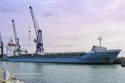
The vessel VARNEBANK (IMO: 9213739, MMSI: 244171000) is a General Cargo that was built in 2000 ( 24 years old ). It's sailing under the flag of [NL] Netherlands.

In this page you can find informations about the vessels current position, last detected port calls, and current voyage information. If the vessels is not in coverage by AIS you will find the latest position.

The current position of VARNEBANK is detected by our AIS receivers and we are not responsible for the reliability of the data. The last position was recorded while the vessel was in Coverage by the Ais receivers of our vessel tracking app.

The current draught of VARNEBANK as reported by AIS is 7.4 meters

Weather

Temperature 17.5°C / 63.5°F
Wind Speed 10 knots
Direction 47° NE
Pressure 1013.8 hPa
Humidity 88.9 %
Cloud Coverage 77 %

Featured Company

Last Port Calls

Port Arrival Departure Time In Port
Flag GDANSK 2024-04-26 17:44 2024-04-28 07:10 1 d
Flag ROSTOCK 2024-04-21 15:23 2024-04-25 19:18 4 d
Flag BARCELONA 2024-04-11 19:12 2024-04-12 22:09 1 d
Flag TARRAGONA 2024-03-30 11:14 2024-04-04 10:11 4 d
Flag ALICANTE 2024-03-28 05:47 2024-03-29 10:13 1 d
Flag SUNDSVALL 2024-03-12 15:49 2024-03-17 13:58 4 d
Flag HARAHOLMEN 2024-03-04 01:35 2024-03-11 19:54 7 d
Flag RIGA 2024-03-02 00:17
Show More

Most Visited Ports (Last year)

Port Arrivals
Flag ALMERIA 2
Flag GRIMSBY 2
Flag SUNDSVALL 2
Flag TARRAGONA 2
Flag SKAERBAEK DOCK 2
Flag HARAHOLMEN 2

Last Trips

Origin Departure Destination Arrival Distance
Flag ROSTOCK 2024-04-25 21:18 Flag GDANSK 2024-04-26 19:44 288.18 nm
Flag BARCELONA 2024-04-13 00:09 Flag ROSTOCK 2024-04-21 17:23 2286.40 nm
Flag TARRAGONA 2024-04-04 12:11 Flag BARCELONA 2024-04-11 21:12 172.59 nm
Flag ALICANTE 2024-03-29 11:13 Flag TARRAGONA 2024-03-30 12:14 197.23 nm
Flag SUNDSVALL 2024-03-17 14:58 Flag ALICANTE 2024-03-28 06:47 2906.85 nm
Flag HARAHOLMEN 2024-03-11 20:54 Flag SUNDSVALL 2024-03-12 16:49 247.28 nm
Flag RIGA 2024-03-02 02:17 Flag HARAHOLMEN 2024-03-04 02:35 589.15 nm

Events

Time Event Details Position / Dest Info
2024-05-08 02:53 Status Changed At anchor
Default
33.10843 / -8.69396
MAJFL
Speed:
Course: -1°
2024-05-08 02:36 Status Changed Default
At anchor
33.10833 / -8.69333
MAJFL
Speed: 0.1 kn
Course: 4°
2024-05-08 02:26 Status Changed At anchor
Default
33.10843 / -8.69404
MAJFL
Speed:
Course: -1°
2024-05-08 02:21 IN Coverage
33.10843 / -8.69404
North Atlantic Ocean
Speed:
Course: 253.1°
2024-05-08 01:21 Status Changed Default
At anchor
33.10833 / -8.69333
MAJFL
Speed:
Course: 5°
2024-05-08 01:17 Status Changed At anchor
Default
33.10839 / -8.69398
MAJFL
Speed:
Course: -1°
2024-05-08 01:17 OUT of Coverage
33.10839 / -8.69398
North Atlantic Ocean
Speed:
Course: 98.9°
2024-05-08 01:09 Status Changed Default
At anchor
33.10833 / -8.69333
MAJFL
Speed:
Course: 10°
2024-05-08 01:03 Status Changed At anchor
Default
33.10839 / -8.69411
MAJFL
Speed:
Course: -1°
2024-05-08 00:57 Status Changed Default
At anchor
33.10833 / -8.69333
MAJFL
Speed:
Course: 3°
Show More