

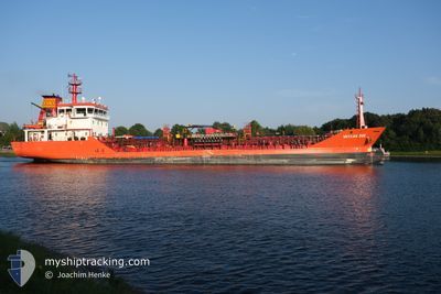
VARKAN EGE
Oil/Chemical Tanker

Current Trip
| Time Travelled | 1 day |
|---|---|
| Remaining Time | 3 h, 43 mins |
| Distance Travelled | 354.45 nm |
| Remaining Distance | 35.59 nm |
| AVG Speed | 8.9 Knots |
| MAX Speed | 11.7 Knots |
| AVG Wind | 8.8 knots |
| MAX Wind | 17 knots |
| MIN Temp | 6.2°C / 43.16°F |
| MAX Temp | 9.2°C / 48.56°F |
| Draught | 6.2 m |
| Position Received | Now |
Current Position
| Longitude | --- |
|---|---|
| Latitude | --- |
| Status | Under way using engine |
| Speed | 7.6 Knots |
| Course | 275.7° |
| Area | North Sea |
| Station | T-AIS |
| Position Received | Now |
Information
The current position of VARKAN EGE is in North Sea with coordinates 51.49304° / 1.11485° as reported on 2025-03-27 12:41 by AIS to our vessel tracker app. The vessel's current speed is 7.6 Knots and is heading at the port of PURFLEET. The estimated time of arrival as calculated by MyShipTracking vessel tracking app is 2025-03-27 16:25 LT
The vessel VARKAN EGE (IMO: 9433092, MMSI: 271002541) is a Oil/Chemical Tanker that was built in 2008 ( 17 years old ). It's sailing under the flag of [TR] Turkey.
In this page you can find informations about the vessels current position, last detected port calls, and current voyage information. If the vessels is not in coverage by AIS you will find the latest position.
The current position of VARKAN EGE is detected by our AIS receivers and we are not responsible for the reliability of the data. The last position was recorded while the vessel was in Coverage by the Ais receivers of our vessel tracking app.
The current draught of VARKAN EGE as reported by AIS is 6.2 meters
Weather
| Temperature | 9.6°C / 49.28°F |
|---|---|
| Wind Speed | 3 knots |
| Direction | 221° SW |
| Pressure | 1020.7 hPa |
| Humidity | 86.3 % |
| Cloud Coverage | 25 % |


Featured Company
Last Port Calls
| Port | Arrival | Departure | Time In Port |
|---|---|---|---|
| 2025-03-24 04:37 | 2025-03-25 21:14 | 1 d | |
| 2025-03-21 00:59 | 2025-03-22 03:12 | 1 d | |
| 2025-03-16 17:35 | 2025-03-18 05:38 | 1 d | |
| 2025-03-11 23:33 | 2025-03-13 15:58 | 1 d | |
| 2025-03-10 16:23 | 2025-03-11 05:18 | 12 h | |
| 2025-03-09 11:22 | 2025-03-10 15:02 | 1 d | |
| 2025-03-09 10:54 | 2025-03-09 11:04 | 9 m | |
| 2025-03-08 15:02 | |||
| 2025-03-08 07:36 | 2025-03-08 14:22 | 6 h | |
| 2025-03-05 05:34 | 2025-03-06 10:16 | 1 d |
Most Visited Ports (Last year)
| Port | Arrivals | |
|---|---|---|
| 13 | ||
| 13 | ||
| 12 | ||
| 12 | ||
| 9 | ||
| 8 |
Last Trips
| Origin | Departure | Destination | Arrival | Distance | |
|---|---|---|---|---|---|
| 2025-03-22 03:12 | 2025-03-24 04:37 | 438.49 nm | |||
| 2025-03-18 05:38 | 2025-03-21 00:59 | 622.58 nm | |||
| 2025-03-13 15:58 | 2025-03-16 17:35 | 643.80 nm | |||
| 2025-03-11 05:18 | 2025-03-11 23:33 | 162.80 nm | |||
| 2025-03-10 15:02 | 2025-03-10 16:23 | 11.44 nm | |||
| 2025-03-09 11:04 | 2025-03-09 11:22 | 0.78 nm | |||
| 2025-03-08 14:22 | 2025-03-09 10:54 | 4.75 nm | |||
| 2025-03-08 14:22 | 2025-03-08 15:02 | 4.64 nm | |||
| 2025-03-06 10:16 | 2025-03-08 07:36 | 403.61 nm | |||
| 2025-03-03 23:56 | 2025-03-05 05:34 | 301.26 nm |
Events
| Time | Event | Details | Position / Dest | Info |
|---|---|---|---|---|
| 2025-03-27 05:38 | Change Sea Area | United Kingdom part of the North Sea Dutch part of the North Sea |
51.87400 / 2.54049
North Sea
DEBKE>GBPFT
|
Speed: 10.3 kn Course: 219.6° |
| 2025-03-27 04:40 | ETA Changed | 2025/03/27 11:00 2025/03/27 09:00 |
51.99564 / 2.71330
DEBKE>GBPFT
|
Speed: 9.5 kn Course: 218.7° |
| 2025-03-27 04:11 | Status Changed | Under way using engine Default |
52.05394 / 2.78470
DEBKE>GBPFT
|
Speed: 9 kn Course: 218° |
| 2025-03-27 04:05 | Status Changed | Default Under way using engine |
52.06536 / 2.79892
DEBKE>GBPFT
|
Speed: 8.9 kn Course: 217.6° |
| 2025-03-27 03:50 | Status Changed | Under way using engine Default |
52.09518 / 2.83640
DEBKE>GBPFT
|
Speed: 8.6 kn Course: 219° |
| 2025-03-27 03:46 | Status Changed | Default Under way using engine |
52.10386 / 2.84751
DEBKE>GBPFT
|
Speed: 8.5 kn Course: 227.4° |
| 2025-03-27 03:35 | Status Changed | Under way using engine Default |
52.12194 / 2.87662
DEBKE>GBPFT
|
Speed: 8.6 kn Course: 224° |
| 2025-03-27 03:29 | Status Changed | Default Under way using engine |
52.13192 / 2.89258
DEBKE>GBPFT
|
Speed: 8.5 kn Course: 220.8° |
| 2025-03-27 03:23 | Status Changed | Under way using engine Default |
52.14416 / 2.91027
DEBKE>GBPFT
|
Speed: 8.4 kn Course: 219° |
| 2025-03-27 03:18 | Status Changed | Default Under way using engine |
52.15327 / 2.92253
DEBKE>GBPFT
|
Speed: 8.4 kn Course: 220.5° |