
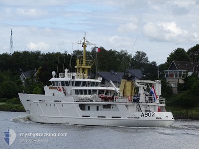
VAN KINSBERGEN
Naval Patrol Vessel
Current Trip
| Time Travelled | 6 h, 53 mins |
|---|---|
| Remaining Time | 1 day |
| Distance Travelled | 43.82 nm |
| Remaining Distance | 217.77 nm |
| AVG Speed | 6.7 Knots |
| MAX Speed | 7.1 Knots |
| AVG Wind | 2.7 knots |
| MAX Wind | 5 knots |
| MIN Temp | -2.7°C / 27.14°F |
| MAX Temp | 1.8°C / 35.24°F |
| Draught | 3.4 m |
| Position Received | 1 m ago |
Current Position
| Longitude | --- |
|---|---|
| Latitude | --- |
| Status | Under way using engine |
| Speed | 7 Knots |
| Course | 218.6° |
| Area | Baltic Sea |
| Station | T-AIS |
| Position Received | 1 m ago |
Info
Information
The current position of VAN KINSBERGEN is in Baltic Sea with coordinates 53.96209° / 9.25044° as reported on 2025-02-18 16:14 by AIS to our vessel tracker app. The vessel's current speed is 7 Knots and is heading at the port of DEN HELDER. The estimated time of arrival as calculated by MyShipTracking vessel tracking app is 2025-02-19 23:36 LT
The vessel VAN KINSBERGEN (IMO: 9201578, MMSI: 244736000) is a Naval Patrol Vessel that was built in 1999 ( 26 years old ). It's sailing under the flag of [NL] Netherlands.
In this page you can find informations about the vessels current position, last detected port calls, and current voyage information. If the vessels is not in coverage by AIS you will find the latest position.
The current position of VAN KINSBERGEN is detected by our AIS receivers and we are not responsible for the reliability of the data. The last position was recorded while the vessel was in Coverage by the Ais receivers of our vessel tracking app.
The current draught of VAN KINSBERGEN as reported by AIS is 3.4 meters
Weather
| Temperature | -0.4°C / 31.28°F |
|---|---|
| Wind Speed | 5 knots |
| Direction | 110° ESE |
| Pressure | 1030.2 hPa |
| Humidity | 40.1 % |
| Cloud Coverage | --- |
Featured Company
Last Port Calls
| Port | Arrival | Departure | Time In Port |
|---|---|---|---|
| 2025-02-18 08:53 | 2025-02-18 09:22 | 28 m | |
| 2025-02-16 08:44 | 2025-02-17 09:16 | 1 d | |
| 2025-02-11 13:55 | 2025-02-14 09:14 | 2 d | |
| 2025-02-08 08:37 | 2025-02-09 09:15 | 1 d | |
| 2025-02-04 14:54 | 2025-02-06 09:16 | 1 d | |
| 2025-02-01 08:41 | 2025-02-02 09:20 | 1 d | |
| 2025-01-28 14:51 | 2025-01-30 09:24 | 1 d | |
| 2025-01-25 08:53 | 2025-01-26 09:28 | 1 d | |
| 2025-01-23 18:35 | 2025-01-23 18:39 | 3 m | |
| 2025-01-22 12:31 |
Most Visited Ports (Last year)
| Port | Arrivals | |
|---|---|---|
| 33 | ||
| 13 | ||
| 6 | ||
| 6 | ||
| 4 | ||
| 4 |
Last Trips
| Origin | Departure | Destination | Arrival | Distance | |
|---|---|---|---|---|---|
| 2025-02-17 10:16 | 2025-02-18 09:53 | 223.66 nm | |||
| 2025-02-14 10:14 | 2025-02-16 09:44 | 438.25 nm | |||
| 2025-02-09 10:15 | 2025-02-11 14:55 | 441.52 nm | |||
| 2025-02-06 10:16 | 2025-02-08 09:37 | 430.90 nm | |||
| 2025-02-02 10:20 | 2025-02-04 15:54 | 460.68 nm | |||
| 2025-01-30 10:24 | 2025-02-01 09:41 | 351.03 nm | |||
| 2025-01-26 10:28 | 2025-01-28 15:51 | 427.03 nm | |||
| 2025-01-23 19:39 | 2025-01-25 09:53 | 364.65 nm | |||
| 2025-01-22 13:31 | 2025-01-23 19:35 | 264.42 nm |
Events
| Time | Event | Details | Position / Dest | Info |
|---|---|---|---|---|
| 2025-02-18 14:59 | Status Changed | Under way using engine Default |
54.09511 / 9.32680
NLDHR
|
Speed: 6.8 kn Course: 195° |
| 2025-02-18 14:52 | Status Changed | Default Under way using engine |
54.10744 / 9.32947
NLDHR
|
Speed: 6.7 kn Course: 185° |
| 2025-02-18 09:33 | ETA Changed | 2025/02/19 14:00 2025/02/19 17:00 |
54.37178 / 10.10143
NLDHR
|
Speed: 6.6 kn Course: 283.5° |
| 2025-02-18 09:22 | PORT DEPARTURE |
|
54.36666 / 10.13492
NLDHR
|
Speed: 5.1 kn Course: 286° |
| 2025-02-18 09:20 | START Moving |
54.36610 / 10.13856
[DE] KIEL
|
Speed: 4.7 kn Course: 283° |
|
| 2025-02-18 09:03 | STOP Moving |
54.36572 / 10.14184
[DE] KIEL
|
Speed: 0.2 kn Course: 289° |
|
| 2025-02-18 08:53 | PORT ARRIVAL |
|
54.36356 / 10.15805
[DE] KIEL
|
Speed: 9.3 kn Course: 210.1° |
| 2025-02-18 06:23 | Change Sea Area | German part of the Baltic Sea Danish part of the Baltic Sea |
54.77420 / 10.15406
Baltic Sea
NLDHR
|
Speed: 10.7 kn Course: 171.6° |
| 2025-02-18 06:17 | Change Sea Area | Danish part of the Baltic Sea Danish part of the Kattegat |
54.79191 / 10.14940
Baltic Sea
NLDHR
|
Speed: 10.9 kn Course: 171° |
| 2025-02-18 03:36 | Destination Changed | NLDHR DKMID |
55.21998 / 9.79905
NLDHR
|
Speed: 11.1 kn Course: 141° |