

UZAVA
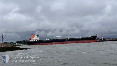
Oil/Chemical Tanker

Current Trip
| Time Travelled | 4 days |
|---|---|
| Remaining Time | --- |
| Distance Travelled | 1436.79 nm |
| Remaining Distance | --- |
| AVG Speed | 13.1 Knots |
| MAX Speed | 15.7 Knots |
| AVG Wind | 9 knots |
| MAX Wind | 18 knots |
| MIN Temp | 15.3°C / 59.54°F |
| MAX Temp | 23.5°C / 74.3°F |
| Draught | 10.3 m |
| Position Received | 2 d ago |
Current Position
| Longitude | --- |
|---|---|
| Latitude | --- |
| Status | Under way using engine |
| Speed | 15.2 Knots |
| Course | 88.7° |
| Area | North Atlantic Ocean |
| Station | T-AIS |
| Position Received | 2 d ago |
Information
The current position of UZAVA is in North Atlantic Ocean with coordinates 23.73786° / -82.33436° as reported on 2025-03-02 14:42 by AIS to our vessel tracker app. The vessel's current speed is 15.2 Knots and is heading at the port of MONTREAL. The estimated time of arrival as calculated by MyShipTracking vessel tracking app is 2025-03-12 08:00 LT
The vessel UZAVA (IMO: 9323388, MMSI: 538002774) is a Oil/Chemical Tanker that was built in 2008 ( 17 years old ). It's sailing under the flag of [MH] Marshall Is.
In this page you can find informations about the vessels current position, last detected port calls, and current voyage information. If the vessels is not in coverage by AIS you will find the latest position.
The current position of UZAVA is detected by our AIS receivers and we are not responsible for the reliability of the data. The last position was recorded while the vessel was in Coverage by the Ais receivers of our vessel tracking app.
The current draught of UZAVA as reported by AIS is 10.3 meters
Weather
| Temperature | 16.9°C / 62.42°F |
|---|---|
| Wind Speed | 17 knots |
| Direction | 93° E |
| Pressure | 1026 hPa |
| Humidity | 59.7 % |
| Cloud Coverage | 46 % |


Featured Company
Last Port Calls
| Port | Arrival | Departure | Time In Port |
|---|---|---|---|
| 2025-02-25 18:42 | 2025-02-27 20:14 | 2 d | |
| 2025-02-14 18:53 | 2025-02-15 16:43 | 21 h | |
| 2025-02-08 16:08 | 2025-02-10 10:26 | 1 d | |
| 2025-01-30 16:43 | 2025-02-02 20:03 | 3 d | |
| 2025-01-18 16:47 | 2025-01-19 03:15 | 10 h | |
| 2025-01-13 10:09 | 2025-01-15 11:27 | 2 d | |
| 2025-01-05 21:39 | 2025-01-08 07:16 | 2 d |
Most Visited Ports (Last year)
| Port | Arrivals | |
|---|---|---|
| 5 | ||
| 3 | ||
| 2 | ||
| 2 | ||
| 1 | ||
| 1 |
Last Trips
| Origin | Departure | Destination | Arrival | Distance | |
|---|---|---|---|---|---|
| 2025-02-15 16:43 | 2025-02-25 18:42 | 2353.65 nm | |||
| 2025-02-10 10:26 | 2025-02-14 18:53 | 268.80 nm | |||
| 2025-02-02 20:03 | 2025-02-08 16:08 | 1317.96 nm | |||
| 2025-01-19 03:15 | 2025-01-30 16:43 | 1956.32 nm | |||
| 2025-01-15 11:27 | 2025-01-18 16:47 | 656.39 nm | |||
| 2025-01-08 07:16 | 2025-01-13 10:09 | 1304.24 nm | |||
| 2024-12-23 20:55 | 2025-01-05 21:39 | 3070.63 nm |
Events
| Time | Event | Details | Position / Dest | Info |
|---|---|---|---|---|
| 2025-03-02 14:48 | Status Changed | Default Under way using engine |
23.73811 / -82.30671
CAMTR
|
Speed: 15.2 kn Course: 88.7° |
| 2025-03-02 14:42 | Detected in Sea | Cuban part of the North Atlantic Ocean |
23.73786 / -82.33436
North Atlantic Ocean
CAMTR
|
Speed: 15.2 kn Course: 88.7° |
| 2025-03-02 14:42 | Status Changed | Under way using engine Default |
23.73786 / -82.33436
CAMTR
|
Speed: 15.2 kn Course: 89° |
| 2025-03-02 14:42 | OUT of Coverage |
23.73786 / -82.33436
North Atlantic Ocean
CAMTR
|
Speed: 15.2 kn Course: 88.7° |
|
| 2025-03-02 14:33 | IN Coverage |
23.73786 / -82.33436
North Atlantic Ocean
CAMTR
|
Speed: 15.2 kn Course: 88.7° |
|
| 2025-02-28 07:43 | Status Changed | Default Under way using engine |
28.91509 / -94.00408
CAMTR
|
Speed: 13.1 kn Course: 126.9° |
| 2025-02-28 07:38 | OUT of Coverage |
28.92582 / -94.02024
Gulf of Mexico
CAMTR
|
Speed: 13.1 kn Course: 126.9° |
|
| 2025-02-28 07:05 | Status Changed | Under way using engine Default |
28.99541 / -94.12929
CAMTR
|
Speed: 12.7 kn Course: 125° |
| 2025-02-28 07:03 | Status Changed | Default Under way using engine |
28.99781 / -94.13306
CAMTR
|
Speed: 12.7 kn Course: 124.9° |
| 2025-02-28 06:34 | Status Changed | Under way using engine Default |
29.05623 / -94.23042
CAMTR
|
Speed: 12.6 kn Course: 124° |