

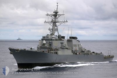
US GOV VESSEL
Military ops

Current Trip
000000000000
| Time Travelled | 12 h, 7 mins |
|---|---|
| Remaining Time | --- |
| Distance Travelled | 73.66 nm |
| Remaining Distance | --- |
| AVG Speed | 13.9 Knots |
| MAX Speed | 15 Knots |
| AVG Wind | 5.6 knots |
| MAX Wind | 9 knots |
| MIN Temp | 14.4°C / 57.92°F |
| MAX Temp | 15.2°C / 59.36°F |
| Draught | 0 m |
| Position Received | 5 h, 0 m ago |
Current Position
| Longitude | --- |
|---|---|
| Latitude | --- |
| Status | Under way using engine |
| Speed | 13.3 Knots |
| Course | 41.3° |
| Area | North Pacific Ocean |
| Station | T-AIS |
| Position Received | 5 h, 0 m ago |
Information
The current position of US GOV VESSEL is in North Pacific Ocean with coordinates 31.82549° / -117.72019° as reported on 2025-03-27 02:33 by AIS to our vessel tracker app. The vessel's current speed is 13.3 Knots
The vessel US GOV VESSEL (MMSI: 368765000) is a Military ops It's sailing under the flag of [US] USA.
In this page you can find informations about the vessels current position, last detected port calls, and current voyage information. If the vessels is not in coverage by AIS you will find the latest position.
The current position of US GOV VESSEL is detected by our AIS receivers and we are not responsible for the reliability of the data. The last position was recorded while the vessel was in Coverage by the Ais receivers of our vessel tracking app.
Weather
| Temperature | 15°C / 59°F |
|---|---|
| Wind Speed | 9 knots |
| Direction | 312° NW |
| Pressure | 1017.4 hPa |
| Humidity | 83.9 % |
| Cloud Coverage | 16 % |


Featured Company
Most Visited Ports (Last year)
| Port | Arrivals | |
|---|---|---|
| 15 | ||
| 2 | ||
| 1 | ||
| 1 |
Last Trips
| Origin | Departure | Destination | Arrival | Distance | |
|---|---|---|---|---|---|
| 2025-03-15 19:38 | 2025-03-16 08:18 | 121.38 nm | |||
| 2025-03-10 08:15 | 2025-03-10 18:32 | 140.30 nm | |||
| 2025-01-16 08:31 | 2025-02-14 13:47 | 631.24 nm | |||
| 2025-01-13 11:37 | 2025-01-13 14:38 | 28.65 nm |
Events
| Time | Event | Details | Position / Dest | Info |
|---|---|---|---|---|
| 2025-03-27 02:33 | OUT of Coverage |
31.82549 / -117.72019
North Pacific Ocean
|
Speed: 13.3 kn Course: 41.3° |
|
| 2025-03-27 01:36 | IN Coverage |
31.78175 / -117.72513
North Pacific Ocean
|
Speed: 3 kn Course: 14.3° |
|
| 2025-03-26 22:45 | OUT of Coverage |
32.14344 / -117.63809
North Pacific Ocean
|
Speed: 14.5 kn Course: 182.3° |
|
| 2025-03-26 20:44 | Change Sea Area | Mexican part of the North Pacific Ocean United States part of the North Pacific Ocean |
32.59293 / -117.50119
North Pacific Ocean
|
Speed: 14.9 kn Course: 218.6° |
| 2025-03-26 19:27 | PORT DEPARTURE |
|
32.67526 / -117.22912
000000000000
|
Speed: 12.9 kn Course: 171.6° |
| 2025-03-26 18:35 | START Moving |
32.67450 / -117.12929
[US] SAN DIEGO
|
Speed: 3.3 kn Course: 318.3° |