
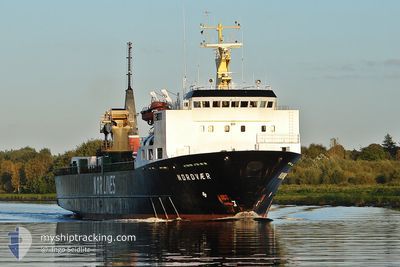
URANUS III
Pallet Carrier
Current Trip
| Time Travelled | 2 days |
|---|---|
| Remaining Time | 6 days |
| Distance Travelled | 724.69 nm |
| Remaining Distance | 1634.79 nm |
| AVG Speed | 10 Knots |
| MAX Speed | 13.5 Knots |
| AVG Wind | 10.6 knots |
| MAX Wind | 18 knots |
| MIN Temp | 15.7°C / 60.26°F |
| MAX Temp | 18.1°C / 64.58°F |
| Draught | 5.6 m |
| Position Received | 4 h, 29 m ago |
Current Position
| Longitude | --- |
|---|---|
| Latitude | --- |
| Status | Under way using engine |
| Speed | 10.2 Knots |
| Course | 77.1° |
| Area | Mediterranean Sea - Western Basin |
| Station | T-AIS |
| Position Received | 4 h, 29 m ago |
Info
Information
The current position of URANUS III is in Mediterranean Sea - Western Basin with coordinates 37.09100° / 1.61627° as reported on 2025-12-08 00:48 by AIS to our vessel tracker app. The vessel's current speed is 10.2 Knots and is heading at the port of HAIFA. The estimated time of arrival as calculated by MyShipTracking vessel tracking app is 2025-12-14 23:50 LT
The vessel URANUS III (IMO: 8601680, MMSI: 352002212) is a Pallet Carrier that was built in 1986 ( 39 years old ). It's sailing under the flag of [PA] Panama.
In this page you can find informations about the vessels current position, last detected port calls, and current voyage information. If the vessels is not in coverage by AIS you will find the latest position.
The current position of URANUS III is detected by our AIS receivers and we are not responsible for the reliability of the data. The last position was recorded while the vessel was in Coverage by the Ais receivers of our vessel tracking app.
The current draught of URANUS III as reported by AIS is 5.6 meters
Weather
| Temperature | 17.1°C / 62.78°F |
|---|---|
| Wind Speed | 8 knots |
| Direction | 249° WSW |
| Pressure | 1022.1 hPa |
| Humidity | 78.8 % |
| Cloud Coverage | --- |
Featured Company
Events
| Time | Event | Details | Position / Dest | Info |
|---|---|---|---|---|
| 2025-12-08 00:57 | Status Changed | Default Under way using engine |
37.09645 / 1.64556
HAIFA
|
Speed: 10.2 kn Course: 77.1° |
| 2025-12-08 00:48 | OUT of Coverage |
37.09100 / 1.61627
Mediterranean Sea - Western Basin
HAIFA
|
Speed: 10.2 kn Course: 77.1° |
|
| 2025-12-08 00:41 | Status Changed | Under way using engine Default |
37.08634 / 1.59085
HAIFA
|
Speed: 10.3 kn Course: 74° |
| 2025-12-07 23:53 | Status Changed | Default Under way using engine |
37.04870 / 1.42277
HAIFA
|
Speed: 10.7 kn Course: 74.2° |
| 2025-12-07 23:31 | Status Changed | Under way using engine Default |
37.03162 / 1.34337
HAIFA
|
Speed: 10.5 kn Course: 77° |
| 2025-12-07 23:29 | Status Changed | Default Under way using engine |
37.03040 / 1.33755
HAIFA
|
Speed: 10.4 kn Course: 75° |
| 2025-12-07 23:04 | Status Changed | Under way using engine Default |
37.01220 / 1.25095
HAIFA
|
Speed: 10.4 kn Course: 76° |
| 2025-12-07 22:57 | Status Changed | Default Under way using engine |
37.00677 / 1.22508
HAIFA
|
Speed: 10.4 kn Course: 74.4° |
| 2025-12-07 21:18 | IN Coverage |
36.93598 / .87441
Mediterranean Sea - Western Basin
HAIFA
|
Speed: 10.4 kn Course: 77.2° |
|
| 2025-12-07 21:17 | Status Changed | Under way using engine Default |
36.93532 / .87088
HAIFA
|
Speed: 10.4 kn Course: 76° |