

ULTIMA
Cargo

Current Trip
| Time Travelled | 4 days |
|---|---|
| Remaining Time | --- |
| Distance Travelled | 1296.15 nm |
| Remaining Distance | --- |
| AVG Speed | 13.1 Knots |
| MAX Speed | 17 Knots |
| AVG Wind | 12.3 knots |
| MAX Wind | 30.8 knots |
| MIN Temp | 3.7°C / 38.66°F |
| MAX Temp | 23.7°C / 74.66°F |
| Draught | 7.1 m |
| Position Received | 3 h, 2 m ago |
Current Position
| Longitude | --- |
|---|---|
| Latitude | --- |
| Status | Under way using engine |
| Speed | 10.7 Knots |
| Course | 264.1° |
| Area | Yellow Sea |
| Station | T-AIS |
| Position Received | 3 h, 2 m ago |
Information
The current position of ULTIMA is in Yellow Sea with coordinates 37.32719° / 126.49755° as reported on 2025-03-08 12:31 by AIS to our vessel tracker app. The vessel's current speed is 10.7 Knots
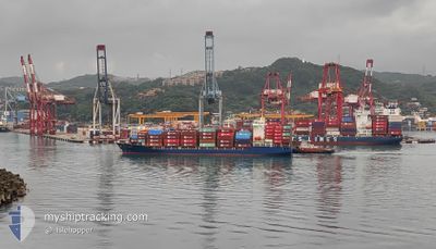
The vessel ULTIMA (IMO: 9674646, MMSI: 311000169) is a Cargo It's sailing under the flag of [BS] Bahamas.
In this page you can find informations about the vessels current position, last detected port calls, and current voyage information. If the vessels is not in coverage by AIS you will find the latest position.
The current position of ULTIMA is detected by our AIS receivers and we are not responsible for the reliability of the data. The last position was recorded while the vessel was in Coverage by the Ais receivers of our vessel tracking app.
The current draught of ULTIMA as reported by AIS is 7.1 meters
Weather
| Temperature | 4.7°C / 40.46°F |
|---|---|
| Wind Speed | 5 knots |
| Direction | 263° W |
| Pressure | 1028.8 hPa |
| Humidity | 78.3 % |
| Cloud Coverage | 7 % |


Featured Company
Last Trips
| Origin | Departure | Destination | Arrival | Distance | |
|---|---|---|---|---|---|
| 2025-02-22 20:01 | 2025-03-03 21:40 | 2366.41 nm | |||
| 2025-02-09 20:57 | 2025-02-22 04:52 | 3660.17 nm | |||
| 2025-01-27 22:45 | 2025-02-09 06:48 | 3631.25 nm | |||
| 2025-01-12 08:49 | 2025-01-26 21:41 | 3683.72 nm | |||
| 2024-12-29 07:29 | 2025-01-11 19:04 | 3659.46 nm |
Events
| Time | Event | Details | Position / Dest | Info |
|---|---|---|---|---|
| 2025-03-08 12:36 | Status Changed | Default Under way using engine |
37.32531 / 126.47403
KR INC
|
Speed: 10.7 kn Course: 264.1° |
| 2025-03-08 12:31 | Status Changed | Under way using engine Default |
37.32719 / 126.49755
KR INC
|
Speed: 7 kn Course: 264° |
| 2025-03-08 12:31 | OUT of Coverage |
37.32719 / 126.49755
Yellow Sea
|
Speed: 10.7 kn Course: 264.1° |
|
| 2025-03-08 12:25 | IN Coverage |
37.32719 / 126.49755
Yellow Sea
|
Speed: 10.7 kn Course: 264.1° |
|
| 2025-03-08 11:57 | START Moving | 6.57 nm, South of INCHEON |
37.33818 / 126.62743
KR INC
|
Speed: 9.5 kn Course: 246° |
| 2025-03-07 23:48 | Status Changed | Default Under way using engine |
37.34176 / 126.63663
KR INC
|
Speed: 4.2 kn Course: 71° |
| 2025-03-07 23:48 | STOP Moving | 6.51 nm, South of INCHEON |
37.34176 / 126.63663
KR INC
|
Speed: Course: 270° |
| 2025-03-07 23:31 | Status Changed | Under way using engine Default |
37.33775 / 126.62878
KR INC
|
Speed: 6.5 kn Course: 67° |
| 2025-03-07 23:31 | OUT of Coverage |
37.33775 / 126.62878
Yellow Sea
KR INC
|
Speed: 4.2 kn Course: 68.9° |
|
| 2025-03-07 23:26 | Status Changed | Default Under way using engine |
37.33456 / 126.62118
KR INC
|
Speed: 6.6 kn Course: 71° |