
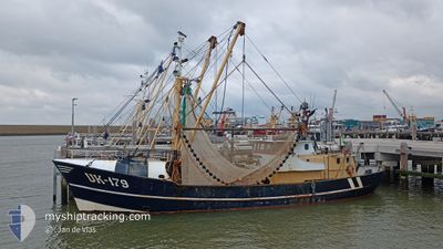
UK179 ONDERNEMING
Fishing Vessel
Current Trip
| Trip Time | 3 days |
|---|---|
| Trip Distance | 249.54 nm |
| AVG Speed | 4.7 Knots |
| MAX Speed | 4.7 Knots |
| Draught | 3 m |
| AVG Wind | 15.9 knots |
| MAX Wind | 22 knots |
| MIN Temp | 11.7°C / 53.06°F |
| MAX Temp | 15.4°C / 59.72°F |
| Position Received | 1 m ago |
Current Position
| Longitude | 5.60027° |
|---|---|
| Latitude | 52.65906° |
| Status | Engaged in Fishing |
| Speed | |
| Course | 175° |
| Area | North Sea |
| Station | T-AIS |
| Position Received | 1 m ago |
Info
Information
The current position of UK179 ONDERNEMING is in North Sea with coordinates 52.65906° / 5.60027° as reported on 2024-06-17 09:03 by AIS to our vessel tracker app. The vessel's current speed is 0 Knots and is currently inside the port of URK.
The vessel UK179 ONDERNEMING (IMO: 8431530, MMSI: 245562000) is a Fishing Vessel that was built in 1965 ( 59 years old ). It's sailing under the flag of [NL] Netherlands.
In this page you can find informations about the vessels current position, last detected port calls, and current voyage information. If the vessels is not in coverage by AIS you will find the latest position.
The current position of UK179 ONDERNEMING is detected by our AIS receivers and we are not responsible for the reliability of the data. The last position was recorded while the vessel was in Coverage by the Ais receivers of our vessel tracking app.
The current draught of UK179 ONDERNEMING as reported by AIS is 3 meters
Weather
| Temperature | 15.3°C / 59.54°F |
|---|---|
| Wind Speed | 15 knots |
| Direction | 219° SW |
| Pressure | 1009.6 hPa |
| Humidity | 75.7 % |
| Cloud Coverage | 51 % |
Featured Company
Last Port Calls
| Port | Arrival | Departure | Time In Port |
|---|---|---|---|
| 2024-06-14 14:50 | |||
| 2024-06-07 05:46 | 2024-06-11 12:23 | 4 d | |
| 2024-06-04 05:12 | 2024-06-04 15:44 | 10 h | |
| 2024-05-31 04:40 | 2024-06-03 13:09 | 3 d | |
| 2024-05-24 05:35 | 2024-05-27 01:09 | 2 d | |
| 2024-05-16 10:00 | 2024-05-20 20:48 | 4 d | |
| 2024-05-03 06:35 | 2024-05-13 10:06 | 10 d | |
| 2024-04-26 07:21 | 2024-04-29 15:13 | 3 d | |
| 2024-04-25 04:03 | |||
| 2024-04-18 16:12 | 2024-04-22 00:05 | 3 d |
Most Visited Ports (Last year)
| Port | Arrivals | |
|---|---|---|
| 20 | ||
| 12 | ||
| 9 | ||
| 5 | ||
| 1 |
Last Trips
| Origin | Departure | Destination | Arrival | Distance | |
|---|---|---|---|---|---|
| 2024-06-11 14:23 | 2024-06-14 16:50 | 249.54 nm | |||
| 2024-06-04 17:44 | 2024-06-07 07:46 | 86.08 nm | |||
| 2024-06-03 15:09 | 2024-06-04 07:12 | 39.78 nm | |||
| 2024-05-27 03:09 | 2024-05-31 06:40 | 245.45 nm | |||
| 2024-05-20 22:48 | 2024-05-24 07:35 | 251.71 nm | |||
| 2024-05-13 12:06 | 2024-05-16 12:00 | 235.27 nm | |||
| 2024-04-29 17:13 | 2024-05-03 08:35 | 277.32 nm | |||
| 2024-04-25 06:03 | 2024-04-26 09:21 | 79.78 nm | |||
| 2024-04-17 09:36 | 2024-04-18 18:12 | 126.55 nm | |||
| 2024-04-10 16:16 | 2024-04-12 10:53 | 165.50 nm |
Events
| Time | Event | Details | Position / Dest | Info |
|---|---|---|---|---|
| 2024-06-14 14:53 | STOP Moving |
52.65919 / 5.60070
[NL] URK
|
Speed: 0.2 kn Course: 338° |
|
| 2024-06-14 14:50 | PORT ARRIVAL |
|
52.65638 / 5.59882
[NL] URK
|
Speed: 5.6 kn Course: 335.6° |
| 2024-06-14 12:40 | Status Changed | Engaged in Fishing Under way using engine |
52.83877 / 5.30848
LAUWERSOOG
|
Speed: 46.3 kn Course: 185.7° |
| 2024-06-14 12:40 | Status Changed | Under way using engine Engaged in Fishing |
52.83902 / 5.30851
LAUWERSOOG
|
Speed: 8 kn Course: 191.2° |
| 2024-06-14 10:53 | START Moving | 2.32 nm, West of MAKKUM |
53.06585 / 5.33805
LAUWERSOOG
|
Speed: 3.8 kn Course: 154° |
| 2024-06-14 10:34 | STOP Moving | 2.45 nm, North West of MAKKUM |
53.06951 / 5.33683
LAUWERSOOG
|
Speed: 0.1 kn Course: 155° |
| 2024-06-14 10:27 | START Moving | 2.61 nm, North West of MAKKUM |
53.07343 / 5.33508
LAUWERSOOG
|
Speed: 3.1 kn Course: 162° |
| 2024-06-14 08:01 | IN Coverage |
53.07699 / 5.33279
North Sea
|
Speed: Course: 0° |
|
| 2024-06-14 05:00 | OUT of Coverage |
53.07693 / 5.33279
North Sea
|
Speed: Course: 0° |
|
| 2024-06-14 03:55 | STOP Moving | 2.79 nm, North West of MAKKUM |
53.07692 / 5.33279
LAUWERSOOG
|
Speed: 0.1 kn Course: 153° |