
TYRO
Not available
Current Trip
| Time Travelled | 1 day |
|---|---|
| Remaining Time | --- |
| Distance Travelled | 100.91 nm |
| Remaining Distance | --- |
| AVG Speed | 6.2 Knots |
| MAX Speed | 7.6 Knots |
| AVG Wind | 7.1 knots |
| MAX Wind | 10 knots |
| MIN Temp | 7.1°C / 44.78°F |
| MAX Temp | 9.4°C / 48.92°F |
| Draught | 2.5 m |
| Position Received | 5 m ago |
Current Position
| Longitude | --- |
|---|---|
| Latitude | --- |
| Status | Moored |
| Speed | |
| Course | 190° |
| Area | North Sea |
| Station | T-AIS |
| Position Received | 5 m ago |
Info
Information
The current position of TYRO is in North Sea with coordinates 52.18277° / 4.99602° as reported on 2025-12-18 06:44 by AIS to our vessel tracker app. The vessel's current speed is 0 Knots
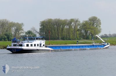
The vessel TYRO (MMSI: 244630224) is a Not available It's sailing under the flag of [NL] Netherlands.
In this page you can find informations about the vessels current position, last detected port calls, and current voyage information. If the vessels is not in coverage by AIS you will find the latest position.
The current position of TYRO is detected by our AIS receivers and we are not responsible for the reliability of the data. The last position was recorded while the vessel was in Coverage by the Ais receivers of our vessel tracking app.
The current draught of TYRO as reported by AIS is 2.5 meters
Weather
| Temperature | 8.2°C / 46.76°F |
|---|---|
| Wind Speed | 12 knots |
| Direction | 197° SSW |
| Pressure | 1012.9 hPa |
| Humidity | 72.2 % |
| Cloud Coverage | 100 % |
Featured Company
Last Port Calls
| Port | Arrival | Departure | Time In Port |
|---|---|---|---|
| 2025-12-16 16:34 | 2025-12-16 17:42 | 1 h | |
| 2025-12-16 13:33 | 2025-12-16 14:04 | 30 m | |
| 2025-12-12 15:08 | 2025-12-15 11:48 | 2 d | |
| 2025-12-11 13:21 | 2025-12-12 08:51 | 19 h | |
| 2025-12-10 10:12 | 2025-12-10 10:36 | 23 m | |
| 2025-12-10 07:18 | 2025-12-10 07:49 | 30 m | |
| 2025-12-09 12:10 | 2025-12-09 12:16 | 6 m | |
| 2025-12-05 11:48 | 2025-12-05 12:42 | 54 m | |
| 2025-12-02 21:47 | 2025-12-03 12:26 | 14 h | |
| 2025-12-02 19:57 | 2025-12-02 20:36 | 38 m |
Most Visited Ports (Last year)
| Port | Arrivals | |
|---|---|---|
| 19 | ||
| 16 | ||
| 15 | ||
| 11 | ||
| 10 | ||
| 9 |
Last Trips
| Origin | Departure | Destination | Arrival | Distance | |
|---|---|---|---|---|---|
| 2025-12-16 14:04 | 2025-12-16 16:34 | 11.96 nm | |||
| 2025-12-15 11:48 | 2025-12-16 13:33 | 50.81 nm | |||
| 2025-12-12 08:51 | 2025-12-12 15:08 | 1.28 nm | |||
| 2025-12-10 10:36 | 2025-12-11 13:21 | 69.05 nm | |||
| 2025-12-10 07:49 | 2025-12-10 10:12 | 11.67 nm | |||
| 2025-12-09 12:16 | 2025-12-10 07:18 | 66.03 nm | |||
| 2025-12-05 12:42 | 2025-12-09 12:10 | 54.16 nm | |||
| 2025-12-03 12:26 | 2025-12-05 11:48 | 133.99 nm | |||
| 2025-12-02 20:36 | 2025-12-02 21:47 | 6.25 nm | |||
| 2025-12-02 15:21 | 2025-12-02 19:57 | 20.99 nm |
Events
| Time | Event | Details | Position / Dest | Info |
|---|---|---|---|---|
| 2025-12-17 20:46 | Status Changed | Moored Default |
52.18279 / 4.99602
VENLO
|
Speed: Course: 191° |
| 2025-12-17 20:40 | Status Changed | Default Moored |
52.18277 / 4.99601
VENLO
|
Speed: Course: 190° |
| 2025-12-17 17:09 | STOP Moving | 0.9 nm, South West of NIEUWERSLUIS |
52.18277 / 4.99596
VENLO
|
Speed: 0.1 kn Course: 189° |
| 2025-12-17 17:05 | Status Changed | Moored Under way using engine |
52.18375 / 4.99586
VENLO
|
Speed: 3 kn Course: 178° |
| 2025-12-17 15:17 | START Moving | 0.48 nm, South West of SCHELLINGWOUDE |
52.37540 / 4.95539
VENLO
|
Speed: 4.7 kn Course: 170° |
| 2025-12-17 14:31 | STOP Moving | 0.42 nm, South West of SCHELLINGWOUDE |
52.37731 / 4.95502
VENLO
|
Speed: Course: 171° |
| 2025-12-17 14:23 | START Moving | 0.25 nm, West of SCHELLINGWOUDE |
52.38242 / 4.95834
VENLO
|
Speed: 4.1 kn Course: 267° |
| 2025-12-17 14:06 | STOP Moving | 0.14 nm, West of SCHELLINGWOUDE |
52.38149 / 4.96094
VENLO
|
Speed: 0.2 kn Course: 304° |
| 2025-12-17 11:14 | START Moving | 0.18 nm, West of LELYSTAD |
52.52612 / 5.43391
VENLO
|
Speed: 3.6 kn Course: 187° |
| 2025-12-17 11:07 | STOP Moving | 0.2 nm, North West of LELYSTAD |
52.52804 / 5.43413
VENLO
|
Speed: Course: 187° |