
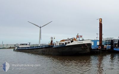
TYPHOON
Reserved for future use
Current Trip
ZUTENDAAL
| Time Travelled | 5 days |
|---|---|
| Remaining Time | --- |
| Distance Travelled | 166.06 nm |
| Remaining Distance | --- |
| AVG Speed | 7.7 Knots |
| MAX Speed | 13.1 Knots |
| AVG Wind | 6.3 knots |
| MAX Wind | 13.7 knots |
| MIN Temp | 3.4°C / 38.12°F |
| MAX Temp | 12°C / 53.6°F |
| Draught | 0 m |
| Position Received | 48 m ago |
Current Position
| Longitude | --- |
|---|---|
| Latitude | --- |
| Status | Default |
| Speed | 8.8 Knots |
| Course | 314.1° |
| Area | North Sea |
| Station | T-AIS |
| Position Received | 48 m ago |
Info
Information
The current position of TYPHOON is in North Sea with coordinates 51.51933° / 6.14197° as reported on 2026-04-03 06:35 by AIS to our vessel tracker app. The vessel's current speed is 8.8 Knots
The vessel TYPHOON (MMSI: 253231106) is a Reserved for future use It's sailing under the flag of [LU] Luxembourg.
In this page you can find informations about the vessels current position, last detected port calls, and current voyage information. If the vessels is not in coverage by AIS you will find the latest position.
The current position of TYPHOON is detected by our AIS receivers and we are not responsible for the reliability of the data. The last position was recorded while the vessel was in Coverage by the Ais receivers of our vessel tracking app.
Weather
| Temperature | 3.6°C / 38.48°F |
|---|---|
| Wind Speed | 5 knots |
| Direction | 203° SSW |
| Pressure | 1017.8 hPa |
| Humidity | 78.1 % |
| Cloud Coverage | 75 % |
Featured Company
Last Port Calls
| Port | Arrival | Departure | Time In Port |
|---|---|---|---|
| 2026-03-28 16:01 | 2026-03-28 16:45 | 43 m | |
| 2026-03-17 14:55 | 2026-03-17 16:34 | 1 h | |
| 2026-03-14 11:06 | 2026-03-14 11:59 | 52 m | |
| 2026-02-27 12:22 | 2026-03-12 09:03 | 12 d | |
| 2026-02-22 15:27 | 2026-02-22 16:09 | 42 m | |
| 2026-02-13 13:04 | 2026-02-13 20:52 | 7 h | |
| 2026-02-12 14:25 | 2026-02-12 15:45 | 1 h | |
| 2026-02-06 07:24 | 2026-02-11 11:51 | 5 d | |
| 2026-02-05 22:03 | 2026-02-06 06:42 | 8 h | |
| 2026-02-05 19:40 | 2026-02-05 20:49 | 1 h |
Last Trips
| Origin | Departure | Destination | Arrival | Distance | |
|---|---|---|---|---|---|
| 2026-03-17 16:34 | 2026-03-28 16:01 | 91.61 nm | |||
| 2026-03-14 11:59 | 2026-03-17 14:55 | 118.33 nm | |||
| 2026-03-12 09:03 | 2026-03-14 11:06 | 80.92 nm | |||
| 2026-02-22 16:09 | 2026-02-27 12:22 | 143.29 nm | |||
| 2026-02-13 20:52 | 2026-02-22 15:27 | 43.66 nm | |||
| 2026-02-12 15:45 | 2026-02-13 13:04 | 33.22 nm | |||
| 2026-02-11 11:51 | 2026-02-12 14:25 | 107.76 nm | |||
| 2026-02-06 06:42 | 2026-02-06 07:24 | 3.22 nm | |||
| 2026-02-05 20:49 | 2026-02-05 22:03 | 7.38 nm | |||
| 2026-02-05 15:10 | 2026-02-05 19:40 | 27.35 nm |
Events
| Time | Event | Details | Position / Dest | Info |
|---|---|---|---|---|
| 2026-04-03 05:58 | IN Coverage |
51.44095 / 6.15437
North Sea
|
Speed: 9 kn Course: 14.2° |
|
| 2026-04-02 12:16 | OUT of Coverage |
51.03333 / 5.79824
North Sea
|
Speed: 1.8 kn Course: 2.4° |
|
| 2026-04-02 11:26 | IN Coverage |
51.00288 / 5.77417
North Sea
|
Speed: 8 kn Course: 21.1° |
|
| 2026-03-30 12:24 | OUT of Coverage |
50.80065 / 5.69181
North Sea
|
Speed: 1.2 kn Course: 188.6° |
|
| 2026-03-30 12:24 | IN Coverage |
50.80065 / 5.69181
North Sea
|
Speed: 1.2 kn Course: 188.6° |
|
| 2026-03-30 10:05 | OUT of Coverage |
51.00153 / 5.77308
North Sea
|
Speed: 6.4 kn Course: 194.8° |
|
| 2026-03-30 09:50 | IN Coverage |
51.02148 / 5.78859
North Sea
|
Speed: 6.5 kn Course: 202.3° |
|
| 2026-03-29 14:19 | OUT of Coverage |
51.48840 / 6.16695
North Sea
|
Speed: 6.6 kn Course: 182.7° |
|
| 2026-03-29 14:02 | IN Coverage |
51.51458 / 6.15367
North Sea
|
Speed: 6.7 kn Course: 114.4° |
|
| 2026-03-29 10:35 | OUT of Coverage |
51.75456 / 5.87174
North Sea
|
Speed: 6.3 kn Course: 129.5° |