
VIBRANCE
Not available
Current Trip
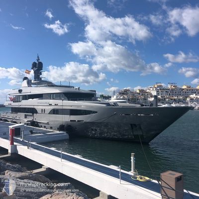
RYBOVICH WPB FLORIDA
| Time Travelled | --- |
|---|---|
| Remaining Time | --- |
| Distance Travelled | 299.00 nm |
| Remaining Distance | --- |
| AVG Speed | 6.4 Knots |
| MAX Speed | 11.4 Knots |
| AVG Wind | 10.7 knots |
| MAX Wind | 19.7 knots |
| MIN Temp | 20°C / 68°F |
| MAX Temp | 27.2°C / 80.96°F |
| Draught | 3 m |
| Position Received | 6 m ago |
Current Position
| Longitude | --- |
|---|---|
| Latitude | --- |
| Status | Moored |
| Speed | |
| Course | 179° |
| Area | North Atlantic Ocean |
| Station | T-AIS |
| Position Received | 6 m ago |
Information
The current position of VIBRANCE is in North Atlantic Ocean with coordinates 26.74876° / -80.04894° as reported on 2025-03-27 17:05 by AIS to our vessel tracker app. The vessel's current speed is 0 Knots
The vessel VIBRANCE (MMSI: 319129000) is a Not available It's sailing under the flag of [KY] Cayman Is.
In this page you can find informations about the vessels current position, last detected port calls, and current voyage information. If the vessels is not in coverage by AIS you will find the latest position.
The current position of VIBRANCE is detected by our AIS receivers and we are not responsible for the reliability of the data. The last position was recorded while the vessel was in Coverage by the Ais receivers of our vessel tracking app.
The current draught of VIBRANCE as reported by AIS is 3 meters
Weather
| Temperature | 25.3°C / 77.54°F |
|---|---|
| Wind Speed | 11 knots |
| Direction | 74° ENE |
| Pressure | 1023.9 hPa |
| Humidity | 49.5 % |
| Cloud Coverage | 19 % |


Featured Company
Last Port Calls
| Port | Arrival | Departure | Time In Port |
|---|---|---|---|
| 2025-01-16 15:09 | 2025-01-16 15:48 | 39 m | |
| 2025-01-08 13:51 | 2025-01-11 20:07 | 3 d | |
| 2025-01-02 18:13 | 2025-01-03 17:04 | 22 h |
Most Visited Ports (Last year)
| Port | Arrivals | |
|---|---|---|
| 13 | ||
| 2 | ||
| 2 | ||
| 2 | ||
| 2 | ||
| 1 |
Last Trips
| Origin | Departure | Destination | Arrival | Distance | |
|---|---|---|---|---|---|
| 2025-01-11 16:07 | 2025-01-16 10:09 | 1144.10 nm | |||
| 2025-01-03 13:04 | 2025-01-08 09:51 | 19.74 nm | |||
| 2024-12-26 08:40 | 2025-01-02 14:13 | 20.15 nm |
Events
| Time | Event | Details | Position / Dest | Info |
|---|---|---|---|---|
| 2025-03-27 11:56 | Status Changed | Moored Under way using engine |
26.74878 / -80.04892
RYBOVICH WPB FLORIDA
|
Speed: Course: 179° |
| 2025-03-27 11:41 | STOP Moving | 1.5 nm, South of PALM BEACH |
26.74840 / -80.04916
RYBOVICH WPB FLORIDA
|
Speed: Course: 260° |
| 2025-03-27 10:40 | Destination Changed | RYBOVICH WPB FLORIDA FREEPORT |
26.75825 / -79.95016
RYBOVICH WPB FLORIDA
|
Speed: 8.5 kn Course: 285° |
| 2025-03-27 10:19 | Detected in Sea | United States part of the North Atlantic Ocean |
26.74652 / -79.89928
North Atlantic Ocean
|
Speed: 8.9 kn Course: 284° |
| 2025-03-27 10:19 | IN Coverage |
26.74652 / -79.89928
North Atlantic Ocean
|
Speed: 8.9 kn Course: 284° |
|
| 2025-03-26 15:37 | OUT of Coverage |
26.57193 / -79.20223
North Atlantic Ocean
|
Speed: 11.4 kn Course: 104° |
|
| 2025-03-26 14:07 | Change Sea Area | Bahamas part of the North Atlantic Ocean United States part of the North Atlantic Ocean |
26.65376 / -79.49711
North Atlantic Ocean
|
Speed: 10.8 kn Course: 104.9° |
| 2025-03-26 14:05 | IN Coverage |
26.65376 / -79.49711
North Atlantic Ocean
|
Speed: 10.8 kn Course: 104.9° |
|
| 2025-03-26 12:26 | OUT of Coverage |
26.72719 / -79.81635
North Atlantic Ocean
|
Speed: 10.4 kn Course: 104° |
|
| 2025-03-26 11:22 | Destination Changed | FREEPORT PALM HARBOR WPB |
26.77196 / -80.01900
FREEPORT
|
Speed: 11.2 kn Course: 91° |