

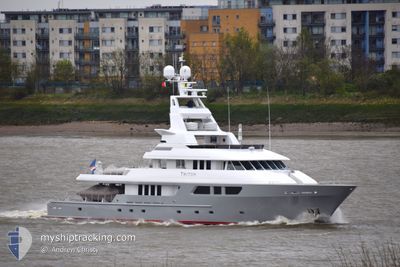
TRITON
Pleasure Craft

Current Trip
ANTIGUA
| Time Travelled | 3 days |
|---|---|
| Remaining Time | --- |
| Distance Travelled | 28.69 nm |
| Remaining Distance | --- |
| AVG Speed | 12.3 Knots |
| MAX Speed | 12.6 Knots |
| AVG Wind | 1.1 knots |
| MAX Wind | 2.2 knots |
| MIN Temp | 24.1°C / 75.38°F |
| MAX Temp | 24.9°C / 76.82°F |
| Draught | 3.5 m |
| Position Received | 3 d ago |
Current Position
| Longitude | --- |
|---|---|
| Latitude | --- |
| Status | Under way using engine |
| Speed | 12.4 Knots |
| Course | 260.2° |
| Area | Caribbean Sea |
| Station | T-AIS |
| Position Received | 3 d ago |
Information
The current position of TRITON is in Caribbean Sea with coordinates 16.90151° / -62.30141° as reported on 2025-03-18 12:49 by AIS to our vessel tracker app. The vessel's current speed is 12.4 Knots
The vessel TRITON (IMO: 9093799, MMSI: 538070070) is a Pleasure Craft It's sailing under the flag of [MH] Marshall Is.
In this page you can find informations about the vessels current position, last detected port calls, and current voyage information. If the vessels is not in coverage by AIS you will find the latest position.
The current position of TRITON is detected by our AIS receivers and we are not responsible for the reliability of the data. The last position was recorded while the vessel was in Coverage by the Ais receivers of our vessel tracking app.
The current draught of TRITON as reported by AIS is 3.5 meters
Weather
| Temperature | 24.8°C / 76.64°F |
|---|---|
| Wind Speed | 1 knots |
| Direction | 103° ESE |
| Pressure | 1014.7 hPa |
| Humidity | 73.3 % |
| Cloud Coverage | 49 % |


Featured Company
Last Port Calls
| Port | Arrival | Departure | Time In Port |
|---|---|---|---|
| 2025-02-24 17:33 | 2025-03-18 06:16 | 21 d | |
| 2025-02-19 11:43 | 2025-02-24 08:34 | 4 d | |
| 2025-02-18 16:46 | 2025-02-19 09:03 | 16 h | |
| 2025-02-10 18:09 | 2025-02-12 08:38 | 1 d | |
| 2025-02-04 15:06 | 2025-02-08 11:16 | 3 d | |
| 2025-02-04 08:55 | |||
| 2025-01-10 21:31 | 2025-01-26 13:16 | 15 d | |
| 2025-01-06 13:45 | 2025-01-10 05:20 | 3 d | |
| 2025-01-01 10:08 |
Most Visited Ports (Last year)
| Port | Arrivals | |
|---|---|---|
| 3 | ||
| 2 | ||
| 2 | ||
| 2 | ||
| 1 | ||
| 1 |
Last Trips
| Origin | Departure | Destination | Arrival | Distance | |
|---|---|---|---|---|---|
| 2025-02-24 08:34 | 2025-02-24 17:33 | 101.14 nm | |||
| 2025-02-19 09:03 | 2025-02-19 11:43 | 17.98 nm | |||
| 2025-02-12 08:38 | 2025-02-18 16:46 | 170.92 nm | |||
| 2025-02-08 11:16 | 2025-02-10 18:09 | 28.87 nm | |||
| 2025-02-04 08:55 | 2025-02-04 15:06 | 40.26 nm | |||
| 2025-01-10 05:20 | 2025-01-10 21:31 | 162.76 nm | |||
| 2025-01-01 10:08 | 2025-01-06 13:45 | 209.99 nm |
Events
| Time | Event | Details | Position / Dest | Info |
|---|---|---|---|---|
| 2025-03-18 12:49 | OUT of Coverage |
16.90151 / -62.30141
Caribbean Sea
|
Speed: 12.4 kn Course: 260.2° |
|
| 2025-03-18 12:36 | Change Sea Area | Antigua and Barbuda part of the Caribbean Sea Montserrat part of the Caribbean Sea |
16.91049 / -62.25812
Caribbean Sea
|
Speed: 12.3 kn Course: 262.5° |
| 2025-03-18 11:40 | Change Sea Area | Montserrat part of the Caribbean Sea Antigua and Barbuda part of the Caribbean Sea |
16.94959 / -62.06083
Caribbean Sea
|
Speed: 12.3 kn Course: 261.3° |
| 2025-03-18 10:16 | PORT DEPARTURE |
|
17.01186 / -61.77790
ANTIGUA
|
Speed: 5 kn Course: 258° |
| 2025-03-18 10:15 | START Moving |
17.01217 / -61.77645
[AG] ANTIGUA
|
Speed: 5 kn Course: 258° |
|
| 2025-03-18 09:50 | Status Changed | Under way using engine Moored |
17.01234 / -61.77119
[AG] ANTIGUA
|
Speed: Course: 338° |
| 2025-03-18 05:03 | IN Coverage |
17.01237 / -61.77120
Caribbean Sea
[AG] ANTIGUA
|
Speed: Course: 174° |
|
| 2025-03-18 03:48 | OUT of Coverage |
17.01238 / -61.77116
Caribbean Sea
[AG] ANTIGUA
|
Speed: Course: 174° |
|
| 2025-03-18 01:15 | IN Coverage |
17.01242 / -61.77121
Caribbean Sea
[AG] ANTIGUA
|
Speed: Course: 174° |
|
| 2025-03-18 00:12 | OUT of Coverage |
17.01238 / -61.77121
Caribbean Sea
[AG] ANTIGUA
|
Speed: Course: 174° |