

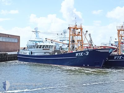
TRIJNTJE
Fishing

Current Trip
HOERNUM
| Time Travelled | 7 mins |
|---|---|
| Remaining Time | --- |
| Distance Travelled | 0.86 nm |
| Remaining Distance | --- |
| AVG Speed | --- |
| MAX Speed | --- |
| AVG Wind | 9.4 knots |
| MAX Wind | 9.7 knots |
| MIN Temp | 7.6°C / 45.68°F |
| MAX Temp | 7.6°C / 45.68°F |
| Draught | 1.2 m |
| Position Received | 1 m ago |
Current Position
| Longitude | --- |
|---|---|
| Latitude | --- |
| Status | Engaged in Fishing |
| Speed | 9 Knots |
| Course | 51.8° |
| Area | North Sea |
| Station | T-AIS |
| Position Received | 1 m ago |
Information
The current position of TRIJNTJE is in North Sea with coordinates 54.77479° / 8.31607° as reported on 2025-04-10 11:58 by AIS to our vessel tracker app. The vessel's current speed is 9 Knots
The vessel TRIJNTJE (MMSI: 211282410) is a Fishing It's sailing under the flag of [DE] Germany.
In this page you can find informations about the vessels current position, last detected port calls, and current voyage information. If the vessels is not in coverage by AIS you will find the latest position.
The current position of TRIJNTJE is detected by our AIS receivers and we are not responsible for the reliability of the data. The last position was recorded while the vessel was in Coverage by the Ais receivers of our vessel tracking app.
The current draught of TRIJNTJE as reported by AIS is 1.2 meters
Weather
| Temperature | 7.5°C / 45.5°F |
|---|---|
| Wind Speed | 8 knots |
| Direction | 271° W |
| Pressure | 1025.6 hPa |
| Humidity | 84.9 % |
| Cloud Coverage | 38 % |


Featured Company
Last Port Calls
| Port | Arrival | Departure | Time In Port |
|---|---|---|---|
| 2025-04-10 12:10 | 2025-04-10 13:53 | 1 h | |
| 2025-04-09 16:58 | 2025-04-10 07:27 | 14 h | |
| 2025-04-08 17:51 | 2025-04-09 07:05 | 13 h | |
| 2025-04-07 17:47 | 2025-04-08 07:19 | 13 h | |
| 2025-04-07 16:32 | 2025-04-07 17:18 | 46 m | |
| 2025-04-06 17:33 | 2025-04-07 08:31 | 14 h | |
| 2025-04-06 12:34 | 2025-04-06 14:40 | 2 h | |
| 2025-04-05 17:42 | 2025-04-06 07:22 | 13 h | |
| 2025-04-05 11:02 | 2025-04-05 11:28 | 25 m | |
| 2025-04-04 16:23 | 2025-04-05 07:54 | 15 h |
Last Trips
| Origin | Departure | Destination | Arrival | Distance | |
|---|---|---|---|---|---|
| 2025-04-10 07:27 | 2025-04-10 12:10 | 13.45 nm | |||
| 2025-04-09 07:05 | 2025-04-09 16:58 | 31.86 nm | |||
| 2025-04-08 07:19 | 2025-04-08 17:51 | 34.34 nm | |||
| 2025-04-07 17:18 | 2025-04-07 17:47 | 1.85 nm | |||
| 2025-04-07 08:31 | 2025-04-07 16:32 | 32.31 nm | |||
| 2025-04-06 14:40 | 2025-04-06 17:33 | 10.74 nm | |||
| 2025-04-06 07:22 | 2025-04-06 12:34 | 17.64 nm | |||
| 2025-04-05 11:28 | 2025-04-05 17:42 | 18.22 nm | |||
| 2025-04-05 07:54 | 2025-04-05 11:02 | 14.86 nm | |||
| 2025-04-04 14:10 | 2025-04-04 16:23 | 18.35 nm |
Events
| Time | Event | Details | Position / Dest | Info |
|---|---|---|---|---|
| 2025-04-10 11:53 | PORT DEPARTURE |
|
54.76433 / 8.30300
HOERNUM
|
Speed: 8.7 kn Course: 20° |
| 2025-04-10 11:51 | START Moving |
54.75919 / 8.29774
[DE] HOERNUM
|
Speed: 7.1 kn Course: 32° |
|
| 2025-04-10 10:12 | STOP Moving |
54.75867 / 8.29467
[DE] HOERNUM
|
Speed: 0.3 kn Course: 203° |
|
| 2025-04-10 10:10 | PORT ARRIVAL |
|
54.76044 / 8.29897
[DE] HOERNUM
|
Speed: 9.5 kn Course: 210.4° |
| 2025-04-10 08:51 | START Moving | 2.64 nm, North of HOERNUM |
54.80300 / 8.30943
HOERNUM
|
Speed: 3.4 kn Course: 311° |
| 2025-04-10 08:48 | STOP Moving | 2.55 nm, North of HOERNUM |
54.80136 / 8.31108
HOERNUM
|
Speed: 0.2 kn Course: 341° |
| 2025-04-10 07:24 | START Moving | 2.44 nm, North of HOERNUM |
54.79928 / 8.31266
HOERNUM
|
Speed: 3.9 kn Course: 343° |
| 2025-04-10 07:21 | STOP Moving | 2.36 nm, North of HOERNUM |
54.79816 / 8.31007
HOERNUM
|
Speed: 0.2 kn Course: 158° |
| 2025-04-10 06:40 | START Moving | 1.5 nm, North East of HOERNUM |
54.78043 / 8.32166
HOERNUM
|
Speed: 3.3 kn Course: 346° |
| 2025-04-10 05:42 | STOP Moving | 1.45 nm, North East of HOERNUM |
54.77877 / 8.32317
HOERNUM
|
Speed: Course: 337° |