
TRAMMO MARYCAM
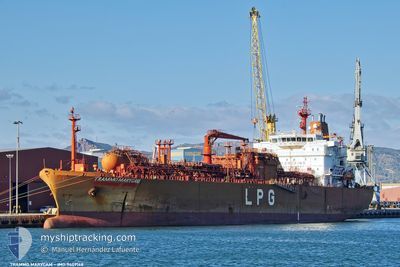
Lpg Tanker
Current Trip
| Time Travelled | 10 days |
|---|---|
| Remaining Time | 4 days |
| Distance Travelled | 1645.34 nm |
| Remaining Distance | 1713.75 nm |
| AVG Speed | 13.4 Knots |
| MAX Speed | 17.3 Knots |
| AVG Wind | 8.3 knots |
| MAX Wind | 27.8 knots |
| MIN Temp | 10.9°C / 51.62°F |
| MAX Temp | 21.7°C / 71.06°F |
| Draught | 6.8 m |
| Position Received | 4 h, 41 m ago |
Current Position
| Longitude | 1.62910° |
|---|---|
| Latitude | 37.13061° |
| Status | Under way using engine |
| Speed | 14.1 Knots |
| Course | 246.2° |
| Area | Mediterranean Sea - Western Basin |
| Station | T-AIS |
| Position Received | 4 h, 41 m ago |
Info
Information
The current position of TRAMMO MARYCAM is in Mediterranean Sea - Western Basin with coordinates 37.13061° / 1.62910° as reported on 2024-05-14 00:11 by AIS to our vessel tracker app. The vessel's current speed is 14.1 Knots and is heading at the port of TERNEUZEN. The estimated time of arrival as calculated by MyShipTracking vessel tracking app is 2024-05-19 02:24 LT
The vessel TRAMMO MARYCAM (IMO: 9409168, MMSI: 563195100) is a Lpg Tanker that was built in 2009 ( 15 years old ). It's sailing under the flag of [SG] Singapore.
In this page you can find informations about the vessels current position, last detected port calls, and current voyage information. If the vessels is not in coverage by AIS you will find the latest position.
The current position of TRAMMO MARYCAM is detected by our AIS receivers and we are not responsible for the reliability of the data. The last position was recorded while the vessel was in Coverage by the Ais receivers of our vessel tracking app.
The current draught of TRAMMO MARYCAM as reported by AIS is 6.8 meters
Weather
| Temperature | 18.7°C / 65.66°F |
|---|---|
| Wind Speed | 16 knots |
| Direction | 214° SW |
| Pressure | 1006.4 hPa |
| Humidity | 80 % |
| Cloud Coverage | 38 % |
Featured Company
Last Port Calls
| Port | Arrival | Departure | Time In Port |
|---|---|---|---|
| 2024-04-14 13:18 | 2024-05-03 16:03 | 19 d | |
| 2024-04-04 06:28 | 2024-04-06 10:57 | 2 d | |
| 2024-04-02 08:04 | 2024-04-03 05:12 | 21 h | |
| 2024-03-27 12:58 | 2024-03-28 06:54 | 17 h | |
| 2024-03-19 14:48 | 2024-03-20 06:55 | 16 h |
Most Visited Ports (Last year)
| Port | Arrivals | |
|---|---|---|
| 5 | ||
| 4 | ||
| 4 | ||
| 3 | ||
| 3 | ||
| 2 |
Last Trips
| Origin | Departure | Destination | Arrival | Distance | |
|---|---|---|---|---|---|
| 2024-04-06 12:57 | 2024-04-14 16:18 | 1737.75 nm | |||
| 2024-04-03 07:12 | 2024-04-04 08:28 | 43.04 nm | |||
| 2024-03-28 08:54 | 2024-04-02 10:04 | 1502.26 nm | |||
| 2024-03-20 08:55 | 2024-03-27 14:58 | 1375.16 nm | |||
| 2024-01-25 10:33 | 2024-03-19 16:48 | 6930.61 nm |
Events
| Time | Event | Details | Position / Dest | Info |
|---|---|---|---|---|
| 2024-05-14 00:16 | Status Changed | Default Under way using engine |
37.12264 / 1.60668
FOR ORDER
|
Speed: 14.1 kn Course: 246.2° |
| 2024-05-14 00:11 | Status Changed | Under way using engine Default |
37.13061 / 1.62910
FOR ORDER
|
Speed: 14.1 kn Course: 246° |
| 2024-05-14 00:11 | OUT of Coverage |
37.13061 / 1.62910
Mediterranean Sea - Western Basin
FOR ORDER
|
Speed: 14.1 kn Course: 246.2° |
|
| 2024-05-14 00:01 | IN Coverage |
37.13061 / 1.62910
Mediterranean Sea - Western Basin
FOR ORDER
|
Speed: 14.1 kn Course: 246.2° |
|
| 2024-05-13 22:16 | Status Changed | Default Under way using engine |
37.28282 / 2.16683
FOR ORDER
|
Speed: 14.9 kn Course: 263° |
| 2024-05-13 22:12 | OUT of Coverage |
37.28494 / 2.19195
Mediterranean Sea - Western Basin
FOR ORDER
|
Speed: 14.9 kn Course: 263° |
|
| 2024-05-13 22:11 | Status Changed | Under way using engine Default |
37.28525 / 2.19517
FOR ORDER
|
Speed: 15.6 kn Course: 266° |
| 2024-05-13 22:05 | Status Changed | Default Under way using engine |
37.28749 / 2.22982
FOR ORDER
|
Speed: 14.9 kn Course: 265° |
| 2024-05-13 21:58 | Status Changed | Under way using engine Default |
37.28983 / 2.26730
FOR ORDER
|
Speed: 15.7 kn Course: 265° |
| 2024-05-13 20:55 | OUT of Coverage |
37.30721 / 2.61290
Mediterranean Sea - Western Basin
FOR ORDER
|
Speed: 15.9 kn Course: 265° |