
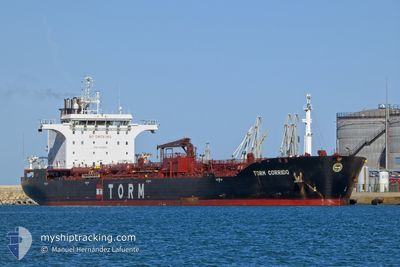
TORM CORRIDO
Oil/Chemical Tanker
Current Trip
| Time Travelled | 7 h, 7 mins |
|---|---|
| Remaining Time | --- |
| Distance Travelled | 45.54 nm |
| Remaining Distance | --- |
| AVG Speed | 13.6 Knots |
| MAX Speed | 15 Knots |
| AVG Wind | 7.9 knots |
| MAX Wind | 10.9 knots |
| MIN Temp | 25°C / 77°F |
| MAX Temp | 28.3°C / 82.94°F |
| Draught | 12.2 m |
| Position Received | 3 h, 42 m ago |
Current Position
| Longitude | -89.39950° |
|---|---|
| Latitude | 29.34109° |
| Status | Under way using engine |
| Speed | 14.4 Knots |
| Course | 136.4° |
| Area | Gulf of Mexico |
| Station | T-AIS |
| Position Received | 3 h, 42 m ago |
Info
Information
The current position of TORM CORRIDO is in Gulf of Mexico with coordinates 29.34109° / -89.39950° as reported on 2024-05-04 19:31 by AIS to our vessel tracker app. The vessel's current speed is 14.4 Knots
The vessel TORM CORRIDO (IMO: 9411305, MMSI: 219028420) is a Oil/Chemical Tanker that was built in 2011 ( 13 years old ). It's sailing under the flag of [DK] Denmark.
In this page you can find informations about the vessels current position, last detected port calls, and current voyage information. If the vessels is not in coverage by AIS you will find the latest position.
The current position of TORM CORRIDO is detected by our AIS receivers and we are not responsible for the reliability of the data. The last position was recorded while the vessel was in Coverage by the Ais receivers of our vessel tracking app.
The current draught of TORM CORRIDO as reported by AIS is 12.2 meters
Weather
| Temperature | 27.3°C / 81.14°F |
|---|---|
| Wind Speed | 7 knots |
| Direction | 114° ESE |
| Pressure | 1015.4 hPa |
| Humidity | 60.2 % |
| Cloud Coverage | 100 % |
Featured Company
Last Trips
| Origin | Departure | Destination | Arrival | Distance | |
|---|---|---|---|---|---|
| 2024-04-17 02:15 | 2024-04-25 13:26 | 1893.94 nm | |||
| 2024-04-14 12:14 | 2024-04-17 00:55 | 44.40 nm | |||
| 2024-03-22 13:59 | 2024-04-13 06:03 | 5200.38 nm | |||
| 2024-03-18 19:02 | 2024-03-20 13:55 | 325.58 nm | |||
| 2024-02-18 12:17 | 2024-03-17 15:30 | 5758.39 nm |
Events
| Time | Event | Details | Position / Dest | Info |
|---|---|---|---|---|
| 2024-05-04 19:34 | Status Changed | Default Under way using engine |
29.33384 / -89.39211
USMSY
|
Speed: 14.4 kn Course: 136.4° |
| 2024-05-04 19:31 | Status Changed | Under way using engine Default |
29.34109 / -89.39950
USMSY
|
Speed: 13.8 kn Course: 114° |
| 2024-05-04 19:31 | OUT of Coverage |
29.34109 / -89.39950
Gulf of Mexico
|
Speed: 14.4 kn Course: 136.4° |
|
| 2024-05-04 18:38 | Status Changed | Default Under way using engine |
29.39201 / -89.59490
USMSY
|
Speed: 12.8 kn Course: 184.1° |
| 2024-05-04 18:30 | Status Changed | Under way using engine Default |
29.41473 / -89.60704
USMSY
|
Speed: 10.8 kn Course: 196° |
| 2024-05-04 18:06 | Status Changed | Default Under way using engine |
29.45709 / -89.64650
USMSY
|
Speed: 15.1 kn Course: 153.6° |
| 2024-05-04 17:30 | Status Changed | Under way using engine Default |
29.55115 / -89.76847
USMSY
|
Speed: 14.8 kn Course: 136° |
| 2024-05-04 17:18 | Status Changed | Default Under way using engine |
29.58369 / -89.80958
USMSY
|
Speed: 14.4 kn Course: 121.4° |
| 2024-05-04 17:06 | Status Changed | Under way using engine Default |
29.60400 / -89.85741
USMSY
|
Speed: 10.9 kn Course: 109° |
| 2024-05-04 17:02 | IN Coverage |
29.60305 / -89.85055
Gulf of Mexico
|
Speed: 13.4 kn Course: 98.5° |