
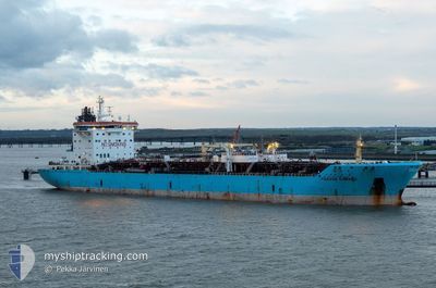
TONDA
Oil/Chemical Tanker
Current Trip
IN IXY
| Time Travelled | 5 days |
|---|---|
| Remaining Time | --- |
| Distance Travelled | 553.93 nm |
| Remaining Distance | --- |
| AVG Speed | 11.4 Knots |
| MAX Speed | 13.7 Knots |
| AVG Wind | 4.4 knots |
| MAX Wind | 13.3 knots |
| MIN Temp | 22.8°C / 73.04°F |
| MAX Temp | 31.9°C / 89.42°F |
| Draught | 10.2 m |
| Position Received | 20 d ago |
Current Position
| Longitude | --- |
|---|---|
| Latitude | --- |
| Status | Under way using engine |
| Speed | 12 Knots |
| Course | 98.4° |
| Area | Laccadive Sea |
| Station | T-AIS |
| Position Received | 20 d ago |
Info
Information
The current position of TONDA is in Laccadive Sea with coordinates 5.71363° / 80.26705° as reported on 2025-02-14 22:39 by AIS to our vessel tracker app. The vessel's current speed is 12 Knots
The vessel TONDA (IMO: 9274654, MMSI: 538009156) is a Oil/Chemical Tanker that was built in 2005 ( 20 years old ). It's sailing under the flag of [MH] Marshall Is.
In this page you can find informations about the vessels current position, last detected port calls, and current voyage information. If the vessels is not in coverage by AIS you will find the latest position.
The current position of TONDA is detected by our AIS receivers and we are not responsible for the reliability of the data. The last position was recorded while the vessel was in Coverage by the Ais receivers of our vessel tracking app.
The current draught of TONDA as reported by AIS is 10.2 meters
Weather
| Temperature | 27°C / 80.6°F |
|---|---|
| Wind Speed | 4 knots |
| Direction | 50° NE |
| Pressure | 1010.5 hPa |
| Humidity | 78.4 % |
| Cloud Coverage | 36 % |
Featured Company
Last Trips
| Origin | Departure | Destination | Arrival | Distance | |
|---|---|---|---|---|---|
| 2025-02-23 21:13 | 2025-02-27 17:24 | 309.34 nm | |||
| 2025-02-02 12:25 | 2025-02-21 23:25 | 3073.75 nm | |||
| 2025-01-26 01:30 | 2025-02-01 05:55 | 1230.99 nm | |||
| 2025-01-08 06:11 | 2025-01-22 02:00 | 1348.14 nm | |||
| 2024-12-19 14:51 | 2025-01-06 17:31 | 318.13 nm |
Events
| Time | Event | Details | Position / Dest | Info |
|---|---|---|---|---|
| 2025-03-05 15:50 | START Moving | 12.78 nm, South of PORT KLANG |
2.78762 / 101.31416
IN IXY
|
Speed: 4 kn Course: 286° |
| 2025-03-05 05:06 | STOP Moving | 12.76 nm, South of PORT KLANG |
2.78742 / 101.31685
IN IXY
|
Speed: 0.2 kn Course: 325° |
| 2025-03-04 16:50 | START Moving | 6.03 nm, North West of DUMAI |
1.74884 / 101.37648
IN IXY
|
Speed: 4 kn Course: 110° |
| 2025-03-03 08:22 | STOP Moving | 6.3 nm, North West of DUMAI |
1.75027 / 101.37195
IN IXY
|
Speed: Course: 147° |
| 2025-03-03 07:29 | START Moving | 2.94 nm, North West of DUMAI |
1.72372 / 101.42279
IN IXY
|
Speed: 10.5 kn Course: 299° |
| 2025-03-01 08:44 | STOP Moving | 2.25 nm, North West of DUMAI |
1.71995 / 101.43639
IN IXY
|
Speed: 0.1 kn Course: 113° |
| 2025-03-01 08:05 | PORT DEPARTURE |
|
1.69430 / 101.44812
IN IXY
|
Speed: 3.2 kn Course: 349° |
| 2025-03-01 08:00 | START Moving |
1.69000 / 101.44942
[ID] DUMAI
|
Speed: 3.2 kn Course: 349° |
|
| 2025-02-27 10:24 | STOP Moving |
1.68867 / 101.45143
[ID] DUMAI
|
Speed: 0.1 kn Course: 271° |
|
| 2025-02-27 10:24 | PORT ARRIVAL |
|
1.68867 / 101.45143
[ID] DUMAI
|
Speed: 4.1 kn Course: 212° |