

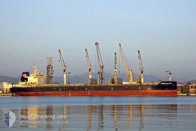
TOMINI SOLANO
Cargo

Current Trip
| Time Travelled | 9 days |
|---|---|
| Remaining Time | 8 days |
| Distance Travelled | 2491.49 nm |
| Remaining Distance | 2156.66 nm |
| AVG Speed | 11.7 Knots |
| MAX Speed | 15.3 Knots |
| AVG Wind | 8.3 knots |
| MAX Wind | 16.3 knots |
| MIN Temp | 17.3°C / 63.14°F |
| MAX Temp | 30°C / 86°F |
| Draught | 6.9 m |
| Position Received | 13 h, 59 m ago |
Current Position
| Longitude | --- |
|---|---|
| Latitude | --- |
| Status | Under way using engine |
| Speed | 11.1 Knots |
| Course | 320.6° |
| Area | North Pacific Ocean |
| Station | T-AIS |
| Position Received | 13 h, 59 m ago |
Information
The current position of TOMINI SOLANO is in North Pacific Ocean with coordinates 20.94571° / -110.59906° as reported on 2025-03-28 04:10 by AIS to our vessel tracker app. The vessel's current speed is 11.1 Knots and is heading at the port of VANCOUVER. The estimated time of arrival as calculated by MyShipTracking vessel tracking app is 2025-04-05 22:29 LT
The vessel TOMINI SOLANO (IMO: 9711731, MMSI: 538005695) is a Cargo It's sailing under the flag of [MH] Marshall Is.
In this page you can find informations about the vessels current position, last detected port calls, and current voyage information. If the vessels is not in coverage by AIS you will find the latest position.
The current position of TOMINI SOLANO is detected by our AIS receivers and we are not responsible for the reliability of the data. The last position was recorded while the vessel was in Coverage by the Ais receivers of our vessel tracking app.
The current draught of TOMINI SOLANO as reported by AIS is 6.9 meters
Weather
| Temperature | 17.6°C / 63.68°F |
|---|---|
| Wind Speed | 13 knots |
| Direction | 339° NNW |
| Pressure | 1016.3 hPa |
| Humidity | 84.4 % |
| Cloud Coverage | 11 % |


Featured Company
Most Visited Ports (Last year)
| Port | Arrivals | |
|---|---|---|
| 3 | ||
| 2 | ||
| 1 | ||
| 1 | ||
| 1 | ||
| 1 |
Last Trips
| Origin | Departure | Destination | Arrival | Distance | |
|---|---|---|---|---|---|
| 2025-03-14 04:45 | 2025-03-16 22:03 | 613.57 nm | |||
| 2025-01-19 06:33 | 2025-03-05 21:58 | 2453.02 nm | |||
| 2025-01-08 15:29 | 2025-01-11 01:52 | 601.08 nm | |||
| 2025-01-01 17:12 | 2025-01-05 09:58 | 517.15 nm |
Events
| Time | Event | Details | Position / Dest | Info |
|---|---|---|---|---|
| 2025-03-28 04:14 | Status Changed | Default Under way using engine |
20.95472 / -110.60703
CA VAN
|
Speed: 11.1 kn Course: 320.6° |
| 2025-03-28 04:10 | OUT of Coverage |
20.94571 / -110.59906
North Pacific Ocean
CA VAN
|
Speed: 11.1 kn Course: 320.6° |
|
| 2025-03-28 03:48 | Status Changed | Under way using engine Default |
20.89440 / -110.55384
CA VAN
|
Speed: 10.8 kn Course: 320° |
| 2025-03-28 03:35 | IN Coverage |
20.89440 / -110.55384
North Pacific Ocean
CA VAN
|
Speed: 10.9 kn Course: 320.1° |
|
| 2025-03-27 19:46 | Status Changed | Default Under way using engine |
19.79691 / -109.56409
CA VAN
|
Speed: 10.7 kn Course: 304.7° |
| 2025-03-27 19:43 | OUT of Coverage |
19.79119 / -109.55558
North Pacific Ocean
CA VAN
|
Speed: 10.7 kn Course: 304.7° |
|
| 2025-03-27 19:14 | Status Changed | Under way using engine Default |
19.74162 / -109.48176
CA VAN
|
Speed: 10.7 kn Course: 305° |
| 2025-03-27 19:06 | Status Changed | Default Under way using engine |
19.72749 / -109.46135
CA VAN
|
Speed: 10.7 kn Course: 305.7° |
| 2025-03-27 19:02 | Status Changed | Under way using engine Default |
19.72012 / -109.45066
CA VAN
|
Speed: 10.8 kn Course: 306° |
| 2025-03-27 18:44 | IN Coverage |
19.72012 / -109.45066
North Pacific Ocean
CA VAN
|
Speed: 10.7 kn Course: 305.7° |