
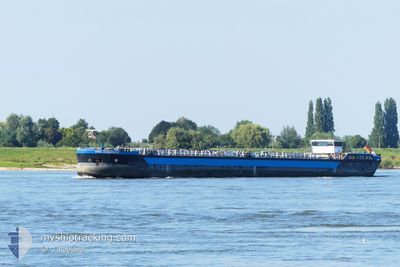
TOM BURMESTER
Tanker
Current Trip
| Time Travelled | 2 days |
|---|---|
| Remaining Time | --- |
| Distance Travelled | 60.15 nm |
| Remaining Distance | --- |
| AVG Speed | 4.8 Knots |
| MAX Speed | 7.2 Knots |
| AVG Wind | 11 knots |
| MAX Wind | 12.8 knots |
| MIN Temp | 10.4°C / 50.72°F |
| MAX Temp | 12.8°C / 55.04°F |
| Draught | 2.5 m |
| Position Received | 23 h, 2 m ago |
Current Position
| Longitude | --- |
|---|---|
| Latitude | --- |
| Status | Under way using engine |
| Speed | 5.9 Knots |
| Course | 59.7° |
| Area | North Sea |
| Station | T-AIS |
| Position Received | 23 h, 2 m ago |
Info
Information
The current position of TOM BURMESTER is in North Sea with coordinates 51.63583° / 6.68410° as reported on 2025-12-10 13:09 by AIS to our vessel tracker app. The vessel's current speed is 5.9 Knots and is heading at the port of GELMER. The estimated time of arrival as calculated by MyShipTracking vessel tracking app is 2025-12-11 18:00 LT
The vessel TOM BURMESTER (MMSI: 211328590) is a Tanker It's sailing under the flag of [DE] Germany.
In this page you can find informations about the vessels current position, last detected port calls, and current voyage information. If the vessels is not in coverage by AIS you will find the latest position.
The current position of TOM BURMESTER is detected by our AIS receivers and we are not responsible for the reliability of the data. The last position was recorded while the vessel was in Coverage by the Ais receivers of our vessel tracking app.
The current draught of TOM BURMESTER as reported by AIS is 2.5 meters
Weather
| Temperature | 12.7°C / 54.86°F |
|---|---|
| Wind Speed | 11 knots |
| Direction | 229° SW |
| Pressure | 1017.8 hPa |
| Humidity | 83.4 % |
| Cloud Coverage | 86 % |
Featured Company
Last Port Calls
| Port | Arrival | Departure | Time In Port |
|---|---|---|---|
| 2025-12-08 12:40 | 2025-12-09 07:34 | 18 h | |
| 2025-12-07 07:59 | 2025-12-08 07:28 | 23 h | |
| 2025-12-06 16:12 | 2025-12-07 07:34 | 15 h | |
| 2025-12-06 12:41 | 2025-12-06 12:53 | 11 m | |
| 2025-12-03 06:07 | |||
| 2025-11-30 06:35 | 2025-11-30 06:56 | 20 m | |
| 2025-11-21 08:06 | 2025-11-29 16:31 | 8 d | |
| 2025-11-20 18:02 | 2025-11-21 07:33 | 13 h | |
| 2025-11-20 14:41 | 2025-11-20 15:32 | 51 m | |
| 2025-11-19 11:17 | 2025-11-20 09:38 | 22 h |
Most Visited Ports (Last year)
| Port | Arrivals | |
|---|---|---|
| 25 | ||
| 20 | ||
| 15 | ||
| 9 | ||
| 9 | ||
| 8 |
Last Trips
| Origin | Departure | Destination | Arrival | Distance | |
|---|---|---|---|---|---|
| 2025-12-08 08:28 | 2025-12-08 13:40 | 30.22 nm | |||
| 2025-12-07 08:34 | 2025-12-07 08:59 | 3.81 nm | |||
| 2025-12-06 13:53 | 2025-12-06 17:12 | 28.59 nm | |||
| 2025-12-03 07:07 | 2025-12-06 13:41 | 88.77 nm | |||
| 2025-11-29 17:31 | 2025-11-30 07:35 | 31.39 nm | |||
| 2025-11-21 08:33 | 2025-11-21 09:06 | 4.48 nm | |||
| 2025-11-20 16:32 | 2025-11-20 19:02 | 22.72 nm | |||
| 2025-11-20 10:38 | 2025-11-20 15:41 | 45.83 nm | |||
| 2025-11-19 11:53 | 2025-11-19 12:17 | 1.76 nm | |||
| 2025-11-05 07:10 | 2025-11-18 11:25 | 437.81 nm |
Events
| Time | Event | Details | Position / Dest | Info |
|---|---|---|---|---|
| 2025-12-10 13:09 | OUT of Coverage |
51.63583 / 6.68410
North Sea
GELMER
|
Speed: 5.9 kn Course: 59.7° |
|
| 2025-12-10 13:09 | IN Coverage |
51.63583 / 6.68410
North Sea
GELMER
|
Speed: 5.9 kn Course: 59.7° |
|
| 2025-12-10 10:46 | OUT of Coverage |
51.63158 / 6.60949
North Sea
GELMER
|
Speed: 0.9 kn Course: 128° |
|
| 2025-12-10 10:01 | IN Coverage |
51.65808 / 6.54241
North Sea
GELMER
|
Speed: 5.5 kn Course: 99.8° |
|
| 2025-12-10 08:22 | Status Changed | Default Under way using engine |
51.75167 / 6.41667
GELMER
|
Speed: 5.9 kn Course: 76.9° |
| 2025-12-10 08:06 | OUT of Coverage |
51.75427 / 6.37734
North Sea
GELMER
|
Speed: 5.9 kn Course: 76.9° |
|
| 2025-12-10 08:04 | Status Changed | Under way using engine Default |
51.75348 / 6.37166
GELMER
|
Speed: 6 kn Course: 111° |
| 2025-12-10 07:55 | IN Coverage |
51.75348 / 6.37166
North Sea
GELMER
|
Speed: 5.9 kn Course: 77.4° |
|
| 2025-12-10 07:07 | Status Changed | Default Under way using engine |
51.81500 / 6.27667
GELMER
|
Speed: 5.8 kn Course: 110.5° |
| 2025-12-10 06:57 | OUT of Coverage |
51.82509 / 6.25514
North Sea
GELMER
|
Speed: 5.8 kn Course: 110.5° |