

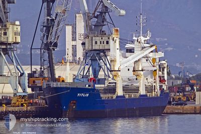
TITLIS
Cargo

Current Trip
| Time Travelled | 2 days |
|---|---|
| Remaining Time | --- |
| Distance Travelled | 222.31 nm |
| Remaining Distance | --- |
| AVG Speed | 10 Knots |
| MAX Speed | 10.8 Knots |
| AVG Wind | 4.7 knots |
| MAX Wind | 15.7 knots |
| MIN Temp | 13.8°C / 56.84°F |
| MAX Temp | 18°C / 64.4°F |
| Draught | 4 m |
| Position Received | 9 m ago |
Current Position
| Longitude | --- |
|---|---|
| Latitude | --- |
| Status | At anchor |
| Speed | |
| Course | 130° |
| Area | Mediterranean Sea - Western Basin |
| Station | T-AIS |
| Position Received | 9 m ago |
Information
The current position of TITLIS is in Mediterranean Sea - Western Basin with coordinates 37.56755° / -1.01306° as reported on 2025-03-28 11:34 by AIS to our vessel tracker app. The vessel's current speed is 0 Knots
The vessel TITLIS (MMSI: 255806316) is a Cargo It's sailing under the flag of [PT] Portugal.
In this page you can find informations about the vessels current position, last detected port calls, and current voyage information. If the vessels is not in coverage by AIS you will find the latest position.
The current position of TITLIS is detected by our AIS receivers and we are not responsible for the reliability of the data. The last position was recorded while the vessel was in Coverage by the Ais receivers of our vessel tracking app.
The current draught of TITLIS as reported by AIS is 4 meters
Weather
| Temperature | 18°C / 64.4°F |
|---|---|
| Wind Speed | 3 knots |
| Direction | 226° SW |
| Pressure | 1016.1 hPa |
| Humidity | 51.6 % |
| Cloud Coverage | 6 % |


Featured Company
Last Port Calls
| Port | Arrival | Departure | Time In Port |
|---|---|---|---|
| 2025-03-23 08:56 | 2025-03-25 12:48 | 2 d | |
| 2025-03-21 00:48 | 2025-03-22 09:36 | 1 d | |
| 2025-03-15 15:09 | 2025-03-19 08:07 | 3 d | |
| 2025-03-06 11:06 | 2025-03-07 21:30 | 1 d | |
| 2025-03-02 07:32 | 2025-03-04 11:05 | 2 d | |
| 2025-02-22 21:45 | 2025-02-24 21:53 | 2 d | |
| 2025-02-19 20:22 | 2025-02-20 15:57 | 19 h | |
| 2025-02-17 11:30 | 2025-02-17 20:15 | 8 h | |
| 2025-02-15 05:38 | 2025-02-15 14:41 | 9 h | |
| 2025-02-13 10:41 | 2025-02-14 19:58 | 1 d |
Most Visited Ports (Last year)
| Port | Arrivals | |
|---|---|---|
| 8 | ||
| 8 | ||
| 7 | ||
| 5 | ||
| 4 | ||
| 4 |
Last Trips
| Origin | Departure | Destination | Arrival | Distance | |
|---|---|---|---|---|---|
| 2025-03-22 10:36 | 2025-03-23 09:56 | 221.37 nm | |||
| 2025-03-19 08:07 | 2025-03-21 01:48 | 441.65 nm | |||
| 2025-03-07 22:30 | 2025-03-15 15:09 | 637.80 nm | |||
| 2025-03-04 12:05 | 2025-03-06 12:06 | 304.69 nm | |||
| 2025-02-24 22:53 | 2025-03-02 08:32 | 1247.69 nm | |||
| 2025-02-20 16:57 | 2025-02-22 22:45 | 573.75 nm | |||
| 2025-02-17 21:15 | 2025-02-19 21:22 | 191.36 nm | |||
| 2025-02-15 15:41 | 2025-02-17 12:30 | 429.13 nm | |||
| 2025-02-14 20:58 | 2025-02-15 06:38 | 112.71 nm | |||
| 2025-02-10 16:12 | 2025-02-13 11:41 | 630.34 nm |
Events
| Time | Event | Details | Position / Dest | Info |
|---|---|---|---|---|
| 2025-03-28 11:37 | Status Changed | Default At anchor |
37.56777 / -1.01319
ESCAR
|
Speed: Course: 130° |
| 2025-03-28 11:34 | Status Changed | At anchor Default |
37.56755 / -1.01306
ESCAR
|
Speed: 0.3 kn Course: 121° |
| 2025-03-28 11:13 | Status Changed | Default At anchor |
37.56676 / -1.01223
ESCAR
|
Speed: Course: 127° |
| 2025-03-28 10:49 | Status Changed | At anchor Default |
37.56632 / -1.01311
ESCAR
|
Speed: 0.2 kn Course: 102° |
| 2025-03-28 10:37 | Status Changed | Default At anchor |
37.56633 / -1.01294
ESCAR
|
Speed: Course: 102° |
| 2025-03-28 09:28 | Status Changed | At anchor Default |
37.56472 / -1.01182
ESCAR
|
Speed: 0.1 kn Course: 358° |
| 2025-03-28 09:25 | Status Changed | Default At anchor |
37.56469 / -1.01174
ESCAR
|
Speed: Course: 356° |
| 2025-03-28 08:43 | Status Changed | At anchor Default |
37.56529 / -1.01119
ESCAR
|
Speed: 0.5 kn Course: 281° |
| 2025-03-28 08:37 | Status Changed | Default At anchor |
37.56615 / -1.01054
ESCAR
|
Speed: Course: 255° |
| 2025-03-28 08:28 | Status Changed | At anchor Default |
37.56688 / -1.01083
ESCAR
|
Speed: 0.1 kn Course: 211° |