

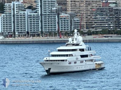
TITANIA
Yacht

Current Trip
SB SBH
| Time Travelled | 16 h, 24 mins |
|---|---|
| Remaining Time | --- |
| Distance Travelled | 2.49 nm |
| Remaining Distance | --- |
| AVG Speed | 3.6 Knots |
| MAX Speed | 3.7 Knots |
| AVG Wind | 16.9 knots |
| MAX Wind | 19 knots |
| MIN Temp | 25.8°C / 78.44°F |
| MAX Temp | 26.3°C / 79.34°F |
| Draught | 3.7 m |
| Position Received | 9 h, 0 m ago |
Current Position
| Longitude | --- |
|---|---|
| Latitude | --- |
| Status | Under way using engine |
| Speed | 1.5 Knots |
| Course | 93° |
| Area | Caribbean Sea |
| Station | T-AIS |
| Position Received | 9 h, 0 m ago |
Information
The current position of TITANIA is in Caribbean Sea with coordinates 17.90317° / -62.85760° as reported on 2025-03-26 21:58 by AIS to our vessel tracker app. The vessel's current speed is 1.5 Knots
The vessel TITANIA (IMO: 1008695, MMSI: 235081036) is a Yacht that was built in 2006 ( 19 years old ). It's sailing under the flag of [GB] United Kingdom.
In this page you can find informations about the vessels current position, last detected port calls, and current voyage information. If the vessels is not in coverage by AIS you will find the latest position.
The current position of TITANIA is detected by our AIS receivers and we are not responsible for the reliability of the data. The last position was recorded while the vessel was in Coverage by the Ais receivers of our vessel tracking app.
The current draught of TITANIA as reported by AIS is 3.7 meters
Weather
| Temperature | 26.2°C / 79.16°F |
|---|---|
| Wind Speed | 15 knots |
| Direction | 108° ESE |
| Pressure | 1015.8 hPa |
| Humidity | 76.3 % |
| Cloud Coverage | 90 % |


Featured Company
Last Port Calls
| Port | Arrival | Departure | Time In Port |
|---|---|---|---|
| 2025-03-25 15:21 | 2025-03-26 10:35 | 19 h | |
| 2025-03-24 13:29 | 2025-03-25 07:17 | 17 h | |
| 2025-03-22 13:42 | 2025-03-24 06:14 | 1 d | |
| 2025-03-15 09:37 | 2025-03-21 15:08 | 6 d | |
| 2025-03-05 13:50 | 2025-03-08 07:57 | 2 d | |
| 2025-03-05 03:19 | 2025-03-05 10:08 | 6 h | |
| 2025-02-01 16:27 | 2025-03-04 18:17 | ||
| 2025-01-11 08:54 | 2025-01-12 08:47 | 23 h | |
| 2025-01-05 16:54 | 2025-01-09 08:36 | 3 d |
Most Visited Ports (Last year)
| Port | Arrivals | |
|---|---|---|
| 6 | ||
| 6 | ||
| 4 | ||
| 4 | ||
| 3 | ||
| 3 |
Last Trips
| Origin | Departure | Destination | Arrival | Distance | |
|---|---|---|---|---|---|
| 2025-03-25 07:17 | 2025-03-25 15:21 | 3.70 nm | |||
| 2025-03-24 06:14 | 2025-03-24 13:29 | 2.58 nm | |||
| 2025-03-21 15:08 | 2025-03-22 13:42 | 19.17 nm | |||
| 2025-03-08 07:57 | 2025-03-15 09:37 | 277.30 nm | |||
| 2025-03-05 10:08 | 2025-03-05 13:50 | 10.70 nm | |||
| 2025-03-04 18:17 | 2025-03-05 03:19 | 97.00 nm | |||
| 2025-01-12 08:47 | 2025-02-01 16:27 | 740.24 nm | |||
| 2025-01-09 08:36 | 2025-01-11 08:54 | 43.73 nm | |||
| 2024-12-21 18:30 | 2025-01-05 16:54 | 410.67 nm |
Events
| Time | Event | Details | Position / Dest | Info |
|---|---|---|---|---|
| 2025-03-26 21:58 | OUT of Coverage |
17.90317 / -62.85760
Caribbean Sea
|
Speed: 1.5 kn Course: 100.2° |
|
| 2025-03-26 21:40 | START Moving | 1.13 nm, North West of GUSTAVIA |
17.90938 / -62.87070
SB SBH
|
Speed: 3.5 kn Course: 95° |
| 2025-03-26 21:25 | Status Changed | Under way using engine At anchor |
17.91072 / -62.87065
SB SBH
|
Speed: 0.6 kn Course: 113° |
| 2025-03-26 15:24 | Status Changed | At anchor Moored |
17.91137 / -62.87138
SB SBH
|
Speed: Course: 90° |
| 2025-03-26 15:03 | STOP Moving | 1.23 nm, North West of GUSTAVIA |
17.91158 / -62.87135
SB SBH
|
Speed: 0.3 kn Course: 156° |
| 2025-03-26 14:35 | START Moving | 0.41 nm, North West of GUSTAVIA |
17.90368 / -62.85967
SB SBH
|
Speed: 4.3 kn Course: 281° |
| 2025-03-26 14:35 | PORT DEPARTURE |
|
17.90368 / -62.85967
SB SBH
|
Speed: 3 kn Course: 291° |
| 2025-03-26 12:29 | IN Coverage |
17.90343 / -62.85538
Caribbean Sea
[BL] GUSTAVIA
|
Speed: 0.1 kn Course: 48.5° |
|
| 2025-03-26 02:29 | OUT of Coverage |
17.90342 / -62.85538
Caribbean Sea
[BL] GUSTAVIA
|
Speed: Course: 234.9° |
|
| 2025-03-25 23:38 | IN Coverage |
17.90343 / -62.85540
Caribbean Sea
[BL] GUSTAVIA
|
Speed: 0.2 kn Course: 178.5° |