
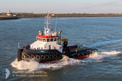
TILL
Tug
Current Trip
DKROD
| Time Travelled | 137 days |
|---|---|
| Remaining Time | --- |
| Distance Travelled | 222.37 nm |
| Remaining Distance | --- |
| AVG Speed | 6.6 Knots |
| MAX Speed | 11.3 Knots |
| AVG Wind | 11.5 knots |
| MAX Wind | 30 knots |
| MIN Temp | 1.9°C / 35.42°F |
| MAX Temp | 16.3°C / 61.34°F |
| Draught | 2.8 m |
| Position Received | Now |
Current Position
| Longitude | 11.33343° |
|---|---|
| Latitude | 54.59781° |
| Status | Under way using engine |
| Speed | 0.9 Knots |
| Course | 26° |
| Area | Baltic Sea |
| Station | T-AIS |
| Position Received | Now |
Info
Information
The current position of TILL is in Baltic Sea with coordinates 54.59781° / 11.33343° as reported on 2024-06-17 08:28 by AIS to our vessel tracker app. The vessel's current speed is 0.9 Knots
The vessel TILL (IMO: 9487029, MMSI: 244468000) is a Tug that was built in 2008 ( 16 years old ). It's sailing under the flag of [NL] Netherlands.
In this page you can find informations about the vessels current position, last detected port calls, and current voyage information. If the vessels is not in coverage by AIS you will find the latest position.
The current position of TILL is detected by our AIS receivers and we are not responsible for the reliability of the data. The last position was recorded while the vessel was in Coverage by the Ais receivers of our vessel tracking app.
The current draught of TILL as reported by AIS is 2.8 meters
Weather
| Temperature | 14.9°C / 58.82°F |
|---|---|
| Wind Speed | 6 knots |
| Direction | 204° SSW |
| Pressure | 1010.7 hPa |
| Humidity | 87 % |
| Cloud Coverage | 90 % |
Featured Company
Last Port Calls
Most Visited Ports (Last year)
| Port | Arrivals | |
|---|---|---|
| 21 | ||
| 9 | ||
| 8 | ||
| 2 | ||
| 1 | ||
| 1 |
Last Trips
| Origin | Departure | Destination | Arrival | Distance |
|---|
Events
| Time | Event | Details | Position / Dest | Info |
|---|---|---|---|---|
| 2024-06-17 06:24 | STOP Moving | 3.3 nm, South of RODBYHAVN |
54.59872 / 11.33320
DKROD
|
Speed: 0.3 kn Course: 178° |
| 2024-06-17 06:16 | START Moving | 3.01 nm, South of RODBYHAVN |
54.60316 / 11.33668
DKROD
|
Speed: 5.7 kn Course: 185.1° |
| 2024-06-17 06:10 | Status Changed | Under way using engine At anchor |
54.60501 / 11.33790
DKROD
|
Speed: Course: 334° |
| 2024-06-16 13:22 | STOP Moving | 2.91 nm, South of RODBYHAVN |
54.60489 / 11.33768
DKROD
|
Speed: 0.3 kn Course: 290° |
| 2024-06-16 13:18 | START Moving | 3.34 nm, South of RODBYHAVN |
54.59755 / 11.33784
DKROD
|
Speed: 8.9 kn Course: 5.5° |
| 2024-06-16 12:58 | STOP Moving | 3.44 nm, South of RODBYHAVN |
54.59616 / 11.33569
DKROD
|
Speed: 0.3 kn Course: 270° |
| 2024-06-16 12:54 | START Moving | 2.98 nm, South of RODBYHAVN |
54.60366 / 11.33648
DKROD
|
Speed: 9.2 kn Course: 189.2° |
| 2024-06-16 08:54 | STOP Moving | 2.89 nm, South of RODBYHAVN |
54.60518 / 11.33819
DKROD
|
Speed: 0.3 kn Course: 324° |
| 2024-06-16 08:51 | START Moving | 3.02 nm, South of RODBYHAVN |
54.60379 / 11.33042
DKROD
|
Speed: 7.5 kn Course: 72.2° |
| 2024-06-16 08:37 | STOP Moving | 3.12 nm, South of RODBYHAVN |
54.60237 / 11.32808
DKROD
|
Speed: 0.3 kn Course: 302° |