
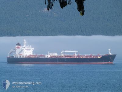
TEXAS
Tanker
Current Trip
NIKISKI, AK
| Time Travelled | 1 day |
|---|---|
| Remaining Time | --- |
| Distance Travelled | 268.36 nm |
| Remaining Distance | --- |
| AVG Speed | 13.2 Knots |
| MAX Speed | 16.4 Knots |
| AVG Wind | 13.8 knots |
| MAX Wind | 22 knots |
| MIN Temp | -5.3°C / 22.46°F |
| MAX Temp | 4.4°C / 39.92°F |
| Draught | 10.7 m |
| Position Received | 9 d ago |
Current Position
| Longitude | --- |
|---|---|
| Latitude | --- |
| Status | Under way using engine |
| Speed | 13.6 Knots |
| Course | 304.5° |
| Area | North Pacific Ocean |
| Station | T-AIS |
| Position Received | 9 d ago |
Info
Information
The current position of TEXAS is in North Pacific Ocean with coordinates 46.60673° / -125.19647° as reported on 2025-01-19 10:17 by AIS to our vessel tracker app. The vessel's current speed is 13.6 Knots
The vessel TEXAS (IMO: 9704788, MMSI: 369037000) is a Tanker It's sailing under the flag of [US] USA.
In this page you can find informations about the vessels current position, last detected port calls, and current voyage information. If the vessels is not in coverage by AIS you will find the latest position.
The current position of TEXAS is detected by our AIS receivers and we are not responsible for the reliability of the data. The last position was recorded while the vessel was in Coverage by the Ais receivers of our vessel tracking app.
The current draught of TEXAS as reported by AIS is 10.7 meters
Weather
| Temperature | 1°C / 33.8°F |
|---|---|
| Wind Speed | 10 knots |
| Direction | 229° SW |
| Pressure | 1016.4 hPa |
| Humidity | 66.9 % |
| Cloud Coverage | 41 % |
Featured Company
Last Port Calls
| Port | Arrival | Departure | Time In Port |
|---|---|---|---|
| 2025-01-25 20:07 | 2025-01-26 19:39 | 23 h | |
| 2025-01-17 20:19 | 2025-01-18 23:39 | 1 d | |
| 2025-01-15 21:28 | 2025-01-16 13:09 | 15 h | |
| 2025-01-05 01:19 | 2025-01-11 09:23 | 6 d | |
| 2024-12-27 21:19 | 2024-12-31 19:15 | 3 d | |
| 2024-12-19 13:39 | 2024-12-21 18:11 | 2 d | |
| 2024-12-13 09:35 | 2024-12-14 00:31 | 14 h | |
| 2024-12-09 23:46 | 2024-12-11 02:35 | 1 d | |
| 2024-12-02 19:19 | 2024-12-05 22:51 | 3 d | |
| 2024-11-28 11:30 | 2024-11-29 03:06 | 15 h |
Most Visited Ports (Last year)
| Port | Arrivals | |
|---|---|---|
| 21 | ||
| 17 | ||
| 12 | ||
| 10 | ||
| 7 | ||
| 4 |
Last Trips
| Origin | Departure | Destination | Arrival | Distance | |
|---|---|---|---|---|---|
| 2025-01-18 15:39 | 2025-01-25 11:07 | 1504.89 nm | |||
| 2025-01-16 05:09 | 2025-01-17 12:19 | 379.03 nm | |||
| 2025-01-11 01:23 | 2025-01-15 13:28 | 1224.20 nm | |||
| 2024-12-31 11:15 | 2025-01-04 17:19 | 1236.02 nm | |||
| 2024-12-21 09:11 | 2024-12-27 13:19 | 1593.98 nm | |||
| 2024-12-13 16:31 | 2024-12-19 04:39 | 1418.96 nm | |||
| 2024-12-10 18:35 | 2024-12-13 01:35 | 378.19 nm | |||
| 2024-12-05 14:51 | 2024-12-09 15:46 | 1168.72 nm | |||
| 2024-11-28 19:06 | 2024-12-02 11:19 | 1118.43 nm | |||
| 2024-11-26 12:25 | 2024-11-28 03:30 | 428.56 nm |
Events
| Time | Event | Details | Position / Dest | Info |
|---|---|---|---|---|
| 2025-01-28 00:07 | START Moving | 1.86 nm, North East of HOMER |
59.62708 / -151.37006
NIKISKI, AK
|
Speed: 5.1 kn Course: 200° |
| 2025-01-27 02:45 | STOP Moving | 1.99 nm, North East of HOMER |
59.63241 / -151.37601
NIKISKI, AK
|
Speed: 0.2 kn Course: 139° |
| 2025-01-26 19:39 | PORT DEPARTURE |
|
60.66484 / -151.40332
NIKISKI, AK
|
Speed: 7.7 kn Course: 185° |
| 2025-01-26 19:35 | START Moving |
60.67556 / -151.40222
[US] NIKISKI
|
Speed: 7.7 kn Course: 185° |
|
| 2025-01-25 20:19 | STOP Moving |
60.68356 / -151.40007
[US] NIKISKI
|
Speed: Course: 159° |
|
| 2025-01-25 20:07 | PORT ARRIVAL |
|
60.68460 / -151.40131
[US] NIKISKI
|
Speed: 2.9 kn Course: 135° |
| 2025-01-25 13:11 | START Moving | 1.58 nm, North East of HOMER |
59.62388 / -151.37643
NIKISKI, AK
|
Speed: 3.1 kn Course: 175° |
| 2025-01-23 15:43 | STOP Moving | 1.47 nm, North East of HOMER |
59.62321 / -151.38071
NIKISKI, AK
|
Speed: 0.3 kn Course: 1° |
| 2025-01-19 10:21 | Status Changed | Default Under way using engine |
46.61464 / -125.21305
NIKISKI, AK
|
Speed: 13.6 kn Course: 304.5° |
| 2025-01-19 10:17 | OUT of Coverage |
46.60673 / -125.19647
North Pacific Ocean
NIKISKI, AK
|
Speed: 13.6 kn Course: 304.5° |