

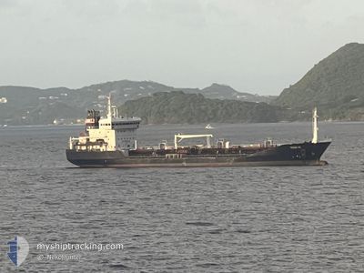
TESSA PG
Oil/Chemical Tanker

Current Trip
| Trip Time | 3 days |
|---|---|
| Trip Distance | 618.18 nm |
| AVG Speed | 10 Knots |
| MAX Speed | 12.7 Knots |
| Draught | 5.5 m |
| AVG Wind | 17.4 knots |
| MAX Wind | 24 knots |
| MIN Temp | 22.4°C / 72.32°F |
| MAX Temp | 26.3°C / 79.34°F |
| Position Received | 3 d ago |
Current Position
| Longitude | --- |
|---|---|
| Latitude | --- |
| Status | Under way using engine |
| Speed | 9.9 Knots |
| Course | 140° |
| Area | Caribbean Sea |
| Station | T-AIS |
| Position Received | 3 d ago |
Information
The current position of TESSA PG is in Caribbean Sea with coordinates 13.53765° / -60.98282° as reported on 2025-02-15 04:03 by AIS to our vessel tracker app. The vessel's current speed is 9.9 Knots and is currently inside the port of PARAMARIBO.
The vessel TESSA PG (IMO: 9268265, MMSI: 235009020) is a Oil/Chemical Tanker that was built in 2005 ( 20 years old ). It's sailing under the flag of [GB] United Kingdom.
In this page you can find informations about the vessels current position, last detected port calls, and current voyage information. If the vessels is not in coverage by AIS you will find the latest position.
The current position of TESSA PG is detected by our AIS receivers and we are not responsible for the reliability of the data. The last position was recorded while the vessel was in Coverage by the Ais receivers of our vessel tracking app.
The current draught of TESSA PG as reported by AIS is 5.5 meters
Weather
| Temperature | 26.5°C / 79.7°F |
|---|---|
| Wind Speed | 6 knots |
| Direction | 41° NE |
| Pressure | 1009.6 hPa |
| Humidity | 73.5 % |
| Cloud Coverage | 81 % |


Featured Company
Last Port Calls
| Port | Arrival | Departure | Time In Port |
|---|---|---|---|
| 2025-02-18 07:31 | |||
| 2025-02-13 20:59 | 2025-02-14 20:49 | 23 h | |
| 2025-02-08 14:19 | 2025-02-10 02:43 | 1 d | |
| 2025-02-03 11:31 | 2025-02-05 13:55 | 2 d | |
| 2025-02-02 08:38 | 2025-02-03 08:43 | 1 d | |
| 2025-01-29 17:23 | 2025-01-30 17:11 | 23 h | |
| 2025-01-26 09:39 | 2025-01-27 02:31 | 16 h | |
| 2025-01-21 09:31 | 2025-01-23 10:59 | 2 d | |
| 2025-01-17 11:43 | 2025-01-18 06:22 | 18 h | |
| 2025-01-14 15:43 | 2025-01-16 07:07 | 1 d |
Most Visited Ports (Last year)
| Port | Arrivals | |
|---|---|---|
| 19 | ||
| 12 | ||
| 9 | ||
| 7 | ||
| 5 | ||
| 4 |
Last Trips
| Origin | Departure | Destination | Arrival | Distance | |
|---|---|---|---|---|---|
| 2025-02-14 20:49 | 2025-02-18 07:31 | 618.18 nm | |||
| 2025-02-10 02:43 | 2025-02-13 20:59 | 697.45 nm | |||
| 2025-02-05 13:55 | 2025-02-08 14:19 | 597.57 nm | |||
| 2025-02-03 08:43 | 2025-02-03 11:31 | 24.95 nm | |||
| 2025-01-30 17:11 | 2025-02-02 08:38 | 622.35 nm | |||
| 2025-01-27 02:31 | 2025-01-29 17:23 | 620.00 nm | |||
| 2025-01-23 10:59 | 2025-01-26 09:39 | 626.99 nm | |||
| 2025-01-18 06:22 | 2025-01-21 09:31 | 620.06 nm | |||
| 2025-01-16 07:07 | 2025-01-17 11:43 | 34.77 nm | |||
| 2025-01-12 03:02 | 2025-01-14 15:43 | 215.44 nm |
Events
| Time | Event | Details | Position / Dest | Info |
|---|---|---|---|---|
| 2025-02-18 11:15 | STOP Moving |
5.78982 / -55.15767
[SR] PARAMARIBO
|
Speed: 0.2 kn Course: 323° |
|
| 2025-02-18 10:31 | PORT ARRIVAL |
|
5.83258 / -55.09922
[SR] PARAMARIBO
|
Speed: 11.9 kn Course: 201° |
| 2025-02-18 08:19 | START Moving | 21.31 nm, North of PARAMARIBO |
6.17377 / -55.17157
SR PBM
|
Speed: 5.4 kn Course: 195° |
| 2025-02-17 13:15 | STOP Moving | 21.49 nm, North of PARAMARIBO |
6.17683 / -55.17377
SR PBM
|
Speed: 0.1 kn Course: 97° |
| 2025-02-15 04:03 | Status Changed | Default Under way using engine |
13.53623 / -60.98165
SR PBM
|
Speed: 9.9 kn Course: 140° |
| 2025-02-15 04:03 | Status Changed | Under way using engine Default |
13.53765 / -60.98282
SR PBM
|
Speed: 9.6 kn Course: 141° |
| 2025-02-15 04:03 | OUT of Coverage |
13.53765 / -60.98282
Caribbean Sea
SR PBM
|
Speed: 9.9 kn Course: 140° |
|
| 2025-02-15 03:43 | IN Coverage |
13.53765 / -60.98282
Caribbean Sea
SR PBM
|
Speed: 9.9 kn Course: 140° |
|
| 2025-02-15 02:15 | Status Changed | Default Under way using engine |
13.77768 / -61.14157
SR PBM
|
Speed: 9.4 kn Course: 151° |
| 2025-02-15 02:08 | OUT of Coverage |
13.79575 / -61.15205
Caribbean Sea
SR PBM
|
Speed: 9.4 kn Course: 151° |