
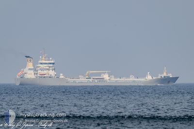
TERNHOLM
Oil/Chemical Tanker
Current Trip
| Time Travelled | 2 days |
|---|---|
| Remaining Time | 22 h, 40 mins |
| Distance Travelled | 565.93 nm |
| Remaining Distance | 287.03 nm |
| AVG Speed | 11.2 Knots |
| MAX Speed | 12.8 Knots |
| AVG Wind | 5.3 knots |
| MAX Wind | 12 knots |
| MIN Temp | 2.6°C / 36.68°F |
| MAX Temp | 5.4°C / 41.72°F |
| Draught | 8.8 m |
| Position Received | 1 m ago |
Current Position
| Longitude | --- |
|---|---|
| Latitude | --- |
| Status | Under way using engine |
| Speed | 12.5 Knots |
| Course | 29° |
| Area | Baltic Sea |
| Station | T-AIS |
| Position Received | 1 m ago |
Info
Information
The current position of TERNHOLM is in Baltic Sea with coordinates 57.95991° / 18.30298° as reported on 2025-02-27 23:47 by AIS to our vessel tracker app. The vessel's current speed is 12.5 Knots and is heading at the port of PORI. The estimated time of arrival as calculated by MyShipTracking vessel tracking app is 2025-03-01 00:28 LT
The vessel TERNHOLM (IMO: 9300829, MMSI: 219076000) is a Oil/Chemical Tanker that was built in 2005 ( 20 years old ). It's sailing under the flag of [DK] Denmark.
In this page you can find informations about the vessels current position, last detected port calls, and current voyage information. If the vessels is not in coverage by AIS you will find the latest position.
The current position of TERNHOLM is detected by our AIS receivers and we are not responsible for the reliability of the data. The last position was recorded while the vessel was in Coverage by the Ais receivers of our vessel tracking app.
The current draught of TERNHOLM as reported by AIS is 8.8 meters
Weather
| Temperature | 3.1°C / 37.58°F |
|---|---|
| Wind Speed | 5 knots |
| Direction | 328° NNW |
| Pressure | 1019.8 hPa |
| Humidity | 94 % |
| Cloud Coverage | 100 % |
Featured Company
Last Port Calls
| Port | Arrival | Departure | Time In Port |
|---|---|---|---|
| 2025-02-24 20:21 | 2025-02-25 22:53 | 1 d | |
| 2025-02-20 15:25 | 2025-02-21 12:15 | 20 h | |
| 2025-02-16 01:51 | 2025-02-17 02:21 | 1 d | |
| 2025-02-05 11:30 | 2025-02-08 13:51 | 3 d | |
| 2025-02-03 01:51 | 2025-02-03 15:12 | 13 h | |
| 2025-02-01 11:08 | 2025-02-01 21:55 | 10 h | |
| 2025-01-31 01:44 | 2025-01-31 17:09 | 15 h | |
| 2025-01-26 15:27 | 2025-01-27 23:08 | 1 d | |
| 2025-01-16 22:34 | 2025-01-17 07:16 | 8 h | |
| 2025-01-15 15:59 | 2025-01-16 03:54 | 11 h |
Last Trips
| Origin | Departure | Destination | Arrival | Distance | |
|---|---|---|---|---|---|
| 2025-02-21 12:15 | 2025-02-24 20:21 | 951.15 nm | |||
| 2025-02-17 02:21 | 2025-02-20 15:25 | 1085.38 nm | |||
| 2025-02-08 13:51 | 2025-02-16 01:51 | 1448.14 nm | |||
| 2025-02-03 15:12 | 2025-02-05 11:30 | 507.89 nm | |||
| 2025-02-01 21:55 | 2025-02-03 01:51 | 406.40 nm | |||
| 2025-01-31 17:09 | 2025-02-01 11:08 | 213.74 nm | |||
| 2025-01-27 23:08 | 2025-01-31 01:44 | 1008.58 nm | |||
| 2025-01-17 07:16 | 2025-01-26 15:27 | 1607.52 nm | |||
| 2025-01-16 03:54 | 2025-01-16 22:34 | 242.70 nm | |||
| 2025-01-10 17:33 | 2025-01-15 15:59 | 1273.95 nm |
Events
| Time | Event | Details | Position / Dest | Info |
|---|---|---|---|---|
| 2025-02-27 20:41 | Status Changed | Under way using engine Default |
57.38246 / 17.75111
PORI
|
Speed: 12.6 kn Course: 20° |
| 2025-02-27 20:38 | IN Coverage |
57.39169 / 17.75735
Baltic Sea
PORI
|
Speed: 12.5 kn Course: 20.2° |
|
| 2025-02-27 13:30 | Status Changed | Default Under way using engine |
56.03046 / 16.63222
PORI
|
Speed: 12.5 kn Course: 58.3° |
| 2025-02-27 13:29 | OUT of Coverage |
56.02956 / 16.62960
Baltic Sea
PORI
|
Speed: 12.5 kn Course: 58.3° |
|
| 2025-02-27 09:19 | Detected in Sea | Swedish part of the Baltic Sea |
55.62292 / 15.37426
Baltic Sea
PORI
|
Speed: 11.3 kn Course: 60° |
| 2025-02-27 03:40 | Change Sea Area | Danish part of the Kattegat Swedish part of the Baltic Sea |
54.99606 / 14.04068
Kattegat
PORI
|
Speed: 10.2 kn Course: 69.7° |
| 2025-02-27 03:22 | Change Sea Area | Swedish part of the Baltic Sea German part of the Baltic Sea |
54.97869 / 13.95620
Baltic Sea
PORI
|
Speed: 10.1 kn Course: 70.7° |
| 2025-02-27 01:16 | Status Changed | Under way using engine Default |
54.87270 / 13.35843
PORI
|
Speed: 10.3 kn Course: 71° |
| 2025-02-27 01:13 | Status Changed | Default Under way using engine |
54.87041 / 13.34661
PORI
|
Speed: 10.3 kn Course: 71.5° |
| 2025-02-27 01:02 | Status Changed | Under way using engine Default |
54.86011 / 13.29245
PORI
|
Speed: 10.1 kn Course: 72° |