
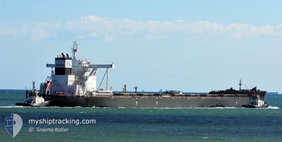
TENG MAY
Cargo
Current Trip
QINGDA0
| Time Travelled | 1 day |
|---|---|
| Remaining Time | --- |
| Distance Travelled | 390.80 nm |
| Remaining Distance | --- |
| AVG Speed | 12.7 Knots |
| MAX Speed | 15.1 Knots |
| AVG Wind | 14.7 knots |
| MAX Wind | 29 knots |
| MIN Temp | 5.4°C / 41.72°F |
| MAX Temp | 11.4°C / 52.52°F |
| Draught | 18.5 m |
| Position Received | 18 d ago |
Current Position
| Longitude | --- |
|---|---|
| Latitude | --- |
| Status | Under way using engine |
| Speed | 12 Knots |
| Course | 345.5° |
| Area | Indian Ocean |
| Station | T-AIS |
| Position Received | 18 d ago |
Information
The current position of TENG MAY is in Indian Ocean with coordinates -17.58021° / 118.05434° as reported on 2025-03-07 09:53 by AIS to our vessel tracker app. The vessel's current speed is 12 Knots
The vessel TENG MAY (IMO: 9862853, MMSI: 636018655) is a Cargo It's sailing under the flag of [LR] Liberia.
In this page you can find informations about the vessels current position, last detected port calls, and current voyage information. If the vessels is not in coverage by AIS you will find the latest position.
The current position of TENG MAY is detected by our AIS receivers and we are not responsible for the reliability of the data. The last position was recorded while the vessel was in Coverage by the Ais receivers of our vessel tracking app.
The current draught of TENG MAY as reported by AIS is 18.5 meters
Weather
| Temperature | 9.5°C / 49.1°F |
|---|---|
| Wind Speed | 14 knots |
| Direction | 122° ESE |
| Pressure | 1004.2 hPa |
| Humidity | 75.4 % |
| Cloud Coverage | 5 % |
Featured Company
Last Port Calls
| Port | Arrival | Departure | Time In Port |
|---|---|---|---|
| 2025-03-21 07:28 | 2025-03-24 04:49 | 2 d | |
| 2025-03-05 02:15 | 2025-03-06 18:43 | 1 d | |
| 2025-02-10 05:13 | 2025-02-12 00:07 | 1 d | |
| 2025-01-22 13:37 | 2025-01-24 07:26 | 1 d | |
| 2025-01-04 02:40 | 2025-01-05 09:36 | 1 d | |
| 2025-01-01 03:49 | 2025-01-02 04:13 | 1 d |
Most Visited Ports (Last year)
| Port | Arrivals | |
|---|---|---|
| 3 | ||
| 2 | ||
| 2 | ||
| 2 | ||
| 1 | ||
| 1 |
Last Trips
| Origin | Departure | Destination | Arrival | Distance | |
|---|---|---|---|---|---|
| 2025-03-07 02:43 | 2025-03-21 15:28 | 3915.12 nm | |||
| 2025-02-12 08:07 | 2025-03-05 10:15 | 3370.00 nm | |||
| 2025-01-24 15:26 | 2025-02-10 13:13 | 3501.53 nm | |||
| 2025-01-05 17:36 | 2025-01-22 21:37 | 3613.06 nm | |||
| 2025-01-02 12:13 | 2025-01-04 10:40 | 530.58 nm | |||
| 2024-11-10 04:28 | 2025-01-01 11:49 | 6574.13 nm |
Events
| Time | Event | Details | Position / Dest | Info |
|---|---|---|---|---|
| 2025-03-25 11:58 | START Moving | 12.58 nm, East of DALIAN |
38.90705 / 121.95761
QINGDA0
|
Speed: 5.2 kn Course: 267° |
| 2025-03-24 20:46 | STOP Moving | 12.86 nm, East of DALIAN |
38.91125 / 121.96488
QINGDA0
|
Speed: Course: 215° |
| 2025-03-24 04:49 | START Moving | 7.03 nm, South West of CAOFEIDIAN |
38.90938 / 118.51267
QINGDA0
|
Speed: 4.4 kn Course: 187° |
| 2025-03-24 04:49 | PORT DEPARTURE |
|
38.90938 / 118.51267
QINGDA0
|
Speed: 2.2 kn Course: 199° |
| 2025-03-21 07:32 | STOP Moving |
38.91323 / 118.51123
[CN] CAOFEIDIAN
|
Speed: 0.3 kn Course: 86° |
|
| 2025-03-21 07:28 | PORT ARRIVAL |
|
38.91288 / 118.51096
[CN] CAOFEIDIAN
|
Speed: 0.7 kn Course: 82° |
| 2025-03-21 06:25 | START Moving | 8.5 nm, South of CAOFEIDIAN |
38.87413 / 118.54953
QINGDA0
|
Speed: 3.3 kn Course: 284° |
| 2025-03-21 01:16 | STOP Moving | 8.5 nm, South of CAOFEIDIAN |
38.87289 / 118.55988
QINGDA0
|
Speed: Course: 279° |