
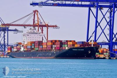
SYNERGY ANTWERP
Container Ship
Current Trip
| Time Travelled | 8 days |
|---|---|
| Remaining Time | 4 days |
| Distance Travelled | 2092.55 nm |
| Remaining Distance | 1412.63 nm |
| AVG Speed | 11.5 Knots |
| MAX Speed | 15.2 Knots |
| AVG Wind | 8.9 knots |
| MAX Wind | 25 knots |
| MIN Temp | 12.1°C / 53.78°F |
| MAX Temp | 27.4°C / 81.32°F |
| Draught | 11.3 m |
| Position Received | 1 d ago |
Current Position
| Longitude | --- |
|---|---|
| Latitude | --- |
| Status | Under way using engine |
| Speed | 12.4 Knots |
| Course | 289.1° |
| Area | Mediterranean Sea - Eastern Basin |
| Station | T-AIS |
| Position Received | 1 d ago |
Info
Information
The current position of SYNERGY ANTWERP is in Mediterranean Sea - Eastern Basin with coordinates 36.03436° / 16.23220° as reported on 2025-12-11 06:31 by AIS to our vessel tracker app. The vessel's current speed is 12.4 Knots and is heading at the port of PORT SAID. The estimated time of arrival as calculated by MyShipTracking vessel tracking app is 2025-12-17 14:14 LT
The vessel SYNERGY ANTWERP (IMO: 9443580, MMSI: 538008756) is a Container Ship that was built in 2008 ( 17 years old ). It's sailing under the flag of [MH] Marshall Is.
In this page you can find informations about the vessels current position, last detected port calls, and current voyage information. If the vessels is not in coverage by AIS you will find the latest position.
The current position of SYNERGY ANTWERP is detected by our AIS receivers and we are not responsible for the reliability of the data. The last position was recorded while the vessel was in Coverage by the Ais receivers of our vessel tracking app.
The current draught of SYNERGY ANTWERP as reported by AIS is 11.3 meters
Weather
| Temperature | 16.4°C / 61.52°F |
|---|---|
| Wind Speed | 8 knots |
| Direction | 90° E |
| Pressure | 1019.4 hPa |
| Humidity | 76.8 % |
| Cloud Coverage | 5 % |
Featured Company
Last Port Calls
| Port | Arrival | Departure | Time In Port |
|---|---|---|---|
| 2025-12-07 08:15 | 2025-12-08 14:57 | 1 d | |
| 2025-12-03 13:45 | 2025-12-04 11:27 | 21 h | |
| 2025-12-01 10:20 | 2025-12-01 19:18 | 8 h | |
| 2025-11-25 07:22 | 2025-11-26 01:37 | 18 h | |
| 2025-11-16 06:49 | 2025-11-17 16:08 | 1 d | |
| 2025-11-12 13:56 | 2025-11-13 11:22 | 21 h | |
| 2025-11-10 09:29 | 2025-11-10 18:11 | 8 h | |
| 2025-11-04 07:17 | 2025-11-04 21:33 | 14 h | |
| 2025-10-26 05:08 | 2025-10-27 14:44 | 1 d | |
| 2025-10-23 08:23 | 2025-10-23 12:33 | 4 h |
Most Visited Ports (Last year)
| Port | Arrivals | |
|---|---|---|
| 45 | ||
| 17 | ||
| 14 | ||
| 9 | ||
| 2 | ||
| 2 |
Last Trips
| Origin | Departure | Destination | Arrival | Distance | |
|---|---|---|---|---|---|
| 2025-12-04 11:27 | 2025-12-07 08:15 | 635.63 nm | |||
| 2025-11-26 01:37 | 2025-12-03 13:45 | 2661.73 nm | |||
| 2025-11-26 01:37 | 2025-12-01 10:20 | 1942.31 nm | |||
| 2025-11-13 11:22 | 2025-11-25 07:22 | 2737.63 nm | |||
| 2025-11-13 11:22 | 2025-11-16 06:49 | 632.09 nm | |||
| 2025-11-04 21:33 | 2025-11-12 13:56 | 2665.42 nm | |||
| 2025-11-04 21:33 | 2025-11-10 09:29 | 1946.30 nm | |||
| 2025-10-23 12:33 | 2025-11-04 07:17 | 2701.51 nm | |||
| 2025-10-23 12:33 | 2025-10-26 05:08 | 636.80 nm | |||
| 2025-10-14 20:55 | 2025-10-22 13:41 | 2657.04 nm |
Events
| Time | Event | Details | Position / Dest | Info |
|---|---|---|---|---|
| 2025-12-11 06:42 | Status Changed | Default Under way using engine |
36.04500 / 16.18833
EGPSD
|
Speed: 12.4 kn Course: 289.1° |
| 2025-12-11 06:31 | Status Changed | Under way using engine Default |
36.03436 / 16.23220
EGPSD
|
Speed: 12 kn Course: 287° |
| 2025-12-11 06:31 | OUT of Coverage |
36.03436 / 16.23220
Mediterranean Sea - Eastern Basin
|
Speed: 12.4 kn Course: 289.1° |
|
| 2025-12-11 06:24 | IN Coverage |
36.03436 / 16.23220
Mediterranean Sea - Eastern Basin
|
Speed: 12.4 kn Course: 289.1° |
|
| 2025-12-11 04:48 | Status Changed | Default Under way using engine |
35.92166 / 16.64667
EGPSD
|
Speed: 12.3 kn Course: 287.8° |
| 2025-12-11 04:47 | Status Changed | Under way using engine Default |
35.92221 / 16.65055
EGPSD
|
Speed: 12 kn Course: 286° |
| 2025-12-11 04:47 | OUT of Coverage |
35.92221 / 16.65055
Mediterranean Sea - Eastern Basin
|
Speed: 12.3 kn Course: 287.8° |
|
| 2025-12-11 04:47 | Change Sea Area | Italian part of the Mediterranean Sea - Eastern Basin Egyptian part of the Gulf of Suez |
35.92221 / 16.65055
Mediterranean Sea - Eastern Basin
|
Speed: 12.3 kn Course: 287.8° |
| 2025-12-11 04:39 | IN Coverage |
35.92221 / 16.65055
Mediterranean Sea - Eastern Basin
|
Speed: 12.3 kn Course: 287.8° |
|
| 2025-12-08 12:57 | PORT DEPARTURE |
|
31.23169 / 32.35885
EGPSD
|
Speed: 7.9 kn Course: 13° |