
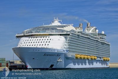
SYMPHONY OF THE SEAS
Passenger
Current Trip
BS-POC
| Time Travelled | 1 day |
|---|---|
| Remaining Time | --- |
| Distance Travelled | 330.13 nm |
| Remaining Distance | --- |
| AVG Speed | 12.5 Knots |
| MAX Speed | 22.1 Knots |
| AVG Wind | 15.1 knots |
| MAX Wind | 22 knots |
| MIN Temp | 21.7°C / 71.06°F |
| MAX Temp | 25.5°C / 77.9°F |
| Draught | 9.2 m |
| Position Received | 4 h, 37 m ago |
Current Position
| Longitude | --- |
|---|---|
| Latitude | --- |
| Status | Under way using engine |
| Speed | 21 Knots |
| Course | 122.3° |
| Area | North Atlantic Ocean |
| Station | T-AIS |
| Position Received | 4 h, 37 m ago |
Info
Information
The current position of SYMPHONY OF THE SEAS is in North Atlantic Ocean with coordinates 25.41820° / -76.09561° as reported on 2025-03-18 01:18 by AIS to our vessel tracker app. The vessel's current speed is 21 Knots
The vessel SYMPHONY OF THE SEAS (IMO: 9744001, MMSI: 311000660) is a Passenger It's sailing under the flag of [BS] Bahamas.
In this page you can find informations about the vessels current position, last detected port calls, and current voyage information. If the vessels is not in coverage by AIS you will find the latest position.
The current position of SYMPHONY OF THE SEAS is detected by our AIS receivers and we are not responsible for the reliability of the data. The last position was recorded while the vessel was in Coverage by the Ais receivers of our vessel tracking app.
The current draught of SYMPHONY OF THE SEAS as reported by AIS is 9.2 meters
Weather
| Temperature | 23.2°C / 73.76°F |
|---|---|
| Wind Speed | 18 knots |
| Direction | 324° NW |
| Pressure | 1016.1 hPa |
| Humidity | 77.6 % |
| Cloud Coverage | 71 % |
Featured Company
Last Port Calls
| Port | Arrival | Departure | Time In Port |
|---|---|---|---|
| 2025-03-16 02:15 | 2025-03-16 16:59 | 14 h | |
| 2025-03-14 08:52 | 2025-03-14 17:08 | 8 h | |
| 2025-03-13 05:59 | 2025-03-13 15:34 | 9 h | |
| 2025-03-11 07:41 | 2025-03-11 17:43 | 10 h | |
| 2025-03-09 01:19 | 2025-03-09 17:08 | 14 h | |
| 2025-03-06 19:12 | 2025-03-06 20:18 | 1 h | |
| 2025-03-06 08:21 | 2025-03-06 18:49 | 10 h | |
| 2025-03-02 02:42 | 2025-03-02 17:39 | 14 h | |
| 2025-02-28 08:30 | 2025-02-28 16:55 | 8 h | |
| 2025-02-27 06:50 | 2025-02-27 16:09 | 9 h |
Last Trips
| Origin | Departure | Destination | Arrival | Distance | |
|---|---|---|---|---|---|
| 2025-03-14 17:08 | 2025-03-16 02:15 | 603.66 nm | |||
| 2025-03-13 15:34 | 2025-03-14 08:52 | 318.91 nm | |||
| 2025-03-11 17:43 | 2025-03-13 05:59 | 682.72 nm | |||
| 2025-03-09 17:08 | 2025-03-11 07:41 | 195.95 nm | |||
| 2025-03-06 20:18 | 2025-03-09 01:19 | 1086.31 nm | |||
| 2025-03-06 18:49 | 2025-03-06 19:12 | 2.41 nm | |||
| 2025-03-02 17:39 | 2025-03-06 08:21 | 1115.59 nm | |||
| 2025-02-28 16:55 | 2025-03-02 02:42 | 610.56 nm | |||
| 2025-02-27 16:09 | 2025-02-28 08:30 | 316.36 nm | |||
| 2025-02-25 17:39 | 2025-02-27 06:50 | 683.44 nm |
Events
| Time | Event | Details | Position / Dest | Info |
|---|---|---|---|---|
| 2025-03-18 01:25 | Status Changed | Default Under way using engine |
25.39562 / -76.05593
BS-POC
|
Speed: 21 kn Course: 122.3° |
| 2025-03-18 01:18 | OUT of Coverage |
25.41820 / -76.09561
North Atlantic Ocean
|
Speed: 21 kn Course: 122.3° |
|
| 2025-03-18 01:12 | Status Changed | Under way using engine Default |
25.43780 / -76.13007
BS-POC
|
Speed: 21.1 kn Course: 122° |
| 2025-03-18 00:49 | Status Changed | Default Under way using engine |
25.50727 / -76.25214
BS-POC
|
Speed: 21.2 kn Course: 121.5° |
| 2025-03-17 23:52 | Status Changed | Under way using engine Default |
25.66712 / -76.58655
BS-POC
|
Speed: 22.1 kn Course: 105° |
| 2025-03-17 23:44 | Status Changed | Default Under way using engine |
25.68013 / -76.64008
BS-POC
|
Speed: 21.9 kn Course: 103.6° |
| 2025-03-17 23:41 | Status Changed | Under way using engine Default |
25.68500 / -76.66036
BS-POC
|
Speed: 22 kn Course: 100° |
| 2025-03-17 23:34 | Status Changed | Default Under way using engine |
25.69283 / -76.70472
BS-POC
|
Speed: 22.1 kn Course: 101.1° |
| 2025-03-17 22:28 | Status Changed | Under way using engine Default |
25.73029 / -77.14538
BS-POC
|
Speed: 21.9 kn Course: 102° |
| 2025-03-17 22:15 | IN Coverage |
25.73029 / -77.14538
North Atlantic Ocean
|
Speed: 21.9 kn Course: 102.4° |