
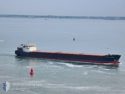
SV.KNYAZ VLADIMIR
General Cargo
Current Trip
| Time Travelled | 9 days |
|---|---|
| Remaining Time | --- |
| Distance Travelled | 728.84 nm |
| Remaining Distance | --- |
| AVG Speed | 8 Knots |
| MAX Speed | 10.2 Knots |
| AVG Wind | 8.1 knots |
| MAX Wind | 25.9 knots |
| MIN Temp | 12.3°C / 54.14°F |
| MAX Temp | 20.9°C / 69.62°F |
| Draught | 3.4 m |
| Position Received | 8 d ago |
Current Position
| Longitude | 29.49405° |
|---|---|
| Latitude | 41.36730° |
| Status | Under way using engine |
| Speed | 10.2 Knots |
| Course | 62.6° |
| Area | Black Sea |
| Station | T-AIS |
| Position Received | 8 d ago |
Info
Information
The current position of SV.KNYAZ VLADIMIR is in Black Sea with coordinates 41.36730° / 29.49405° as reported on 2024-04-26 18:58 by AIS to our vessel tracker app. The vessel's current speed is 10.2 Knots and is heading at the port of AZOV. The estimated time of arrival as calculated by MyShipTracking vessel tracking app is 2024-04-29 12:00 LT
The vessel SV.KNYAZ VLADIMIR (IMO: 9247613, MMSI: 273350360) is a General Cargo that was built in 2003 ( 21 years old ). It's sailing under the flag of [RU] Russia.
In this page you can find informations about the vessels current position, last detected port calls, and current voyage information. If the vessels is not in coverage by AIS you will find the latest position.
The current position of SV.KNYAZ VLADIMIR is detected by our AIS receivers and we are not responsible for the reliability of the data. The last position was recorded while the vessel was in Coverage by the Ais receivers of our vessel tracking app.
The current draught of SV.KNYAZ VLADIMIR as reported by AIS is 3.4 meters
Weather
| Temperature | 13.3°C / 55.94°F |
|---|---|
| Wind Speed | 26 knots |
| Direction | 55° NE |
| Pressure | 1020.1 hPa |
| Humidity | 89.5 % |
| Cloud Coverage | 52 % |
Featured Company
Events
| Time | Event | Details | Position / Dest | Info |
|---|---|---|---|---|
| 2024-04-26 19:05 | Status Changed | Default Under way using engine |
41.37695 / 29.51957
RU AZO
|
Speed: 10.2 kn Course: 62.6° |
| 2024-04-26 18:58 | OUT of Coverage |
41.36730 / 29.49405
Black Sea
RU AZO
|
Speed: 10.2 kn Course: 62.6° |
|
| 2024-04-26 17:10 | Change Sea Area | Turkish part of the Black Sea Turkish part of the Sea of Marmara |
41.23035 / 29.15162
Black Sea
RU AZO
|
Speed: 9.2 kn Course: 59.3° |
| 2024-04-26 12:46 | START Moving | 9.31 nm, South West of MALTEPE |
40.80317 / 28.98688
RU AZO
|
Speed: 3.5 kn Course: 28° |
| 2024-04-26 08:10 | STOP Moving | 8.39 nm, South West of MALTEPE |
40.81665 / 28.99763
RU AZO
|
Speed: 0.3 kn Course: 359° |
| 2024-04-26 02:48 | Status Changed | Under way using engine Default |
40.77605 / 28.24015
RU AZO
|
Speed: 9 kn Course: 82° |
| 2024-04-26 02:39 | Status Changed | Default Under way using engine |
40.77297 / 28.20975
RU AZO
|
Speed: 8.9 kn Course: 81.7° |
| 2024-04-26 02:29 | Status Changed | Under way using engine Default |
40.76925 / 28.17620
RU AZO
|
Speed: 9.1 kn Course: 82° |
| 2024-04-26 02:11 | Status Changed | Default Under way using engine |
40.76302 / 28.11992
RU AZO
|
Speed: 9 kn Course: 81.7° |
| 2024-04-25 21:51 | Status Changed | Under way using engine Default |
40.60378 / 27.28740
RU AZO
|
Speed: 9.1 kn Course: 68° |