
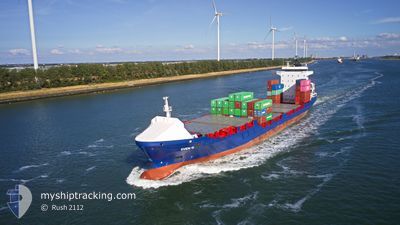
SVEN D
Container Ship
Current Trip
| Time Travelled | 1 day |
|---|---|
| Remaining Time | 3 h, 5 mins |
| Distance Travelled | 505.38 nm |
| Remaining Distance | 52.54 nm |
| AVG Speed | 15.5 Knots |
| MAX Speed | 17.5 Knots |
| AVG Wind | 15.2 knots |
| MAX Wind | 21 knots |
| MIN Temp | -6°C / 21.2°F |
| MAX Temp | 6.8°C / 44.24°F |
| Draught | 7 m |
| Position Received | 1 m ago |
Current Position
| Longitude | --- |
|---|---|
| Latitude | --- |
| Status | Under way using engine |
| Speed | 15.6 Knots |
| Course | 359.2° |
| Area | Skaggerak |
| Station | T-AIS |
| Position Received | 1 m ago |
Info
Information
The current position of SVEN D is in Skaggerak with coordinates 59.16052° / 10.65584° as reported on 2026-01-09 05:09 by AIS to our vessel tracker app. The vessel's current speed is 15.6 Knots and is heading at the port of OSLO. The estimated time of arrival as calculated by MyShipTracking vessel tracking app is 2026-01-09 09:15 LT
The vessel SVEN D (IMO: 9302243, MMSI: 244850970) is a Container Ship that was built in 2005 ( 21 years old ). It's sailing under the flag of [NL] Netherlands.
In this page you can find informations about the vessels current position, last detected port calls, and current voyage information. If the vessels is not in coverage by AIS you will find the latest position.
The current position of SVEN D is detected by our AIS receivers and we are not responsible for the reliability of the data. The last position was recorded while the vessel was in Coverage by the Ais receivers of our vessel tracking app.
The current draught of SVEN D as reported by AIS is 7 meters
Weather
| Temperature | -5.1°C / 22.82°F |
|---|---|
| Wind Speed | 8 knots |
| Direction | 95° E |
| Pressure | 1014.9 hPa |
| Humidity | 88.6 % |
| Cloud Coverage | 85 % |
Featured Company
Last Port Calls
| Port | Arrival | Departure | Time In Port |
|---|---|---|---|
| 2026-01-07 03:56 | 2026-01-07 22:53 | 18 h | |
| 2026-01-04 21:09 | 2026-01-07 02:10 | 2 d | |
| 2026-01-04 02:23 | 2026-01-04 19:46 | 17 h | |
| 2025-12-31 16:51 | 2026-01-02 14:11 | 1 d | |
| 2025-12-30 20:49 | 2025-12-31 14:10 | 17 h | |
| 2025-12-26 20:04 | 2025-12-29 00:39 | 2 d | |
| 2025-12-25 04:06 | 2025-12-26 18:33 | 1 d | |
| 2025-12-23 14:34 | 2025-12-23 23:11 | 8 h | |
| 2025-12-23 01:57 | 2025-12-23 07:26 | 5 h | |
| 2025-12-22 13:37 | 2025-12-22 23:38 | 10 h |
Most Visited Ports (Last year)
| Port | Arrivals | |
|---|---|---|
| 96 | ||
| 61 | ||
| 47 | ||
| 44 | ||
| 41 | ||
| 7 |
Last Trips
| Origin | Departure | Destination | Arrival | Distance | |
|---|---|---|---|---|---|
| 2026-01-07 02:10 | 2026-01-07 03:56 | 16.48 nm | |||
| 2026-01-04 19:46 | 2026-01-04 21:09 | 15.58 nm | |||
| 2026-01-02 14:11 | 2026-01-04 02:23 | 527.56 nm | |||
| 2025-12-31 14:10 | 2025-12-31 16:51 | 35.40 nm | |||
| 2025-12-29 00:39 | 2025-12-30 20:49 | 540.78 nm | |||
| 2025-12-26 18:33 | 2025-12-26 20:04 | 15.77 nm | |||
| 2025-12-23 23:11 | 2025-12-25 04:06 | 417.42 nm | |||
| 2025-12-23 07:26 | 2025-12-23 14:34 | 126.77 nm | |||
| 2025-12-22 23:38 | 2025-12-23 01:57 | 35.02 nm | |||
| 2025-12-21 02:56 | 2025-12-22 13:37 | 552.67 nm |
Events
| Time | Event | Details | Position / Dest | Info |
|---|---|---|---|---|
| 2026-01-08 22:17 | Change Sea Area | Norwegian part of the Skaggerak Danish part of the Skaggerak |
57.68880 / 8.84060
Skaggerak
NOOSL
|
Speed: 16.1 kn Course: 32.1° |
| 2026-01-08 20:31 | Change Sea Area | Danish part of the Skaggerak Danish part of the North Sea |
57.29224 / 8.31938
Skaggerak
NOOSL
|
Speed: 16.9 kn Course: 36.5° |
| 2026-01-08 16:27 | Status Changed | Under way using engine Default |
56.28053 / 7.25304
NOOSL
|
Speed: 17 kn Course: 36° |
| 2026-01-08 16:25 | Status Changed | Default Under way using engine |
56.27473 / 7.24565
NOOSL
|
Speed: 16.9 kn Course: 35.8° |
| 2026-01-08 14:38 | Status Changed | Under way using engine Default |
55.84780 / 6.77995
NOOSL
|
Speed: 17.1 kn Course: 30° |
| 2026-01-08 14:25 | Status Changed | Default Under way using engine |
55.79408 / 6.72573
NOOSL
|
Speed: 17 kn Course: 28.8° |
| 2026-01-08 14:03 | Status Changed | Under way using engine Default |
55.70308 / 6.63411
NOOSL
|
Speed: 17.1 kn Course: 19° |
| 2026-01-08 13:47 | Status Changed | Default Under way using engine |
55.63628 / 6.58461
NOOSL
|
Speed: 17 kn Course: 13.5° |
| 2026-01-08 13:39 | Change Sea Area | Danish part of the North Sea Dutch part of the North Sea |
55.60038 / 6.56785
North Sea
NOOSL
|
Speed: 17.1 kn Course: 15.9° |
| 2026-01-08 13:39 | Status Changed | Under way using engine Default |
55.60038 / 6.56785
NOOSL
|
Speed: 17.1 kn Course: 30° |