
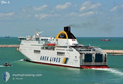
SUPERFAST IV
Ro-Ro/Passenger Ship
Current Trip
| Trip Time | 21 h, 55 mins |
|---|---|
| Trip Distance | 518.86 nm |
| AVG Speed | 24 Knots |
| MAX Speed | 27.6 Knots |
| Draught | 6.3 m |
| AVG Wind | 9.2 knots |
| MAX Wind | 23.7 knots |
| MIN Temp | 11.7°C / 53.06°F |
| MAX Temp | 15.9°C / 60.62°F |
| Position Received | 3 m ago |
Current Position
| Longitude | --- |
|---|---|
| Latitude | --- |
| Status | Moored |
| Speed | |
| Course | 4° |
| Area | Ionian Sea |
| Station | T-AIS |
| Position Received | 3 m ago |
Info
Information
The current position of SUPERFAST IV is in Ionian Sea with coordinates 38.22788° / 21.71901° as reported on 2025-12-06 13:18 by AIS to our vessel tracker app. The vessel's current speed is 0 Knots and is currently inside the port of PATRA.
The vessel SUPERFAST IV (IMO: 9216030, MMSI: 239806000) is a Ro-Ro/Passenger Ship that was built in 2001 ( 24 years old ). It's sailing under the flag of [GR] Greece.
In this page you can find informations about the vessels current position, last detected port calls, and current voyage information. If the vessels is not in coverage by AIS you will find the latest position.
The current position of SUPERFAST IV is detected by our AIS receivers and we are not responsible for the reliability of the data. The last position was recorded while the vessel was in Coverage by the Ais receivers of our vessel tracking app.
The current draught of SUPERFAST IV as reported by AIS is 6.3 meters
Weather
| Temperature | 14.5°C / 58.1°F |
|---|---|
| Wind Speed | 4 knots |
| Direction | 34° NE |
| Pressure | 1005 hPa |
| Humidity | 70.2 % |
| Cloud Coverage | 100 % |
Featured Company
Last Port Calls
| Port | Arrival | Departure | Time In Port |
|---|---|---|---|
| 2025-12-06 13:56 | |||
| 2025-12-04 17:01 | 2025-12-05 15:01 | 22 h | |
| 2025-12-03 23:08 | 2025-12-04 00:15 | 1 h | |
| 2025-11-30 17:59 | 2025-12-03 17:47 | 2 d | |
| 2025-11-29 15:25 | 2025-11-29 19:25 | 3 h | |
| 2025-11-28 23:04 | 2025-11-29 00:20 | 1 h | |
| 2025-11-27 16:41 | 2025-11-28 17:57 | 1 d | |
| 2025-11-27 10:11 | 2025-11-27 11:26 | 1 h | |
| 2025-11-25 18:53 | 2025-11-26 15:53 | 21 h | |
| 2025-11-24 17:12 | 2025-11-24 19:56 | 2 h |
Most Visited Ports (Last year)
| Port | Arrivals | |
|---|---|---|
| 100 | ||
| 69 | ||
| 65 | ||
| 4 | ||
| 3 |
Last Trips
| Origin | Departure | Destination | Arrival | Distance | |
|---|---|---|---|---|---|
| 2025-12-05 15:01 | 2025-12-06 13:56 | 518.86 nm | |||
| 2025-12-04 00:15 | 2025-12-04 17:01 | 396.16 nm | |||
| 2025-12-03 17:47 | 2025-12-03 23:08 | 122.75 nm | |||
| 2025-11-29 19:25 | 2025-11-30 17:59 | 518.72 nm | |||
| 2025-11-29 00:20 | 2025-11-29 15:25 | 402.00 nm | |||
| 2025-11-28 17:57 | 2025-11-28 23:04 | 125.02 nm | |||
| 2025-11-27 11:26 | 2025-11-27 16:41 | 121.67 nm | |||
| 2025-11-26 15:53 | 2025-11-27 10:11 | 402.80 nm | |||
| 2025-11-24 19:56 | 2025-11-25 18:53 | 517.99 nm | |||
| 2025-11-23 18:49 | 2025-11-24 17:12 | 515.95 nm |
Events
| Time | Event | Details | Position / Dest | Info |
|---|---|---|---|---|
| 2025-12-06 12:29 | Status Changed | Moored Under way using engine |
38.22784 / 21.71901
[GR] PATRA
|
Speed: Course: 6° |
| 2025-12-06 12:02 | STOP Moving |
38.22789 / 21.71867
[GR] PATRA
|
Speed: 0.3 kn Course: 9° |
|
| 2025-12-06 11:56 | PORT ARRIVAL |
|
38.21991 / 21.71142
[GR] PATRA
|
Speed: 13.2 kn Course: 67.2° |
| 2025-12-06 11:22 | ETA Changed | 2025/12/06 12:00 |
38.24204 / 21.40820
GRGPA
|
Speed: 27.4 kn Course: 97° |
| 2025-12-06 11:09 | Destination Changed | GRGPA ITAOI |
38.25252 / 21.28067
GRGPA
|
Speed: 27 kn Course: 95.5° |
| 2025-12-06 10:06 | Change Sea Area | Greek part of the Ionian Sea Albanian part of the Adriatic Sea |
38.45861 / 20.76052
Ionian Sea
|
Speed: 27.4 kn Course: 125° |
| 2025-12-06 09:59 | Status Changed | Under way using engine Default |
38.48780 / 20.71046
ITAOI
|
Speed: 26.9 kn Course: 106° |
| 2025-12-06 09:44 | IN Coverage |
38.48780 / 20.71046
Adriatic Sea
|
Speed: 27.2 kn Course: 126.8° |
|
| 2025-12-06 04:43 | OUT of Coverage |
39.75075 / 19.96451
Adriatic Sea
|
Speed: 19.9 kn Course: 188.2° |
|
| 2025-12-06 04:39 | Change Sea Area | Albanian part of the Adriatic Sea Greek part of the Adriatic Sea |
39.77446 / 19.97431
Adriatic Sea
|
Speed: 19.8 kn Course: 198.4° |