
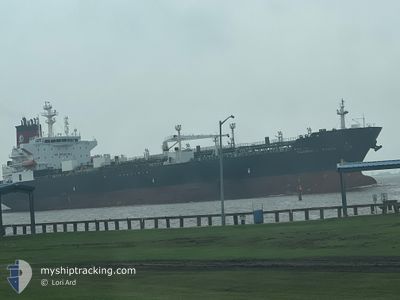
SUNSHINE STATE
Oil/Chemical Tanker
Current Trip
| Time Travelled | 2 days |
|---|---|
| Remaining Time | --- |
| Distance Travelled | 794.43 nm |
| Remaining Distance | --- |
| AVG Speed | 10.3 Knots |
| MAX Speed | 13.7 Knots |
| AVG Wind | 10.7 knots |
| MAX Wind | 20.5 knots |
| MIN Temp | 5.4°C / 41.72°F |
| MAX Temp | 13°C / 55.4°F |
| Draught | 10.9 m |
| Position Received | 2 d ago |
Current Position
| Longitude | --- |
|---|---|
| Latitude | --- |
| Status | Under way using engine |
| Speed | 11.4 Knots |
| Course | 198° |
| Area | North Pacific Ocean |
| Station | T-AIS |
| Position Received | 2 d ago |
Info
Information
The current position of SUNSHINE STATE is in North Pacific Ocean with coordinates 48.01295° / -125.54413° as reported on 2025-12-21 00:39 by AIS to our vessel tracker app. The vessel's current speed is 11.4 Knots and is heading at the port of SAN FRANCISCO. The estimated time of arrival as calculated by MyShipTracking vessel tracking app is 2025-12-23 09:00 LT
The vessel SUNSHINE STATE (IMO: 9408114, MMSI: 367353090) is a Oil/Chemical Tanker that was built in 2009 ( 16 years old ). It's sailing under the flag of [US] USA.
In this page you can find informations about the vessels current position, last detected port calls, and current voyage information. If the vessels is not in coverage by AIS you will find the latest position.
The current position of SUNSHINE STATE is detected by our AIS receivers and we are not responsible for the reliability of the data. The last position was recorded while the vessel was in Coverage by the Ais receivers of our vessel tracking app.
The current draught of SUNSHINE STATE as reported by AIS is 10.9 meters
Weather
| Temperature | 12.4°C / 54.32°F |
|---|---|
| Wind Speed | 8 knots |
| Direction | 12° NNE |
| Pressure | 1013.8 hPa |
| Humidity | 85.8 % |
| Cloud Coverage | 100 % |
Featured Company
Last Port Calls
| Port | Arrival | Departure | Time In Port |
|---|---|---|---|
| 2025-12-17 19:27 | 2025-12-20 00:39 | 2 d | |
| 2025-12-04 09:17 | 2025-12-06 09:22 | 2 d | |
| 2025-11-28 20:50 | 2025-12-01 05:01 | 2 d | |
| 2025-11-26 05:14 | 2025-11-27 10:52 | 1 d | |
| 2025-11-15 17:57 | 2025-11-17 05:48 | 1 d | |
| 2025-11-10 05:47 | 2025-11-12 06:24 | 2 d | |
| 2025-11-02 14:38 | 2025-11-04 06:30 | 1 d | |
| 2025-10-23 02:44 | 2025-10-24 08:56 | 1 d | |
| 2025-10-12 13:21 | 2025-10-13 22:24 | 1 d | |
| 2025-10-03 12:34 | 2025-10-04 15:51 | 1 d |
Most Visited Ports (Last year)
| Port | Arrivals | |
|---|---|---|
| 25 | ||
| 5 | ||
| 3 | ||
| 1 | ||
| 1 | ||
| 1 |
Last Trips
| Origin | Departure | Destination | Arrival | Distance | |
|---|---|---|---|---|---|
| 2025-12-06 09:22 | 2025-12-17 19:27 | 1951.17 nm | |||
| 2025-12-01 05:01 | 2025-12-04 09:17 | 413.16 nm | |||
| 2025-11-27 10:52 | 2025-11-28 20:50 | 403.83 nm | |||
| 2025-11-17 05:48 | 2025-11-26 05:14 | 1908.34 nm | |||
| 2025-11-12 06:24 | 2025-11-15 17:57 | 953.54 nm | |||
| 2025-11-04 06:30 | 2025-11-10 05:47 | 978.75 nm | |||
| 2025-10-24 08:56 | 2025-11-02 14:38 | 1932.01 nm | |||
| 2025-10-13 22:24 | 2025-10-23 02:44 | 1881.14 nm | |||
| 2025-10-04 15:51 | 2025-10-12 13:21 | 1875.54 nm | |||
| 2025-10-02 07:03 | 2025-10-03 12:34 | 385.98 nm |
Events
| Time | Event | Details | Position / Dest | Info |
|---|---|---|---|---|
| 2025-12-21 00:40 | Status Changed | Default Under way using engine |
48.00997 / -125.54570
SAN FRANCISCO
|
Speed: 11.4 kn Course: 198° |
| 2025-12-21 00:39 | Status Changed | Under way using engine Default |
48.01295 / -125.54413
SAN FRANCISCO
|
Speed: 11.2 kn Course: 197° |
| 2025-12-21 00:39 | OUT of Coverage |
48.01295 / -125.54413
North Pacific Ocean
SAN FRANCISCO
|
Speed: 11.4 kn Course: 198° |
|
| 2025-12-21 00:24 | Status Changed | Default Under way using engine |
48.05393 / -125.51019
SAN FRANCISCO
|
Speed: 11.2 kn Course: 214° |
| 2025-12-21 00:10 | Status Changed | Under way using engine Default |
48.09007 / -125.47297
SAN FRANCISCO
|
Speed: 11.2 kn Course: 215° |
| 2025-12-20 23:20 | Status Changed | Default Under way using engine |
48.21337 / -125.34917
SAN FRANCISCO
|
Speed: 10.4 kn Course: 220° |
| 2025-12-20 22:38 | Status Changed | Under way using engine Default |
48.30995 / -125.23642
SAN FRANCISCO
|
Speed: 11 kn Course: 217° |
| 2025-12-20 22:24 | Status Changed | Default Under way using engine |
48.34397 / -125.19894
SAN FRANCISCO
|
Speed: 11 kn Course: 213° |
| 2025-12-20 22:18 | Status Changed | Under way using engine Default |
48.35892 / -125.18443
SAN FRANCISCO
|
Speed: 10.9 kn Course: 213° |
| 2025-12-20 22:16 | Status Changed | Default Under way using engine |
48.36397 / -125.17968
SAN FRANCISCO
|
Speed: 10.9 kn Course: 213° |