

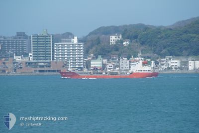
SUNRISE SAMBU
Oil/Chemical Tanker

Current Trip
| Time Travelled | 1 day |
|---|---|
| Remaining Time | 42 mins |
| Distance Travelled | 376.33 nm |
| Remaining Distance | 10.53 nm |
| AVG Speed | 12.5 Knots |
| MAX Speed | 15.2 Knots |
| AVG Wind | 17.4 knots |
| MAX Wind | 29.2 knots |
| MIN Temp | -1.2°C / 29.84°F |
| MAX Temp | 9°C / 48.2°F |
| Draught | 4.5 m |
| Position Received | 4 m ago |
Current Position
| Longitude | --- |
|---|---|
| Latitude | --- |
| Status | Under way using engine |
| Speed | 12 Knots |
| Course | 66.6° |
| Area | North Pacific Ocean |
| Station | T-AIS |
| Position Received | 4 m ago |
Information
The current position of SUNRISE SAMBU is in North Pacific Ocean with coordinates 35.49533° / 139.93458° as reported on 2025-02-23 14:21 by AIS to our vessel tracker app. The vessel's current speed is 12 Knots and is heading at the port of CHIBA. The estimated time of arrival as calculated by MyShipTracking vessel tracking app is 2025-02-23 15:08 LT
The vessel SUNRISE SAMBU (IMO: 9288007, MMSI: 440213000) is a Oil/Chemical Tanker that was built in 2004 ( 21 years old ). It's sailing under the flag of [KR] Korea.
In this page you can find informations about the vessels current position, last detected port calls, and current voyage information. If the vessels is not in coverage by AIS you will find the latest position.
The current position of SUNRISE SAMBU is detected by our AIS receivers and we are not responsible for the reliability of the data. The last position was recorded while the vessel was in Coverage by the Ais receivers of our vessel tracking app.
The current draught of SUNRISE SAMBU as reported by AIS is 4.5 meters
Weather
| Temperature | 4.6°C / 40.28°F |
|---|---|
| Wind Speed | 12 knots |
| Direction | 47° NE |
| Pressure | 1017.8 hPa |
| Humidity | 80.1 % |
| Cloud Coverage | 100 % |


Featured Company
Last Port Calls
| Port | Arrival | Departure | Time In Port |
|---|---|---|---|
| 2025-02-22 00:47 | 2025-02-22 08:28 | 7 h | |
| 2025-02-15 07:45 | 2025-02-16 02:34 | 18 h | |
| 2025-02-11 03:56 | 2025-02-11 17:14 | 13 h | |
| 2025-02-07 06:51 | 2025-02-07 16:46 | 9 h | |
| 2025-02-06 00:19 | 2025-02-06 08:31 | 8 h | |
| 2025-02-01 12:46 | 2025-02-02 06:50 | 18 h | |
| 2025-01-30 11:27 | 2025-01-31 03:34 | 16 h | |
| 2025-01-29 11:32 | 2025-01-30 02:02 | 14 h | |
| 2025-01-26 05:55 | 2025-01-27 00:54 | 18 h | |
| 2025-01-23 10:25 | 2025-01-26 05:39 | 2 d |
Last Trips
| Origin | Departure | Destination | Arrival | Distance | |
|---|---|---|---|---|---|
| 2025-02-16 10:34 | 2025-02-22 09:47 | 1166.24 nm | |||
| 2025-02-12 02:14 | 2025-02-15 15:45 | 924.96 nm | |||
| 2025-02-08 01:46 | 2025-02-11 12:56 | 548.45 nm | |||
| 2025-02-06 17:31 | 2025-02-07 15:51 | 255.96 nm | |||
| 2025-02-02 15:50 | 2025-02-06 09:19 | 377.49 nm | |||
| 2025-01-31 12:34 | 2025-02-01 21:46 | 33.77 nm | |||
| 2025-01-30 11:02 | 2025-01-30 20:27 | 71.12 nm | |||
| 2025-01-27 09:54 | 2025-01-29 20:32 | 543.50 nm | |||
| 2025-01-26 14:39 | 2025-01-26 14:55 | 1.25 nm | |||
| 2025-01-14 19:37 | 2025-01-23 19:25 | 1481.22 nm |
Events
| Time | Event | Details | Position / Dest | Info |
|---|---|---|---|---|
| 2025-02-23 14:04 | Status Changed | Under way using engine Default |
35.47825 / 139.86690
JP CHB
|
Speed: 11.9 kn Course: 51° |
| 2025-02-23 14:01 | Status Changed | Default Under way using engine |
35.47319 / 139.85965
JP CHB
|
Speed: 12.1 kn Course: 41.9° |
| 2025-02-23 13:02 | ETA Changed | 2025/02/23 14:00 2025/02/24 01:30 |
35.31075 / 139.73332
JP CHB
|
Speed: 12.4 kn Course: 322.6° |
| 2025-02-23 12:51 | Status Changed | Under way using engine Default |
35.27841 / 139.76186
JP CHB
|
Speed: 12.4 kn Course: 323° |
| 2025-02-23 12:41 | Status Changed | Default Under way using engine |
35.25055 / 139.78171
JP CHB
|
Speed: 12.2 kn Course: 3.7° |
| 2025-02-23 12:35 | Status Changed | Under way using engine Default |
35.23014 / 139.78139
JP CHB
|
Speed: 12.3 kn Course: 358° |
| 2025-02-23 12:29 | Status Changed | Default Under way using engine |
35.20949 / 139.78084
JP CHB
|
Speed: 12.3 kn Course: 14° |
| 2025-02-23 12:13 | Change Sea Area | Japanese part of the North Pacific Ocean Japanese part of the Philippine Sea |
35.15611 / 139.76582
North Pacific Ocean
JP CHB
|
Speed: 12 kn Course: 8.7° |
| 2025-02-23 12:11 | Status Changed | Under way using engine Default |
35.14893 / 139.76426
JP CHB
|
Speed: 11.8 kn Course: 8° |
| 2025-02-23 12:10 | IN Coverage |
35.15611 / 139.76582
North Pacific Ocean
JP CHB
|
Speed: 12 kn Course: 8.7° |