

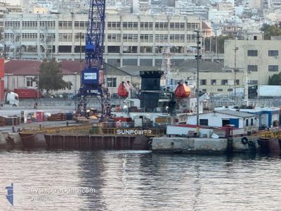
SUNPOWER
Oil Products Tanker

Current Trip
| Time Travelled | 2 days |
|---|---|
| Remaining Time | --- |
| Distance Travelled | 552.14 nm |
| Remaining Distance | --- |
| AVG Speed | 10.3 Knots |
| MAX Speed | 12.1 Knots |
| AVG Wind | 10.6 knots |
| MAX Wind | 28.5 knots |
| MIN Temp | 15.2°C / 59.36°F |
| MAX Temp | 19.9°C / 67.82°F |
| Draught | 4.5 m |
| Position Received | 1 m ago |
Current Position
| Longitude | --- |
|---|---|
| Latitude | --- |
| Status | Under way using engine |
| Speed | 2.2 Knots |
| Course | 27° |
| Area | Aegean Sea |
| Station | T-AIS |
| Position Received | 1 m ago |
Information
The current position of SUNPOWER is in Aegean Sea with coordinates 38.01083° / 23.55618° as reported on 2025-03-28 12:06 by AIS to our vessel tracker app. The vessel's current speed is 2.2 Knots
The vessel SUNPOWER (IMO: 9521643, MMSI: 355306000) is a Oil Products Tanker that was built in 2008 ( 17 years old ). It's sailing under the flag of [PA] Panama.
In this page you can find informations about the vessels current position, last detected port calls, and current voyage information. If the vessels is not in coverage by AIS you will find the latest position.
The current position of SUNPOWER is detected by our AIS receivers and we are not responsible for the reliability of the data. The last position was recorded while the vessel was in Coverage by the Ais receivers of our vessel tracking app.
The current draught of SUNPOWER as reported by AIS is 4.5 meters
Weather
| Temperature | 18.7°C / 65.66°F |
|---|---|
| Wind Speed | 6 knots |
| Direction | 261° W |
| Pressure | 1003.8 hPa |
| Humidity | 39.9 % |
| Cloud Coverage | --- |


Featured Company
Last Port Calls
| Port | Arrival | Departure | Time In Port |
|---|---|---|---|
| 2025-03-23 20:34 | 2025-03-26 12:26 | 2 d | |
| 2025-03-19 21:40 | 2025-03-20 20:46 | 23 h | |
| 2025-03-12 13:48 | 2025-03-13 06:39 | 16 h | |
| 2025-03-06 09:44 | 2025-03-07 22:10 | 1 d | |
| 2025-03-03 23:31 | 2025-03-06 07:39 | 2 d | |
| 2025-03-02 14:09 | 2025-03-03 20:19 | 1 d | |
| 2025-02-27 23:21 | 2025-03-02 07:26 | 2 d | |
| 2025-02-27 22:44 | 2025-02-27 22:47 | 3 m | |
| 2025-02-26 14:50 | 2025-02-27 22:32 | 1 d | |
| 2025-02-26 08:38 | 2025-02-26 14:28 | 5 h |
Most Visited Ports (Last year)
| Port | Arrivals | |
|---|---|---|
| 19 | ||
| 18 | ||
| 11 | ||
| 6 | ||
| 6 | ||
| 4 |
Last Trips
| Origin | Departure | Destination | Arrival | Distance | |
|---|---|---|---|---|---|
| 2025-03-20 20:46 | 2025-03-23 20:34 | 567.85 nm | |||
| 2025-03-13 06:39 | 2025-03-19 21:40 | 699.06 nm | |||
| 2025-03-07 22:10 | 2025-03-12 13:48 | 710.50 nm | |||
| 2025-03-06 07:39 | 2025-03-06 09:44 | 4.83 nm | |||
| 2025-03-03 20:19 | 2025-03-03 23:31 | 4.19 nm | |||
| 2025-03-02 07:26 | 2025-03-02 14:09 | 4.31 nm | |||
| 2025-02-27 22:47 | 2025-02-27 23:21 | 1.99 nm | |||
| 2025-02-27 22:32 | 2025-02-27 22:44 | 0.69 nm | |||
| 2025-02-26 14:28 | 2025-02-26 14:50 | 2.79 nm | |||
| 2025-02-26 01:36 | 2025-02-26 08:38 | 0.91 nm |
Events
| Time | Event | Details | Position / Dest | Info |
|---|---|---|---|---|
| 2025-03-28 11:56 | ETA Changed | 2025/03/28 11:00 2026/01/01 11:00 |
38.00147 / 23.55133
GR ASS
|
Speed: 6.9 kn Course: 8.8° |
| 2025-03-28 11:44 | ETA Changed | 2026/01/01 11:00 2025/03/28 11:00 |
37.97375 / 23.54702
GR ASS
|
Speed: 8 kn Course: 5.7° |
| 2025-03-28 10:14 | ETA Changed | 2025/03/28 11:00 2026/01/01 11:00 |
37.83438 / 23.66105
GR ASS
|
Speed: 9.4 kn Course: 317.1° |
| 2025-03-28 10:08 | ETA Changed | 2026/01/01 11:00 2025/03/28 11:00 |
37.82075 / 23.67112
GR ASS
|
Speed: 9.5 kn Course: 334.2° |
| 2025-03-28 09:20 | ETA Changed | 2025/03/28 11:00 2026/01/01 11:00 |
37.69645 / 23.74552
GR ASS
|
Speed: 11 kn Course: 334.7° |
| 2025-03-28 09:08 | ETA Changed | 2026/01/01 11:00 2025/03/28 11:00 |
37.66557 / 23.77052
GR ASS
|
Speed: 11.1 kn Course: 320.2° |
| 2025-03-28 08:39 | Status Changed | Under way using engine Default |
37.60155 / 23.84233
GR ASS
|
Speed: 10.9 kn Course: 317° |
| 2025-03-28 08:37 | Status Changed | Default Under way using engine |
37.59698 / 23.84748
GR ASS
|
Speed: 10.9 kn Course: 318° |
| 2025-03-28 07:44 | ETA Changed | 2025/03/28 11:00 2025/03/28 13:00 |
37.48355 / 23.99915
GR ASS
|
Speed: 10.8 kn Course: 316.7° |
| 2025-03-27 12:55 | Change Sea Area | Greek part of the Aegean Sea Greek part of the Mediterranean Sea - Eastern Basin |
35.82760 / 27.64833
Aegean Sea
GR ASS
|
Speed: 11.6 kn Course: 291.1° |