

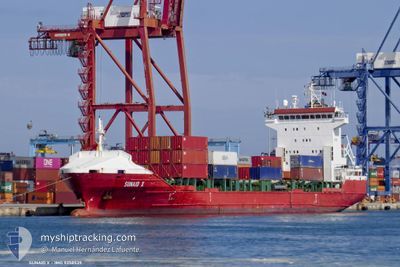
SUNAID X
Container Ship

Current Trip
| Time Travelled | 2 days |
|---|---|
| Remaining Time | 1 day |
| Distance Travelled | 455.92 nm |
| Remaining Distance | 436.55 nm |
| AVG Speed | 10.6 Knots |
| MAX Speed | 15.8 Knots |
| AVG Wind | 9.2 knots |
| MAX Wind | 18.3 knots |
| MIN Temp | 10°C / 50°F |
| MAX Temp | 15.5°C / 59.9°F |
| Draught | 5.5 m |
| Position Received | 9 h, 32 m ago |
Current Position
| Longitude | --- |
|---|---|
| Latitude | --- |
| Status | Under way using engine |
| Speed | 10 Knots |
| Course | 146.3° |
| Area | Adriatic Sea |
| Station | T-AIS |
| Position Received | 9 h, 32 m ago |
Information
The current position of SUNAID X is in Adriatic Sea with coordinates 40.11521° / 18.82873° as reported on 2025-03-30 13:57 by AIS to our vessel tracker app. The vessel's current speed is 10 Knots and is heading at the port of PIRAEUS. The estimated time of arrival as calculated by MyShipTracking vessel tracking app is 2025-04-01 11:26 LT
The vessel SUNAID X (IMO: 9358539, MMSI: 255806259) is a Container Ship that was built in 2006 ( 19 years old ). It's sailing under the flag of [PT] Portugal.
In this page you can find informations about the vessels current position, last detected port calls, and current voyage information. If the vessels is not in coverage by AIS you will find the latest position.
The current position of SUNAID X is detected by our AIS receivers and we are not responsible for the reliability of the data. The last position was recorded while the vessel was in Coverage by the Ais receivers of our vessel tracking app.
The current draught of SUNAID X as reported by AIS is 5.5 meters
Weather
| Temperature | 15.2°C / 59.36°F |
|---|---|
| Wind Speed | 9 knots |
| Direction | 19° NNE |
| Pressure | 1006.8 hPa |
| Humidity | 76 % |
| Cloud Coverage | 100 % |


Featured Company
Last Port Calls
| Port | Arrival | Departure | Time In Port |
|---|---|---|---|
| 2025-03-28 13:07 | 2025-03-28 20:47 | 7 h | |
| 2025-03-27 16:06 | 2025-03-28 02:26 | 10 h | |
| 2025-03-26 20:00 | 2025-03-27 06:40 | 10 h | |
| 2025-03-25 00:26 | 2025-03-25 14:25 | 13 h | |
| 2025-03-22 04:04 | 2025-03-22 16:46 | 12 h | |
| 2025-03-21 06:34 | 2025-03-21 18:50 | 12 h | |
| 2025-03-19 17:47 | 2025-03-20 15:25 | 21 h | |
| 2025-03-14 14:33 | 2025-03-14 20:45 | 6 h | |
| 2025-03-13 11:38 | 2025-03-14 05:16 | 17 h | |
| 2025-03-11 05:50 | 2025-03-11 22:02 | 16 h |
Most Visited Ports (Last year)
| Port | Arrivals | |
|---|---|---|
| 23 | ||
| 9 | ||
| 7 | ||
| 7 | ||
| 4 | ||
| 4 |
Last Trips
| Origin | Departure | Destination | Arrival | Distance | |
|---|---|---|---|---|---|
| 2025-03-28 02:26 | 2025-03-28 13:07 | 113.20 nm | |||
| 2025-03-27 06:40 | 2025-03-27 16:06 | 102.30 nm | |||
| 2025-03-25 14:25 | 2025-03-26 20:00 | 158.17 nm | |||
| 2025-03-22 16:46 | 2025-03-25 00:26 | 116.82 nm | |||
| 2025-03-21 18:50 | 2025-03-22 04:04 | 101.44 nm | |||
| 2025-03-20 15:25 | 2025-03-21 06:34 | 155.92 nm | |||
| 2025-03-14 20:45 | 2025-03-19 17:47 | 123.62 nm | |||
| 2025-03-14 05:16 | 2025-03-14 14:33 | 101.66 nm | |||
| 2025-03-11 22:02 | 2025-03-13 11:38 | 125.25 nm | |||
| 2025-03-10 13:53 | 2025-03-11 05:50 | 208.10 nm |
Events
| Time | Event | Details | Position / Dest | Info |
|---|---|---|---|---|
| 2025-03-30 14:02 | Status Changed | Default Under way using engine |
40.10403 / 18.83864
GRPIR
|
Speed: 10 kn Course: 146.3° |
| 2025-03-30 13:57 | OUT of Coverage |
40.11521 / 18.82873
Adriatic Sea
GRPIR
|
Speed: 10 kn Course: 146.3° |
|
| 2025-03-30 13:47 | Status Changed | Under way using engine Default |
40.13945 / 18.80830
GRPIR
|
Speed: 10 kn Course: 148° |
| 2025-03-30 13:26 | Status Changed | Default Under way using engine |
40.18824 / 18.76916
GRPIR
|
Speed: 9.9 kn Course: 148.9° |
| 2025-03-30 09:41 | Status Changed | Under way using engine Default |
40.73329 / 18.35383
GRPIR
|
Speed: 10.4 kn Course: 132° |
| 2025-03-30 09:41 | IN Coverage |
40.73192 / 18.35503
Adriatic Sea
GRPIR
|
Speed: 10.2 kn Course: 145.8° |
|
| 2025-03-30 06:43 | Status Changed | Default Under way using engine |
41.12172 / 17.83233
GRPIR
|
Speed: 15.8 kn Course: 131.4° |
| 2025-03-30 06:37 | OUT of Coverage |
41.13852 / 17.80711
Adriatic Sea
GRPIR
|
Speed: 15.8 kn Course: 131.4° |
|
| 2025-03-30 05:35 | Status Changed | Under way using engine Default |
41.27368 / 17.60861
GRPIR
|
Speed: 10.4 kn Course: 132° |
| 2025-03-30 05:23 | IN Coverage |
41.27368 / 17.60861
Adriatic Sea
GRPIR
|
Speed: 10.6 kn Course: 131.5° |