
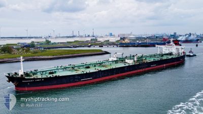
SUEZ ICE SUPREME
Crude Oil Tanker
Current Trip
EG SKT
| Time Travelled | 48 days |
|---|---|
| Remaining Time | --- |
| Distance Travelled | 10807.78 nm |
| Remaining Distance | --- |
| AVG Speed | 11.2 Knots |
| MAX Speed | 11.2 Knots |
| AVG Wind | 12.5 knots |
| MAX Wind | 36 knots |
| MIN Temp | 2.7°C / 36.86°F |
| MAX Temp | 34.3°C / 93.74°F |
| Draught | 9 m |
| Position Received | 3 m ago |
Current Position
| Longitude | 29.63487° |
|---|---|
| Latitude | 31.12272° |
| Status | Moored |
| Speed | |
| Course | 2° |
| Area | Mediterranean Sea - Eastern Basin |
| Station | T-AIS |
| Position Received | 3 m ago |
Info
Information
The current position of SUEZ ICE SUPREME is in Mediterranean Sea - Eastern Basin with coordinates 31.12272° / 29.63487° as reported on 2024-05-16 14:37 by AIS to our vessel tracker app. The vessel's current speed is 0 Knots
The vessel SUEZ ICE SUPREME (IMO: 9296418, MMSI: 636022121) is a Crude Oil Tanker that was built in 2007 ( 17 years old ). It's sailing under the flag of [LR] Liberia.
In this page you can find informations about the vessels current position, last detected port calls, and current voyage information. If the vessels is not in coverage by AIS you will find the latest position.
The current position of SUEZ ICE SUPREME is detected by our AIS receivers and we are not responsible for the reliability of the data. The last position was recorded while the vessel was in Coverage by the Ais receivers of our vessel tracking app.
The current draught of SUEZ ICE SUPREME as reported by AIS is 9 meters
Weather
| Temperature | 29.5°C / 85.1°F |
|---|---|
| Wind Speed | 9 knots |
| Direction | 5° N |
| Pressure | 1017.5 hPa |
| Humidity | 23.1 % |
| Cloud Coverage | --- |
Featured Company
Last Port Calls
| Port | Arrival | Departure | Time In Port |
|---|---|---|---|
| 2024-05-09 05:57 | 2024-05-09 15:09 | 9 h | |
| 2024-04-16 05:10 | 2024-04-16 14:09 | 8 h | |
| 2024-03-27 14:16 | 2024-03-29 11:15 | 1 d | |
| 2024-03-02 02:55 |
Last Trips
| Origin | Departure | Destination | Arrival | Distance | |
|---|---|---|---|---|---|
| 2024-03-29 14:15 | 2024-05-09 07:57 | 10143.82 nm | |||
| 2024-03-29 14:15 | 2024-04-16 07:10 | 4810.99 nm | |||
| 2024-03-02 03:55 | 2024-03-27 17:16 | 661.63 nm |
Events
| Time | Event | Details | Position / Dest | Info |
|---|---|---|---|---|
| 2024-05-16 13:55 | Status Changed | Moored Default |
31.12282 / 29.63407
EG SKT
|
Speed: Course: 8° |
| 2024-05-16 13:13 | Status Changed | Default Moored |
31.12353 / 29.63632
EG SKT
|
Speed: 0.1 kn Course: 324° |
| 2024-05-16 12:49 | Status Changed | Moored Default |
31.12442 / 29.63708
EG SKT
|
Speed: Course: 304° |
| 2024-05-16 12:43 | IN Coverage |
31.12442 / 29.63708
Mediterranean Sea - Eastern Basin
|
Speed: Course: 201° |
|
| 2024-05-16 08:10 | Status Changed | Default Moored |
31.12683 / 29.63718
EG SKT
|
Speed: 0.1 kn Course: 235° |
| 2024-05-16 08:01 | OUT of Coverage |
31.12695 / 29.63712
Mediterranean Sea - Eastern Basin
|
Speed: 0.1 kn Course: 233° |
|
| 2024-05-16 07:58 | Status Changed | Moored Default |
31.12697 / 29.63710
EG SKT
|
Speed: 0.1 kn Course: 233° |
| 2024-05-16 07:52 | Status Changed | Default Moored |
31.12698 / 29.63702
EG SKT
|
Speed: Course: 233° |
| 2024-05-16 07:43 | Status Changed | Moored Default |
31.12710 / 29.63698
EG SKT
|
Speed: Course: 227° |
| 2024-05-16 07:34 | Status Changed | Default Moored |
31.12722 / 29.63685
EG SKT
|
Speed: 0.1 kn Course: 226° |