
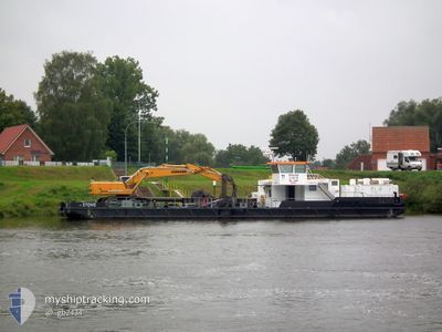
STOVE
Not available
Current Trip
GEESTHACHT
| Time Travelled | 27 days |
|---|---|
| Remaining Time | --- |
| Distance Travelled | 20.13 nm |
| Remaining Distance | --- |
| AVG Speed | 6 Knots |
| MAX Speed | 10 Knots |
| AVG Wind | 5.3 knots |
| MAX Wind | 11 knots |
| MIN Temp | -4°C / 24.8°F |
| MAX Temp | 8.2°C / 46.76°F |
| Draught | 1 m |
| Position Received | Now |
Current Position
| Longitude | --- |
|---|---|
| Latitude | --- |
| Status | Engaged in Fishing |
| Speed | |
| Course | 117° |
| Area | --- |
| Station | T-AIS |
| Position Received | Now |
Info
Information
The current position of STOVE is in --- with coordinates 53.37336° / 10.25142° as reported on 2025-02-17 03:45 by AIS to our vessel tracker app. The vessel's current speed is 0 Knots
The vessel STOVE (MMSI: 211459410) is a Not available It's sailing under the flag of [DE] Germany.
In this page you can find informations about the vessels current position, last detected port calls, and current voyage information. If the vessels is not in coverage by AIS you will find the latest position.
The current position of STOVE is detected by our AIS receivers and we are not responsible for the reliability of the data. The last position was recorded while the vessel was in Coverage by the Ais receivers of our vessel tracking app.
The current draught of STOVE as reported by AIS is 1 meters
Weather
| Temperature | -3.8°C / 25.16°F |
|---|---|
| Wind Speed | 3 knots |
| Direction | 90° E |
| Pressure | 1027.4 hPa |
| Humidity | 71 % |
| Cloud Coverage | 6 % |
Featured Company
Last Port Calls
| Port | Arrival | Departure | Time In Port |
|---|---|---|---|
| 2025-01-16 13:29 | 2025-01-20 08:22 | 3 d | |
| 2025-01-15 13:11 | 2025-01-16 08:14 | 19 h | |
| 2025-01-14 12:52 | 2025-01-15 07:31 | 18 h | |
| 2025-01-13 13:00 | 2025-01-14 09:05 | 20 h | |
| 2025-01-07 13:11 | 2025-01-13 08:32 | 5 d | |
| 2024-12-12 07:36 | 2025-01-07 08:07 | 26 d | |
| 2024-12-04 12:12 | 2024-12-09 08:19 | 4 d | |
| 2024-12-02 08:28 |
Most Visited Ports (Last year)
| Port | Arrivals | |
|---|---|---|
| 50 | ||
| 1 |
Last Trips
| Origin | Departure | Destination | Arrival | Distance | |
|---|---|---|---|---|---|
| 2025-01-16 09:14 | 2025-01-16 14:29 | 2.97 nm | |||
| 2025-01-15 08:31 | 2025-01-15 14:11 | 1.40 nm | |||
| 2025-01-14 10:05 | 2025-01-14 13:52 | 7.98 nm | |||
| 2025-01-13 09:32 | 2025-01-13 14:00 | 5.29 nm | |||
| 2025-01-07 09:07 | 2025-01-07 14:11 | 9.70 nm | |||
| 2024-12-09 09:19 | 2024-12-12 08:36 | 22.90 nm | |||
| 2024-12-02 09:28 | 2024-12-04 13:12 | 18.63 nm |
Events
| Time | Event | Details | Position / Dest | Info |
|---|---|---|---|---|
| 2025-02-13 06:37 | STOP Moving | 4.39 nm, South East of HOOPTE |
53.36355 / 10.28322
GEESTHACHT
|
Speed: 0.2 kn Course: 125° |
| 2025-02-13 06:18 | START Moving | 3.21 nm, South East of HOOPTE |
53.37271 / 10.25415
GEESTHACHT
|
Speed: 3.3 kn Course: 116° |
| 2025-02-12 07:18 | STOP Moving | 3.08 nm, South East of HOOPTE |
53.37362 / 10.25103
GEESTHACHT
|
Speed: 0.3 kn Course: 118° |
| 2025-02-12 07:07 | START Moving | 3.43 nm, South East of HOOPTE |
53.37093 / 10.25964
GEESTHACHT
|
Speed: 3.1 kn Course: 121° |
| 2025-02-12 06:52 | STOP Moving | 4.02 nm, South East of HOOPTE |
53.36638 / 10.27421
GEESTHACHT
|
Speed: 0.3 kn Course: 117° |
| 2025-02-12 06:34 | START Moving | 3.28 nm, South East of HOOPTE |
53.37214 / 10.25590
GEESTHACHT
|
Speed: 3.2 kn Course: 115° |