
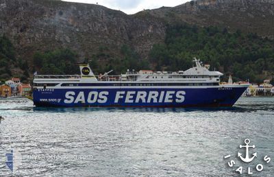
STAVROS
Ro-Ro/Passenger Ship
Current Trip
RHO-KAS-RHO
| Time Travelled | 3 h, 9 mins |
|---|---|
| Remaining Time | --- |
| Distance Travelled | 47.45 nm |
| Remaining Distance | --- |
| AVG Speed | 16.1 Knots |
| MAX Speed | 16.6 Knots |
| AVG Wind | 5 knots |
| MAX Wind | 8 knots |
| MIN Temp | 14.9°C / 58.82°F |
| MAX Temp | 18.5°C / 65.3°F |
| Draught | 4.8 m |
| Position Received | 11 m ago |
Current Position
| Longitude | --- |
|---|---|
| Latitude | --- |
| Status | Under way using engine |
| Speed | 16.1 Knots |
| Course | 281.9° |
| Area | Mediterranean Sea - Eastern Basin |
| Station | T-AIS |
| Position Received | 11 m ago |
Info
Information
The current position of STAVROS is in Mediterranean Sea - Eastern Basin with coordinates 36.33826° / 28.66377° as reported on 2025-12-09 14:45 by AIS to our vessel tracker app. The vessel's current speed is 16.1 Knots
The vessel STAVROS (IMO: 8973136, MMSI: 237352400) is a Ro-Ro/Passenger Ship that was built in 2001 ( 24 years old ). It's sailing under the flag of [GR] Greece.
In this page you can find informations about the vessels current position, last detected port calls, and current voyage information. If the vessels is not in coverage by AIS you will find the latest position.
The current position of STAVROS is detected by our AIS receivers and we are not responsible for the reliability of the data. The last position was recorded while the vessel was in Coverage by the Ais receivers of our vessel tracking app.
The current draught of STAVROS as reported by AIS is 4.8 meters
Weather
| Temperature | 18.4°C / 65.12°F |
|---|---|
| Wind Speed | 8 knots |
| Direction | 333° NNW |
| Pressure | 1013.3 hPa |
| Humidity | 47.7 % |
| Cloud Coverage | --- |
Featured Company
Last Port Calls
| Port | Arrival | Departure | Time In Port |
|---|---|---|---|
| 2025-12-09 13:23 | 2025-12-09 13:48 | 25 m | |
| 2025-12-08 22:17 | 2025-12-09 08:06 | 9 h | |
| 2025-12-08 18:15 | 2025-12-08 18:25 | 9 m | |
| 2025-12-08 16:57 | 2025-12-08 17:09 | 12 m | |
| 2025-12-08 14:49 | 2025-12-08 15:17 | 27 m | |
| 2025-12-07 22:46 | 2025-12-08 08:10 | 9 h | |
| 2025-12-07 20:17 | 2025-12-07 20:33 | 15 m | |
| 2025-12-07 17:46 | 2025-12-07 18:03 | 16 m | |
| 2025-12-07 13:07 | 2025-12-07 13:23 | 16 m | |
| 2025-12-05 16:44 | 2025-12-07 08:11 | 1 d |
Last Trips
| Origin | Departure | Destination | Arrival | Distance | |
|---|---|---|---|---|---|
| 2025-12-09 08:06 | 2025-12-09 13:23 | 74.85 nm | |||
| 2025-12-08 18:25 | 2025-12-08 22:17 | 46.73 nm | |||
| 2025-12-08 17:09 | 2025-12-08 18:15 | 16.32 nm | |||
| 2025-12-08 17:09 | 2025-12-08 16:57 | 16.32 nm | |||
| 2025-12-08 08:10 | 2025-12-08 14:49 | 77.50 nm | |||
| 2025-12-07 20:33 | 2025-12-07 22:46 | 33.98 nm | |||
| 2025-12-07 18:03 | 2025-12-07 20:17 | 33.66 nm | |||
| 2025-12-07 13:23 | 2025-12-07 17:46 | 69.09 nm | |||
| 2025-12-07 08:11 | 2025-12-07 13:07 | 68.69 nm | |||
| 2025-12-04 23:06 | 2025-12-05 16:44 | 12.82 nm |
Events
| Time | Event | Details | Position / Dest | Info |
|---|---|---|---|---|
| 2025-12-09 14:42 | Status Changed | Under way using engine Default |
36.33543 / 28.68347
RHO-KAS-RHO
|
Speed: 15.7 kn Course: 282° |
| 2025-12-09 14:38 | Status Changed | Default Under way using engine |
36.33241 / 28.70176
RHO-KAS-RHO
|
Speed: 16.3 kn Course: 283.7° |
| 2025-12-09 14:14 | Status Changed | Under way using engine Default |
36.30753 / 28.83875
RHO-KAS-RHO
|
Speed: 16 kn Course: 281° |
| 2025-12-09 14:14 | IN Coverage |
36.30753 / 28.83875
Mediterranean Sea - Eastern Basin
|
Speed: 16.5 kn Course: 283.7° |
|
| 2025-12-09 13:39 | Status Changed | Default Under way using engine |
36.26333 / 29.03167
RHO-KAS-RHO
|
Speed: 16.3 kn Course: 287.1° |
| 2025-12-09 13:10 | OUT of Coverage |
36.23053 / 29.19007
Mediterranean Sea - Eastern Basin
|
Speed: 16.3 kn Course: 287.1° |
|
| 2025-12-09 12:55 | Change Sea Area | Turkish part of the Mediterranean Sea - Eastern Basin Greek part of the Mediterranean Sea - Eastern Basin |
36.21099 / 29.27259
Mediterranean Sea - Eastern Basin
|
Speed: 15.8 kn Course: 284.4° |
| 2025-12-09 12:55 | Status Changed | Under way using engine Default |
36.21099 / 29.27259
RHO-KAS-RHO
|
Speed: 15.3 kn Course: 276° |
| 2025-12-09 12:42 | Status Changed | Default Under way using engine |
36.19999 / 29.33734
RHO-KAS-RHO
|
Speed: 15.3 kn Course: 279° |
| 2025-12-09 11:48 | PORT DEPARTURE |
|
36.15655 / 29.59757
RHO-KAS-RHO
|
Speed: 12.5 kn Course: 43° |