
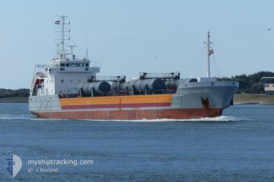
STAR CURACAO
Edible Oil Tanker
Current Trip
| Time Travelled | 19 h, 34 mins |
|---|---|
| Remaining Time | 12 h, 34 mins |
| Distance Travelled | 219.20 nm |
| Remaining Distance | 161.69 nm |
| AVG Speed | 10.8 Knots |
| MAX Speed | 14 Knots |
| AVG Wind | 6.1 knots |
| MAX Wind | 12 knots |
| MIN Temp | 8.4°C / 47.12°F |
| MAX Temp | 12.5°C / 54.5°F |
| Draught | 5.2 m |
| Position Received | 1 h, 28 m ago |
Current Position
| Longitude | 4.00244° |
|---|---|
| Latitude | 52.96321° |
| Status | Under way using engine |
| Speed | 12.6 Knots |
| Course | 231.3° |
| Area | North Sea |
| Station | T-AIS |
| Position Received | 1 h, 28 m ago |
Info
Information
The current position of STAR CURACAO is in North Sea with coordinates 52.96321° / 4.00244° as reported on 2024-05-07 22:36 by AIS to our vessel tracker app. The vessel's current speed is 12.6 Knots and is heading at the port of PURFLEET. The estimated time of arrival as calculated by MyShipTracking vessel tracking app is 2024-05-08 12:39 LT
The vessel STAR CURACAO (IMO: 9402653, MMSI: 245405000) is a Edible Oil Tanker that was built in 2008 ( 16 years old ). It's sailing under the flag of [NL] Netherlands.
In this page you can find informations about the vessels current position, last detected port calls, and current voyage information. If the vessels is not in coverage by AIS you will find the latest position.
The current position of STAR CURACAO is detected by our AIS receivers and we are not responsible for the reliability of the data. The last position was recorded while the vessel was in Coverage by the Ais receivers of our vessel tracking app.
The current draught of STAR CURACAO as reported by AIS is 5.2 meters
Weather
| Temperature | 10.5°C / 50.9°F |
|---|---|
| Wind Speed | 12 knots |
| Direction | 356° N |
| Pressure | 1026 hPa |
| Humidity | 94.6 % |
| Cloud Coverage | 31 % |
Featured Company
Last Port Calls
| Port | Arrival | Departure | Time In Port |
|---|---|---|---|
| 2024-05-04 12:38 | 2024-05-07 04:31 | 2 d | |
| 2024-05-02 22:19 | 2024-05-03 12:27 | 14 h | |
| 2024-05-01 19:06 | 2024-05-02 20:36 | 1 d | |
| 2024-04-28 20:37 | 2024-05-01 18:53 | 2 d | |
| 2024-04-26 09:12 | 2024-04-28 08:32 | 1 d | |
| 2024-04-24 06:31 | 2024-04-25 16:03 | 1 d | |
| 2024-04-23 21:24 | 2024-04-24 06:25 | 9 h | |
| 2024-04-22 08:28 | 2024-04-22 10:14 | 1 h | |
| 2024-04-19 12:26 | 2024-04-21 09:24 | 1 d | |
| 2024-04-18 15:53 | 2024-04-18 15:56 | 3 m |
Most Visited Ports (Last year)
| Port | Arrivals | |
|---|---|---|
| 29 | ||
| 24 | ||
| 16 | ||
| 15 | ||
| 14 | ||
| 12 |
Last Trips
| Origin | Departure | Destination | Arrival | Distance | |
|---|---|---|---|---|---|
| 2024-05-03 14:27 | 2024-05-04 14:38 | 260.59 nm | |||
| 2024-05-02 22:36 | 2024-05-03 00:19 | 16.33 nm | |||
| 2024-05-01 20:53 | 2024-05-01 21:06 | 0.66 nm | |||
| 2024-04-28 10:32 | 2024-04-28 22:37 | 146.25 nm | |||
| 2024-04-25 18:03 | 2024-04-26 11:12 | 156.57 nm | |||
| 2024-04-24 08:25 | 2024-04-24 08:31 | 0.38 nm | |||
| 2024-04-22 12:14 | 2024-04-23 23:24 | 339.50 nm | |||
| 2024-04-21 11:24 | 2024-04-22 10:28 | 230.55 nm | |||
| 2024-04-18 17:56 | 2024-04-19 14:26 | 232.98 nm | |||
| 2024-04-17 06:27 | 2024-04-18 17:53 | 324.18 nm |
Events
| Time | Event | Details | Position / Dest | Info |
|---|---|---|---|---|
| 2024-05-07 22:38 | Status Changed | Default Under way using engine |
52.95991 / 3.99561
DEBKE>GBPFT
|
Speed: 12.6 kn Course: 231.3° |
| 2024-05-07 22:36 | Status Changed | Under way using engine Default |
52.96321 / 4.00244
DEBKE>GBPFT
|
Speed: 12.5 kn Course: 230° |
| 2024-05-07 22:36 | OUT of Coverage |
52.96321 / 4.00244
North Sea
DEBKE>GBPFT
|
Speed: 12.6 kn Course: 231.3° |
|
| 2024-05-07 22:18 | Status Changed | Default Under way using engine |
53.00167 / 4.08667
DEBKE>GBPFT
|
Speed: 12.6 kn Course: 233.8° |
| 2024-05-07 14:52 | Status Changed | Under way using engine Default |
53.73356 / 5.93353
DEBKE>GBPFT
|
Speed: 12.8 kn Course: 251° |
| 2024-05-07 14:45 | Status Changed | Default Under way using engine |
53.74041 / 5.96891
DEBKE>GBPFT
|
Speed: 12.9 kn Course: 251.8° |
| 2024-05-07 14:35 | Status Changed | Under way using engine Default |
53.75225 / 6.02592
DEBKE>GBPFT
|
Speed: 13 kn Course: 254° |
| 2024-05-07 14:24 | Status Changed | Default Under way using engine |
53.76333 / 6.09333
DEBKE>GBPFT
|
Speed: 13.2 kn Course: 251.5° |
| 2024-05-07 14:16 | Change Sea Area | Dutch part of the North Sea German part of the North Sea |
53.77342 / 6.14088
North Sea
DEBKE>GBPFT
|
Speed: 13.2 kn Course: 251.5° |
| 2024-05-07 14:14 | Status Changed | Under way using engine Default |
53.77539 / 6.15069
DEBKE>GBPFT
|
Speed: 13.4 kn Course: 252° |