
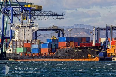
STAR COMET
Container Ship
Current Trip
BBBGI
| Time Travelled | 3 h, 58 mins |
|---|---|
| Remaining Time | --- |
| Distance Travelled | 46.46 nm |
| Remaining Distance | --- |
| AVG Speed | 13.3 Knots |
| MAX Speed | 14.2 Knots |
| AVG Wind | 19.3 knots |
| MAX Wind | 21.7 knots |
| MIN Temp | 25.9°C / 78.62°F |
| MAX Temp | 26.5°C / 79.7°F |
| Draught | 6.2 m |
| Position Received | 3 h, 51 m ago |
Current Position
| Longitude | --- |
|---|---|
| Latitude | --- |
| Status | Under way using engine |
| Speed | 12.9 Knots |
| Course | 220° |
| Area | Caribbean Sea |
| Station | T-AIS |
| Position Received | 3 h, 51 m ago |
Info
Information
The current position of STAR COMET is in Caribbean Sea with coordinates 13.09417° / -59.66567° as reported on 2025-12-14 03:00 by AIS to our vessel tracker app. The vessel's current speed is 12.9 Knots
The vessel STAR COMET (IMO: 9242596, MMSI: 304416000) is a Container Ship that was built in 2002 ( 23 years old ). It's sailing under the flag of [AG] Antigua Barbuda.
In this page you can find informations about the vessels current position, last detected port calls, and current voyage information. If the vessels is not in coverage by AIS you will find the latest position.
The current position of STAR COMET is detected by our AIS receivers and we are not responsible for the reliability of the data. The last position was recorded while the vessel was in Coverage by the Ais receivers of our vessel tracking app.
The current draught of STAR COMET as reported by AIS is 6.2 meters
Weather
| Temperature | 25.9°C / 78.62°F |
|---|---|
| Wind Speed | 20 knots |
| Direction | 84° E |
| Pressure | 1012.8 hPa |
| Humidity | 81.7 % |
| Cloud Coverage | 10 % |
Featured Company
Last Port Calls
| Port | Arrival | Departure | Time In Port |
|---|---|---|---|
| 2025-12-13 16:48 | 2025-12-13 22:54 | 6 h | |
| 2025-12-11 12:19 | 2025-12-11 22:15 | 9 h | |
| 2025-12-08 21:04 | 2025-12-09 19:49 | 22 h | |
| 2025-12-03 19:13 | 2025-12-04 12:04 | 16 h | |
| 2025-12-02 21:53 | 2025-12-03 07:13 | 9 h | |
| 2025-11-30 23:16 | 2025-12-01 20:34 | 21 h | |
| 2025-11-26 09:31 | 2025-11-27 08:22 | 22 h | |
| 2025-11-23 06:18 | 2025-11-23 20:22 | 14 h | |
| 2025-11-19 17:30 | 2025-11-21 05:30 | 1 d | |
| 2025-11-15 22:14 | 2025-11-16 15:30 | 17 h |
Most Visited Ports (Last year)
| Port | Arrivals | |
|---|---|---|
| 30 | ||
| 20 | ||
| 18 | ||
| 12 | ||
| 10 | ||
| 4 |
Last Trips
| Origin | Departure | Destination | Arrival | Distance | |
|---|---|---|---|---|---|
| 2025-12-11 22:15 | 2025-12-13 16:48 | 223.68 nm | |||
| 2025-12-09 19:49 | 2025-12-11 12:19 | 386.24 nm | |||
| 2025-12-04 12:04 | 2025-12-08 21:04 | 397.93 nm | |||
| 2025-12-03 07:13 | 2025-12-03 19:13 | 7.38 nm | |||
| 2025-12-01 20:34 | 2025-12-02 21:53 | 232.43 nm | |||
| 2025-11-27 08:22 | 2025-11-30 23:16 | 384.81 nm | |||
| 2025-11-23 20:22 | 2025-11-26 09:31 | 400.94 nm | |||
| 2025-11-21 05:30 | 2025-11-23 06:18 | 405.97 nm | |||
| 2025-11-16 15:30 | 2025-11-19 17:30 | 411.06 nm | |||
| 2025-11-14 12:46 | 2025-11-15 22:14 | 404.59 nm |
Events
| Time | Event | Details | Position / Dest | Info |
|---|---|---|---|---|
| 2025-12-14 03:09 | Status Changed | Default Under way using engine |
13.06898 / -59.68724
BBBGI
|
Speed: 12.9 kn Course: 220° |
| 2025-12-14 03:00 | Change Sea Area | Barbados part of the Caribbean Sea Trinidad and Tobago part of the Caribbean Sea |
13.09417 / -59.66567
Caribbean Sea
|
Speed: 12.9 kn Course: 220° |
| 2025-12-14 03:00 | Status Changed | Under way using engine Default |
13.09417 / -59.66567
BBBGI
|
Speed: 13 kn Course: 240° |
| 2025-12-14 03:00 | OUT of Coverage |
13.09417 / -59.66567
Caribbean Sea
|
Speed: 12.9 kn Course: 220° |
|
| 2025-12-14 02:54 | PORT DEPARTURE |
|
13.10833 / -59.65116
BBBGI
|
Speed: 4.1 kn Course: 286° |
| 2025-12-14 02:47 | START Moving |
13.10783 / -59.63217
[BB] BRIDGETOWN
|
Speed: 4.1 kn Course: 286° |
|
| 2025-12-14 02:41 | IN Coverage |
13.09417 / -59.66567
Caribbean Sea
|
Speed: 12.9 kn Course: 220° |
|
| 2025-12-13 21:01 | STOP Moving |
13.10600 / -59.63016
[BB] BRIDGETOWN
|
Speed: 0.2 kn Course: 339° |
|
| 2025-12-13 20:48 | PORT ARRIVAL |
|
13.10650 / -59.63083
[BB] BRIDGETOWN
|
Speed: 2.1 kn Course: 68° |
| 2025-12-13 09:34 | OUT of Coverage |
11.99234 / -60.63201
Caribbean Sea
|
Speed: 11.8 kn Course: 35° |