
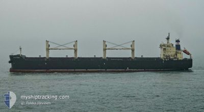
STAR BRIGHT
Bulk Carrier
Current Trip
| Time Travelled | 14 days |
|---|---|
| Remaining Time | --- |
| Distance Travelled | 2928.07 nm |
| Remaining Distance | --- |
| AVG Speed | 9.9 Knots |
| MAX Speed | 14.6 Knots |
| AVG Wind | 12.6 knots |
| MAX Wind | 27 knots |
| MIN Temp | 4.3°C / 39.74°F |
| MAX Temp | 18.3°C / 64.94°F |
| Draught | 6.2 m |
| Position Received | 18 h, 50 m ago |
Current Position
| Longitude | 28.92107° |
|---|---|
| Latitude | 60.03169° |
| Status | Under way using engine |
| Speed | 6.1 Knots |
| Course | 92.5° |
| Area | Gulf of Finland |
| Station | T-AIS |
| Position Received | 18 h, 50 m ago |
Info
Information
The current position of STAR BRIGHT is in Gulf of Finland with coordinates 60.03169° / 28.92107° as reported on 2024-05-01 22:04 by AIS to our vessel tracker app. The vessel's current speed is 6.1 Knots
The vessel STAR BRIGHT (IMO: 9507788, MMSI: 636018927) is a Bulk Carrier that was built in 2010 ( 14 years old ). It's sailing under the flag of [LR] Liberia.
In this page you can find informations about the vessels current position, last detected port calls, and current voyage information. If the vessels is not in coverage by AIS you will find the latest position.
The current position of STAR BRIGHT is detected by our AIS receivers and we are not responsible for the reliability of the data. The last position was recorded while the vessel was in Coverage by the Ais receivers of our vessel tracking app.
The current draught of STAR BRIGHT as reported by AIS is 6.2 meters
Weather
| Temperature | 4.2°C / 39.56°F |
|---|---|
| Wind Speed | 6 knots |
| Direction | 107° ESE |
| Pressure | 1027.7 hPa |
| Humidity | 88.1 % |
| Cloud Coverage | 11 % |
Featured Company
Most Visited Ports (Last year)
| Port | Arrivals | |
|---|---|---|
| 2 | ||
| 2 | ||
| 2 | ||
| 1 | ||
| 1 | ||
| 1 |
Events
| Time | Event | Details | Position / Dest | Info |
|---|---|---|---|---|
| 2024-05-01 22:21 | Status Changed | Default Under way using engine |
60.03034 / 28.97977
ST-PETERSBURG
|
Speed: 6.1 kn Course: 92.5° |
| 2024-05-01 22:04 | OUT of Coverage |
60.03169 / 28.92107
Gulf of Finland
ST-PETERSBURG
|
Speed: 6.1 kn Course: 92.5° |
|
| 2024-05-01 14:35 | ETA Changed | 2024/05/02 01:00 2024/05/02 02:00 |
59.96217 / 26.46750
ST-PETERSBURG
|
Speed: 11.3 kn Course: 73.7° |
| 2024-05-01 14:29 | Detected in Sea | Russian part of the Gulf of Finland |
59.95633 / 26.42780
Gulf of Finland
ST-PETERSBURG
|
Speed: 11.3 kn Course: 74.8° |
| 2024-05-01 13:51 | Status Changed | Under way using engine Default |
59.92675 / 26.20019
ST-PETERSBURG
|
Speed: 11.1 kn Course: 76° |
| 2024-05-01 13:41 | IN Coverage |
59.92825 / 26.21216
Gulf of Finland
ST-PETERSBURG
|
Speed: 11.2 kn Course: 76.2° |
|
| 2024-05-01 11:57 | Status Changed | Default Under way using engine |
59.83988 / 25.49605
ST-PETERSBURG
|
Speed: 11.6 kn Course: 77.8° |
| 2024-05-01 11:50 | OUT of Coverage |
59.83564 / 25.45547
Gulf of Finland
ST-PETERSBURG
|
Speed: 11.6 kn Course: 77.8° |
|
| 2024-05-01 11:47 | Status Changed | Under way using engine Default |
59.83369 / 25.43777
ST-PETERSBURG
|
Speed: 11.6 kn Course: 78° |
| 2024-05-01 11:44 | Status Changed | Default Under way using engine |
59.83183 / 25.41984
ST-PETERSBURG
|
Speed: 11.6 kn Course: 78.4° |