
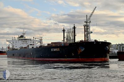
STAMOS
Crude Oil Tanker
Current Trip
| Time Travelled | 32 days |
|---|---|
| Remaining Time | 3 days |
| Distance Travelled | 6809.33 nm |
| Remaining Distance | 1032.84 nm |
| AVG Speed | 10.3 Knots |
| MAX Speed | 10.3 Knots |
| AVG Wind | 14 knots |
| MAX Wind | 34.9 knots |
| MIN Temp | 12.3°C / 54.14°F |
| MAX Temp | 35.1°C / 95.18°F |
| Draught | 14.5 m |
| Position Received | 1 m ago |
Current Position
| Longitude | --- |
|---|---|
| Latitude | --- |
| Status | Under way using engine |
| Speed | 13.4 Knots |
| Course | 3.9° |
| Area | North Sea |
| Station | T-AIS |
| Position Received | 1 m ago |
Info
Information
The current position of STAMOS is in North Sea with coordinates 51.98717° / 2.65062° as reported on 2024-09-30 13:44 by AIS to our vessel tracker app. The vessel's current speed is 13.4 Knots and is heading at the port of GDANSK. The estimated time of arrival as calculated by MyShipTracking vessel tracking app is 2024-10-03 19:12 LT
The vessel STAMOS (IMO: 9592276, MMSI: 248148000) is a Crude Oil Tanker that was built in 2012 ( 12 years old ). It's sailing under the flag of [MT] Malta.
In this page you can find informations about the vessels current position, last detected port calls, and current voyage information. If the vessels is not in coverage by AIS you will find the latest position.
The current position of STAMOS is detected by our AIS receivers and we are not responsible for the reliability of the data. The last position was recorded while the vessel was in Coverage by the Ais receivers of our vessel tracking app.
The current draught of STAMOS as reported by AIS is 14.5 meters
Weather
| Temperature | 16°C / 60.8°F |
|---|---|
| Wind Speed | 29 knots |
| Direction | 170° S |
| Pressure | 999.8 hPa |
| Humidity | 94.4 % |
| Cloud Coverage | 100 % |
Featured Company
Last Port Calls
| Port | Arrival | Departure | Time In Port |
|---|---|---|---|
| 2024-09-15 04:39 | 2024-09-15 13:54 | 9 h | |
| 2024-08-27 23:00 | 2024-08-29 01:28 | 1 d | |
| 2024-07-31 05:28 | 2024-07-31 14:26 | 8 h | |
| 2024-07-27 03:08 | 2024-07-28 13:46 | 1 d | |
| 2024-07-16 19:27 | 2024-07-18 04:34 | 1 d |
Most Visited Ports (Last year)
| Port | Arrivals | |
|---|---|---|
| 2 | ||
| 2 | ||
| 2 | ||
| 1 | ||
| 1 | ||
| 1 |
Last Trips
| Origin | Departure | Destination | Arrival | Distance | |
|---|---|---|---|---|---|
| 2024-08-29 04:28 | 2024-09-15 06:39 | 3336.34 nm | |||
| 2024-07-28 16:46 | 2024-08-28 02:00 | 4126.16 nm | |||
| 2024-07-28 16:46 | 2024-07-31 07:28 | 630.30 nm | |||
| 2024-07-18 06:34 | 2024-07-27 06:08 | 1325.74 nm | |||
| 2024-06-26 08:15 | 2024-07-16 21:27 | 4589.34 nm |
Events
| Time | Event | Details | Position / Dest | Info |
|---|---|---|---|---|
| 2024-09-30 13:01 | Change Sea Area | Dutch part of the North Sea Belgian part of the North Sea |
51.83116 / 2.62424
North Sea
PLGDN
|
Speed: 13.2 kn Course: 4.8° |
| 2024-09-30 11:18 | Change Sea Area | Belgian part of the North Sea French part of the North Sea |
51.52129 / 2.28055
North Sea
PLGDN
|
Speed: 13.6 kn Course: 38.9° |
| 2024-09-30 08:55 | Change Sea Area | French part of the North Sea United Kingdom part of the North Sea |
51.13428 / 1.78262
North Sea
PLGDN
|
Speed: 13.6 kn Course: 54.1° |
| 2024-09-30 08:43 | Detected in Sea | United Kingdom part of the North Sea |
51.10409 / 1.73080
North Sea
PLGDN
|
Speed: 13.3 kn Course: 38.7° |
| 2024-09-30 08:10 | Change Sea Area | French part of the North Sea French part of the English Channel |
51.01578 / 1.60693
North Sea
PLGDN
|
Speed: 12.9 kn Course: 41.5° |
| 2024-09-30 05:47 | Status Changed | Under way using engine Default |
50.62361 / 1.22074
PLGDN
|
Speed: 11.7 kn Course: 44° |
| 2024-09-30 05:45 | Status Changed | Default Under way using engine |
50.61983 / 1.21485
PLGDN
|
Speed: 11.6 kn Course: 47° |
| 2024-09-30 05:37 | Change Sea Area | French part of the English Channel United Kingdom part of the English Channel |
50.60178 / 1.18470
English Channel
PLGDN
|
Speed: 11.6 kn Course: 46.5° |
| 2024-09-30 05:37 | Status Changed | Under way using engine Default |
50.60178 / 1.18470
PLGDN
|
Speed: 11.7 kn Course: 50° |
| 2024-09-30 05:33 | IN Coverage |
50.60178 / 1.18470
English Channel
PLGDN
|
Speed: 11.6 kn Course: 46.5° |