
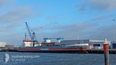
SPEYK
General Cargo
Current Trip
| Time Travelled | 2 days |
|---|---|
| Remaining Time | 2 days |
| Distance Travelled | 527.08 nm |
| Remaining Distance | 464.40 nm |
| AVG Speed | 8 Knots |
| MAX Speed | 12.6 Knots |
| AVG Wind | 10.1 knots |
| MAX Wind | 18.1 knots |
| MIN Temp | 6.2°C / 43.16°F |
| MAX Temp | 21.1°C / 69.98°F |
| Draught | 5.3 m |
| Position Received | 1 m ago |
Current Position
| Longitude | 14.15558° |
|---|---|
| Latitude | 55.02204° |
| Status | Under way using engine |
| Speed | 9.7 Knots |
| Course | 36.7° |
| Area | Kattegat |
| Station | T-AIS |
| Position Received | 1 m ago |
Info
Information
The current position of SPEYK is in Kattegat with coordinates 55.02204° / 14.15558° as reported on 2024-05-01 15:20 by AIS to our vessel tracker app. The vessel's current speed is 9.7 Knots and is heading at the port of MUUGA. The estimated time of arrival as calculated by MyShipTracking vessel tracking app is 2024-05-03 15:44 LT
The vessel SPEYK (IMO: 9374698, MMSI: 244110938) is a General Cargo that was built in 2007 ( 17 years old ). It's sailing under the flag of [NL] Netherlands.
In this page you can find informations about the vessels current position, last detected port calls, and current voyage information. If the vessels is not in coverage by AIS you will find the latest position.
The current position of SPEYK is detected by our AIS receivers and we are not responsible for the reliability of the data. The last position was recorded while the vessel was in Coverage by the Ais receivers of our vessel tracking app.
The current draught of SPEYK as reported by AIS is 5.3 meters
Weather
| Temperature | 10°C / 50°F |
|---|---|
| Wind Speed | 17 knots |
| Direction | 60° ENE |
| Pressure | 1015.2 hPa |
| Humidity | 82.8 % |
| Cloud Coverage | 31 % |
Featured Company
Last Port Calls
| Port | Arrival | Departure | Time In Port |
|---|---|---|---|
| 2024-04-26 14:03 | 2024-04-29 01:33 | 2 d | |
| 2024-04-24 17:33 | 2024-04-26 13:56 | 1 d | |
| 2024-04-21 19:12 | 2024-04-21 19:47 | 34 m | |
| 2024-04-19 23:28 | 2024-04-21 18:55 | 1 d | |
| 2024-04-19 22:30 | 2024-04-19 23:05 | 34 m | |
| 2024-04-05 21:54 | 2024-04-10 11:36 | 4 d | |
| 2024-03-30 20:05 | 2024-04-01 23:51 | 2 d | |
| 2024-03-29 23:55 | 2024-03-30 19:33 | 19 h | |
| 2024-03-24 14:29 | 2024-03-26 18:02 | 2 d | |
| 2024-03-16 07:15 | 2024-03-19 12:54 | 3 d |
Most Visited Ports (Last year)
| Port | Arrivals | |
|---|---|---|
| 4 | ||
| 2 | ||
| 2 | ||
| 2 | ||
| 2 | ||
| 2 |
Last Trips
| Origin | Departure | Destination | Arrival | Distance | |
|---|---|---|---|---|---|
| 2024-04-26 15:56 | 2024-04-26 16:03 | 1.74 nm | |||
| 2024-04-21 20:47 | 2024-04-24 19:33 | 706.89 nm | |||
| 2024-04-21 19:55 | 2024-04-21 20:12 | 1.92 nm | |||
| 2024-04-20 00:05 | 2024-04-20 00:28 | 1.97 nm | |||
| 2024-04-10 14:36 | 2024-04-19 23:30 | 1814.01 nm | |||
| 2024-04-02 01:51 | 2024-04-06 00:54 | 870.98 nm | |||
| 2024-03-30 20:33 | 2024-03-30 21:05 | 3.85 nm | |||
| 2024-03-26 20:02 | 2024-03-30 00:55 | 711.49 nm | |||
| 2024-03-19 13:54 | 2024-03-24 16:29 | 1074.01 nm | |||
| 2024-03-15 21:09 | 2024-03-16 08:15 | 110.98 nm |
Events
| Time | Event | Details | Position / Dest | Info |
|---|---|---|---|---|
| 2024-05-01 14:44 | Change Sea Area | Danish part of the Kattegat Swedish part of the Baltic Sea |
54.97436 / 14.01058
Kattegat
EEMUG
|
Speed: 9.8 kn Course: 65.4° |
| 2024-05-01 14:38 | Change Sea Area | Swedish part of the Baltic Sea German part of the Baltic Sea |
54.96736 / 13.98462
Baltic Sea
EEMUG
|
Speed: 9.9 kn Course: 65.3° |
| 2024-05-01 06:35 | Change Sea Area | German part of the Baltic Sea Danish part of the Baltic Sea |
54.40998 / 12.12071
Baltic Sea
EEMUG
|
Speed: 9.5 kn Course: 90.4° |
| 2024-05-01 03:46 | Change Sea Area | Danish part of the Baltic Sea German part of the Baltic Sea |
54.50866 / 11.42825
Baltic Sea
EEMUG
|
Speed: 9 kn Course: 115.2° |
| 2024-05-01 01:01 | Change Sea Area | German part of the Baltic Sea Danish part of the Baltic Sea |
54.56011 / 10.77067
Baltic Sea
EEMUG
|
Speed: 9.7 kn Course: 83.6° |
| 2024-05-01 00:31 | Change Sea Area | Danish part of the Baltic Sea German part of the Baltic Sea |
54.55018 / 10.63260
Baltic Sea
EEMUG
|
Speed: 9.3 kn Course: 84.5° |
| 2024-04-30 23:01 | Change Sea Area | German part of the Baltic Sea German part of the North Sea |
54.45989 / 10.27205
Baltic Sea
EEMUG
|
Speed: 9.8 kn Course: 40.6° |
| 2024-04-30 22:14 | START Moving | 1.3 nm, South West of STICKENHΟRN SPORT |
54.36548 / 10.14585
EEMUG
|
Speed: 4.2 kn Course: 99° |
| 2024-04-30 21:32 | STOP Moving | 1.35 nm, South West of STICKENHΟRN SPORT |
54.36586 / 10.14282
EEMUG
|
Speed: 0.3 kn Course: 104° |
| 2024-04-30 15:51 | Status Changed | Under way using engine Default |
54.12282 / 9.32921
EEMUG
|
Speed: 6 kn Course: 12° |