

SPEED
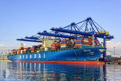
Container Ship

Current Trip
| Time Travelled | 10 days |
|---|---|
| Remaining Time | 11 days |
| Distance Travelled | 3135.43 nm |
| Remaining Distance | 3825.74 nm |
| AVG Speed | 15.7 Knots |
| MAX Speed | 19.9 Knots |
| AVG Wind | 11.8 knots |
| MAX Wind | 22 knots |
| MIN Temp | 13.7°C / 56.66°F |
| MAX Temp | 21.6°C / 70.88°F |
| Draught | 12.8 m |
| Position Received | 1 d ago |
Current Position
| Longitude | --- |
|---|---|
| Latitude | --- |
| Status | Under way using engine |
| Speed | 14.6 Knots |
| Course | 286.1° |
| Area | Mediterranean Sea - Western Basin |
| Station | T-AIS |
| Position Received | 1 d ago |
Information
The current position of SPEED is in Mediterranean Sea - Western Basin with coordinates 37.52350° / 10.74146° as reported on 2025-04-10 22:19 by AIS to our vessel tracker app. The vessel's current speed is 14.6 Knots and is heading at the port of SALALAH. The estimated time of arrival as calculated by MyShipTracking vessel tracking app is 2025-04-23 20:13 LT
The vessel SPEED (IMO: 9475698, MMSI: 241313000) is a Container Ship that was built in 2012 ( 13 years old ). It's sailing under the flag of [GR] Greece.
In this page you can find informations about the vessels current position, last detected port calls, and current voyage information. If the vessels is not in coverage by AIS you will find the latest position.
The current position of SPEED is detected by our AIS receivers and we are not responsible for the reliability of the data. The last position was recorded while the vessel was in Coverage by the Ais receivers of our vessel tracking app.
The current draught of SPEED as reported by AIS is 12.8 meters
Weather
| Temperature | 16.8°C / 62.24°F |
|---|---|
| Wind Speed | 10 knots |
| Direction | 103° ESE |
| Pressure | 1010.2 hPa |
| Humidity | 93.2 % |
| Cloud Coverage | 100 % |


Featured Company
Last Port Calls
| Port | Arrival | Departure | Time In Port |
|---|---|---|---|
| 2025-04-05 18:58 | 2025-04-06 19:42 | 1 d | |
| 2025-03-29 05:54 | 2025-04-02 15:37 | 4 d | |
| 2025-03-24 08:02 | 2025-03-27 09:19 | 3 d | |
| 2025-03-18 20:43 | 2025-03-20 04:22 | 1 d | |
| 2025-02-16 12:05 | 2025-02-18 14:53 | 2 d | |
| 2025-02-02 21:41 | 2025-02-03 10:02 | 12 h |
Most Visited Ports (Last year)
| Port | Arrivals | |
|---|---|---|
| 24 | ||
| 6 | ||
| 4 | ||
| 4 | ||
| 3 | ||
| 2 |
Last Trips
| Origin | Departure | Destination | Arrival | Distance | |
|---|---|---|---|---|---|
| 2025-04-02 15:37 | 2025-04-05 18:58 | 1360.41 nm | |||
| 2025-03-27 09:19 | 2025-03-29 05:54 | 20.79 nm | |||
| 2025-02-18 14:53 | 2025-03-24 08:02 | 14085.42 nm | |||
| 2025-02-18 14:53 | 2025-03-18 20:43 | 12717.27 nm | |||
| 2025-02-03 10:02 | 2025-02-16 12:05 | 2537.80 nm | |||
| 2025-01-28 04:46 | 2025-02-02 21:41 | 733.60 nm |
Events
| Time | Event | Details | Position / Dest | Info |
|---|---|---|---|---|
| 2025-04-10 22:25 | Status Changed | Default Under way using engine |
37.53126 / 10.71055
OMSLL
|
Speed: 14.6 kn Course: 286.1° |
| 2025-04-10 22:19 | OUT of Coverage |
37.52350 / 10.74146
Mediterranean Sea - Western Basin
OMSLL
|
Speed: 14.6 kn Course: 286.1° |
|
| 2025-04-10 22:17 | Status Changed | Under way using engine Default |
37.52197 / 10.74837
OMSLL
|
Speed: 14.6 kn Course: 272° |
| 2025-04-10 21:41 | Status Changed | Default Under way using engine |
37.50091 / 10.92783
OMSLL
|
Speed: 14.6 kn Course: 282.2° |
| 2025-04-10 21:22 | Status Changed | Under way using engine Default |
37.47592 / 11.02379
OMSLL
|
Speed: 14.6 kn Course: 281° |
| 2025-04-10 21:13 | IN Coverage |
37.47592 / 11.02379
Mediterranean Sea - Western Basin
OMSLL
|
Speed: 14.6 kn Course: 281.3° |
|
| 2025-04-10 19:45 | Status Changed | Default Under way using engine |
37.35706 / 11.49270
OMSLL
|
Speed: 14.9 kn Course: 288.4° |
| 2025-04-10 19:42 | OUT of Coverage |
37.35370 / 11.50558
Mediterranean Sea - Western Basin
OMSLL
|
Speed: 14.9 kn Course: 288.4° |
|
| 2025-04-10 19:39 | Change Sea Area | Tunisian part of the Mediterranean Sea - Western Basin Tunisian part of the Mediterranean Sea - Eastern Basin |
37.34978 / 11.52033
Mediterranean Sea - Western Basin
OMSLL
|
Speed: 14.9 kn Course: 288.2° |
| 2025-04-10 18:38 | OUT of Coverage |
37.28240 / 11.82791
Mediterranean Sea - Eastern Basin
OMSLL
|
Speed: 15 kn Course: 284.7° |