
SOYO
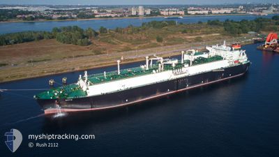
Lng Tanker
Current Trip
AO LAD
| Time Travelled | 4 days |
|---|---|
| Remaining Time | --- |
| Distance Travelled | 1848.06 nm |
| Remaining Distance | --- |
| AVG Speed | 18.6 Knots |
| MAX Speed | 20 Knots |
| AVG Wind | 10.2 knots |
| MAX Wind | 23.8 knots |
| MIN Temp | 16.3°C / 61.34°F |
| MAX Temp | 27.8°C / 82.04°F |
| Draught | 9.6 m |
| Position Received | 1 h, 6 m ago |
Current Position
| Longitude | 18.02724° |
|---|---|
| Latitude | -34.52296° |
| Status | Under way using engine |
| Speed | 18.1 Knots |
| Course | 131.7° |
| Area | South Atlantic Ocean |
| Station | T-AIS |
| Position Received | 1 h, 6 m ago |
Info
Information
The current position of SOYO is in South Atlantic Ocean with coordinates -34.52296° / 18.02724° as reported on 2024-05-21 11:07 by AIS to our vessel tracker app. The vessel's current speed is 18.1 Knots
The vessel SOYO (IMO: 9475208, MMSI: 311038500) is a Lng Tanker that was built in 2011 ( 13 years old ). It's sailing under the flag of [BS] Bahamas.
In this page you can find informations about the vessels current position, last detected port calls, and current voyage information. If the vessels is not in coverage by AIS you will find the latest position.
The current position of SOYO is detected by our AIS receivers and we are not responsible for the reliability of the data. The last position was recorded while the vessel was in Coverage by the Ais receivers of our vessel tracking app.
The current draught of SOYO as reported by AIS is 9.6 meters
Weather
| Temperature | 18.9°C / 66.02°F |
|---|---|
| Wind Speed | 20 knots |
| Direction | 309° NW |
| Pressure | 1019.1 hPa |
| Humidity | 87.3 % |
| Cloud Coverage | 100 % |
Featured Company
Events
| Time | Event | Details | Position / Dest | Info |
|---|---|---|---|---|
| 2024-05-21 11:10 | Status Changed | Default Under way using engine |
-34.53379 / 18.04097
AO LAD
|
Speed: 18.1 kn Course: 131.7° |
| 2024-05-21 11:07 | Status Changed | Under way using engine Default |
-34.52296 / 18.02724
AO LAD
|
Speed: 18 kn Course: 134° |
| 2024-05-21 11:07 | OUT of Coverage |
-34.52296 / 18.02724
South Atlantic Ocean
|
Speed: 18.1 kn Course: 131.7° |
|
| 2024-05-21 10:58 | IN Coverage |
-34.52296 / 18.02724
South Atlantic Ocean
|
Speed: 18.1 kn Course: 131.7° |
|
| 2024-05-21 08:49 | Status Changed | Default Under way using engine |
-33.92667 / 17.54833
AO LAD
|
Speed: 18.7 kn Course: 145.6° |
| 2024-05-21 08:44 | OUT of Coverage |
-33.90776 / 17.53324
South Atlantic Ocean
|
Speed: 18.7 kn Course: 145.6° |
|
| 2024-05-21 08:35 | Status Changed | Under way using engine Default |
-33.86629 / 17.49792
AO LAD
|
Speed: 18 kn Course: 144° |
| 2024-05-21 08:31 | Status Changed | Default Under way using engine |
-33.84833 / 17.48333
AO LAD
|
Speed: 18.6 kn Course: 150.1° |
| 2024-05-21 08:26 | Status Changed | Under way using engine Default |
-33.83041 / 17.46812
AO LAD
|
Speed: 18.7 kn Course: 149° |
| 2024-05-21 07:25 | OUT of Coverage |
-33.53680 / 17.30186
South Atlantic Ocean
|
Speed: 18.9 kn Course: 161° |